USA 250 Shirt →
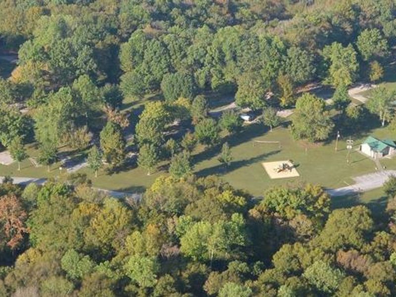
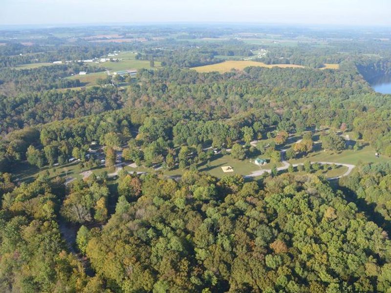
Aerial View of Campground

Holmes Bend

Open

Open seasonally from mid-April through late October. Reservations accepted via Recreation.gov. The campground is now operated by volunteers with limited toll house hours; advance reservations are required.

Flood Watch issued July 21 at 8:23PM EDT until July 22 at 12:00AM EDT by NWS Louisville KY

7:23 PM — 11:00 PM

* WHAT...Flash flooding caused by excessive rainfall continues to be possible. * WHERE...A portion of south central Kentucky, including the following counties, Adair, Allen, Barren, Casey, Clinton, Cumberland, Green, Hart, Metcalfe, Monroe, Russell and Taylor. * WHEN...Until 11 PM CDT /midnight EDT/ this evening. * IMPACTS...Excessive runoff may result in flooding of rivers, creeks, streams, and other low-lying and flood-prone locations. Flooding may occur in poor drainage and urban areas. Extensive street flooding and flooding of creeks and rivers are possible. * ADDITIONAL DETAILS... - Heavy rainfall from thunderstorms ahead of an approaching cold front could lead to isolated flooding and drainage issues. - http://www.weather.gov/safety/flood

Severe Thunderstorm Watch issued July 21 at 8:11PM EDT until July 21 at 10:00PM EDT by NWS Louisville KY

7:11 PM — 9:00 PM

SEVERE THUNDERSTORM WATCH 508 REMAINS VALID UNTIL 9 PM CDT THIS EVENING FOR THE FOLLOWING AREAS IN KENTUCKY THIS WATCH INCLUDES 13 COUNTIES IN SOUTH CENTRAL KENTUCKY ADAIR ALLEN BARREN BUTLER CLINTON CUMBERLAND EDMONSON LOGAN METCALFE MONROE RUSSELL SIMPSON WARREN THIS INCLUDES THE CITIES OF ABERDEEN, ALBANY, ALVATON, AMANDAVILLE, BEAUMONT, BOWLING GREEN, BOYCE, BURKESVILLE, CANE VALLEY, CAVE CITY, COBURG, COLUMBIA, CREELSBORO, CROCUS, CUMBERLAND CITY, DUBRE, DUNBAR, EDMONTON, EIGHTY EIGHT, ELLA, FLAT ROCK, FOREST SPRINGS, FRANKLIN, GASCON, GLASGOW, GLENS FORK, GRADYVILLE, HALFWAY, HAYWOOD, HESTAND, HILLVIEW, JABEZ, JAMESTOWN, KNOB LICK, LECTA, LOGANSPORT, LUCAS, MARROWBONE, MAYNARD, MIDDLETOWN, MORGANTOWN, MUD LICK, OLGA, PEYTONSBURG, PLANO, PRICES MILL, PROVIDENCE, QUALITY, RICHARDSVILLE, ROCKBRIDGE, RUSSELL SPRINGS, RUSSELLVILLE, SALEM, SCOTTSVILLE, STATIC, SUMMER SHADE, TOMPKINSVILLE, AND WISDOM.

Flood Advisory issued July 21 at 5:25PM CDT until July 21 at 8:30PM CDT by NWS Louisville KY

5:25 PM — 8:30 PM

* WHAT...Flooding caused by excessive rainfall is expected. * WHERE...Adair County in south central Kentucky... Barren County in south central Kentucky... Metcalfe County in south central Kentucky... * WHEN...Until 830 PM CDT. * IMPACTS...Minor flooding in low-lying and poor drainage areas. Ponding of water in urban or other areas is occurring or is imminent. * ADDITIONAL DETAILS... - At 525 PM CDT, Doppler radar indicated heavy rain due to thunderstorms. Minor flooding is ongoing or expected to begin shortly in the advisory area. Up to 1 inch of rain has fallen. - Additional rainfall amounts up to 2 inches are expected over the area. This additional rain will result in minor flooding. - Some locations that will experience flooding include... Glasgow, Columbia, Edmonton, Three Springs, Horse Cave, Cave City, Park City, Fountain Run, Clarks Corner and Beechville. - http://www.weather.gov/safety/flood

About

Situated along Kentucky's Highland Rim, Holmes Bend Campground is surrounded by forested tracts, rolling meadows, and the pristine shoreline of Green River Lake. The campground offers 125 sites spread across five loops, with 62 sites featuring water and electric hookups, 40 sites with electric-only hookups, and 23 primitive sites. Modern amenities include flush toilets, hot showers, potable water, and a dump station. Green River Lake spans 8,000 surface acres, making it ideal for boating, fishing, jet skiing, and wakeboarding. Ten boat ramps dot the shoreline, and three full-service marinas operate around the lake. Anglers target walleye, crappie, white bass, channel catfish, muskie, and bluegill. Within a mile of the campground, visitors can access a swimming beach, reservable picnic shelter, boat ramp, courtesy dock, and fishing pier. The surrounding area offers miles of multi-use trails including horseback riding opportunities. The Corps of Engineers Visitor Center and the Civil War-era Atkinson-Griffin Log Cabin are 10 miles northwest. Mammoth Cave National Park and Abraham Lincoln's birthplace are both within an hour's drive.

Directions

From Columbia, KY, take Cumberland Parkway to exit 49 and merge onto Highway 55 north. Continue for 1.5 miles, then turn right on Highway 551. After a mile turn left on Holmes Bend Road and follow directional signs to the campground.

Amenities

Water Yes
Fires Allowed Yes
Toilets Yes
Dump Station Yes
Wifi
Pets Allowed Yes
Showers Yes
Electric Hookups Yes
Water Hookups Yes
Sewer Hookups No
Camp Store
Price $20 - $32

Vehicle

Max RV Length 99ft
Max Trailer Length 99ft
Big Rig Friendly Yes
Pull Through Sites No

Contact

Email andrea.m.davis@usace.army.mil
Phone +1 (270) 384-4623

Cell Service

AT&T Yes
Verizon Yes
T-Mobile Yes

Availability

Photos

Aerial View of Campground
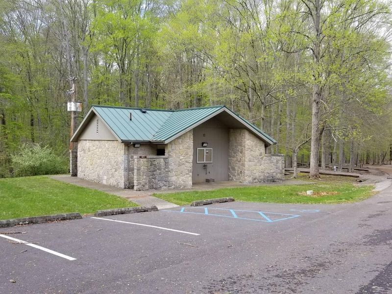
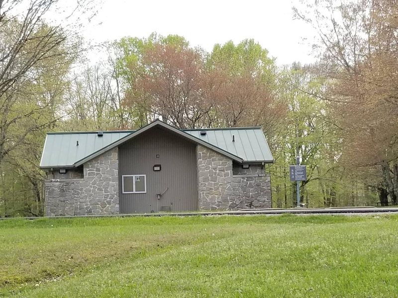
Showerhouse located near sites 85-125
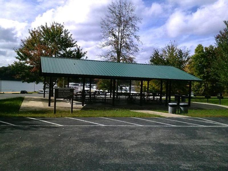
Picnic shelter located near the beach and marina, about 1 mile from the campground
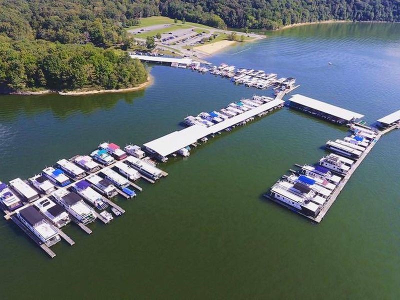
Aerial View of Holmes Bend Marina located about 1 mile from the campground
Showerhouse located near sites 24-43
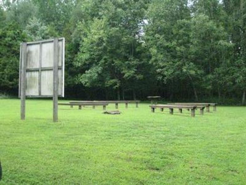
Amphitheater located near the trailhead
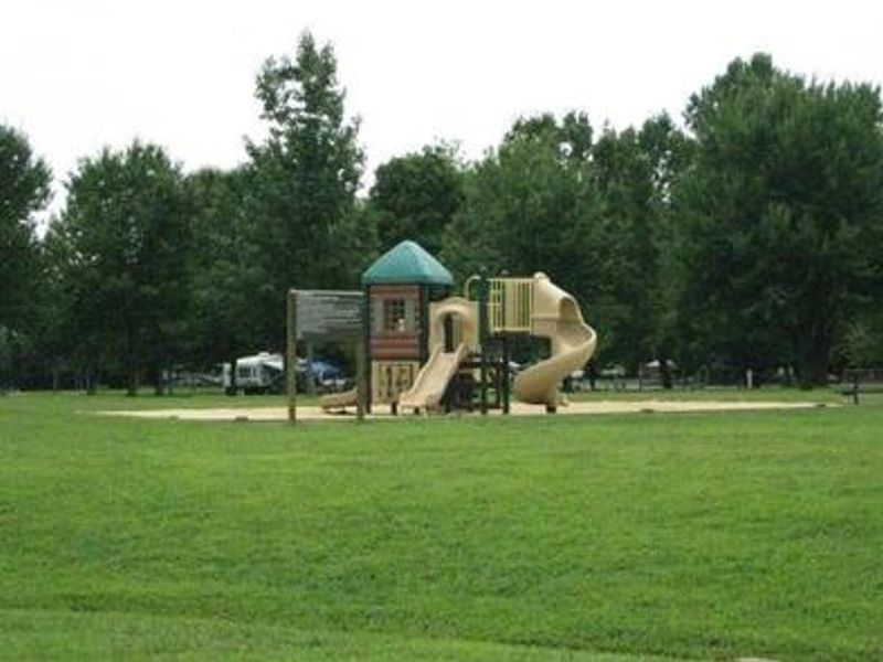
Playground located in the center of the campground
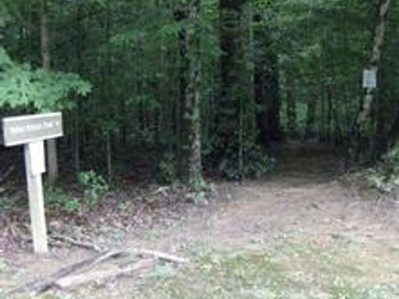
Trailhead located near the amphitheater
Aerial view of campground
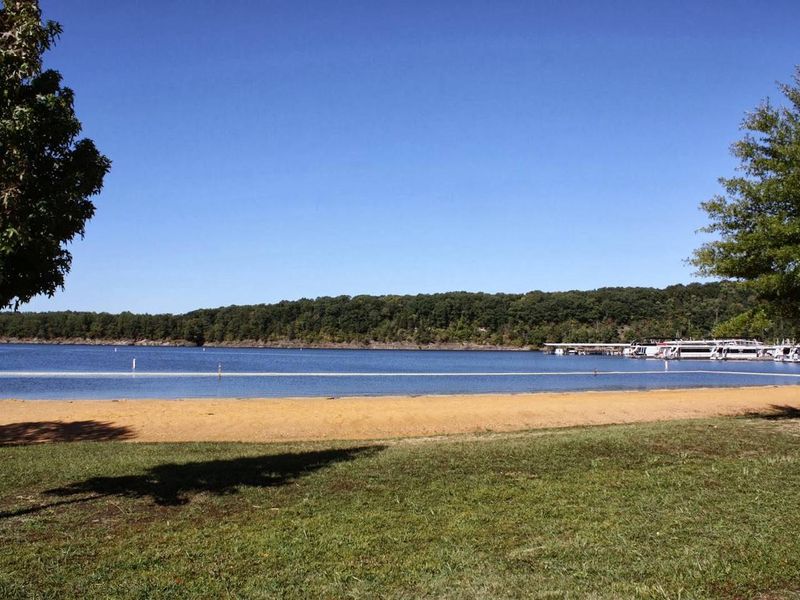
Beach located near the marina, about 1 mile from the campground
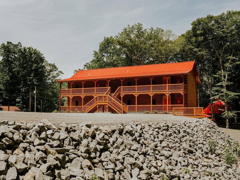
Suites and Meeting Room at Holmes Bend Marina, located about 1 mile from the campground

Community Posts

No posts yet. Be the first to share your experience!