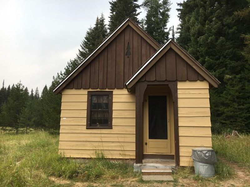
Fry Meadows Guard Station
Open for the 2026 season. The cabin operates May 15 through November 20. Vehicle access typically runs from early June through early November depending on conditions. Winter access requires skis, snowshoes, or snowmobile. Reservations required via Recreation.gov. Maximum stay is 14 consecutive nights.
Air Quality Alert issued July 20 at 7:40PM PDT by NWS Pendleton OR
Oregon Department of Environmental Quality has issued an Air Quality Advisory until 4 PM PDT Wednesday. For the Smoke Air Quality Advisory, wildfires burning in the region combined with forecasted conditions will cause air quality to reach unhealthy levels. Pollutants in smoke can cause burning eyes, runny nose, aggravate heart and lung diseases, and aggravate other serious health problems. Limit outdoor activities and keep children indoors if it is smoky. Please follow medical advice if you have a heart or lung condition. For additional information...please visit the Web site at http://www.oregon.gov/DEQ
Air Quality Alert issued July 20 at 6:03PM PDT by NWS Pendleton OR
Oregon Department of Environmental Quality has issued an Air Quality Advisory until 4 PM PDT Wednesday. For the Smoke Air Quality Advisory, wildfires burning in the region combined with forecasted conditions will cause air quality to reach unhealthy levels. Pollutants in smoke can cause burning eyes, runny nose, aggravate heart and lung diseases, and aggravate other serious health problems. Limit outdoor activities and keep children indoors if it is smoky. Please follow medical advice if you have a heart or lung condition. For additional information...please visit the Web site at http://www.oregon.gov/DEQ
Air Quality Alert issued July 20 at 3:24PM PDT by NWS Pendleton OR
Oregon Department of Environmental Quality has issued an Air Quality Advisory until 4 PM PDT Wednesday. For the Smoke Air Quality Advisory, wildfires burning in the region combined with forecasted conditions will cause air quality to reach unhealthy levels. Pollutants in smoke can cause burning eyes, runny nose, aggravate heart and lung diseases, and aggravate other serious health problems. Limit outdoor activities and keep children indoors if it is smoky. Please follow medical advice if you have a heart or lung condition. For additional information...please visit the Web site at http://www.oregon.gov/DEQ
About
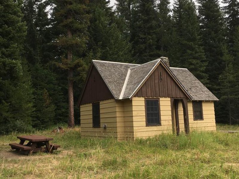
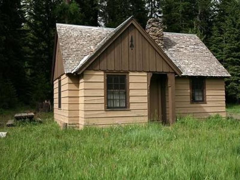
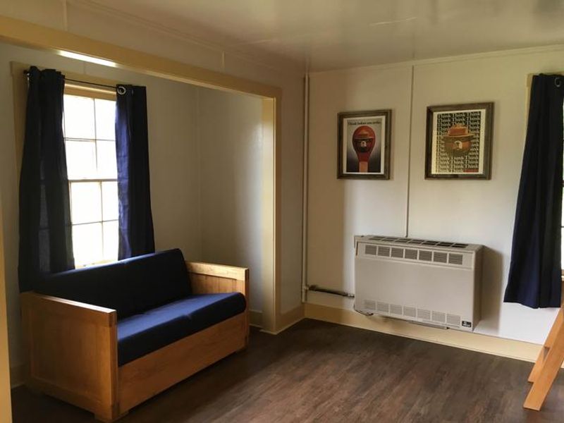
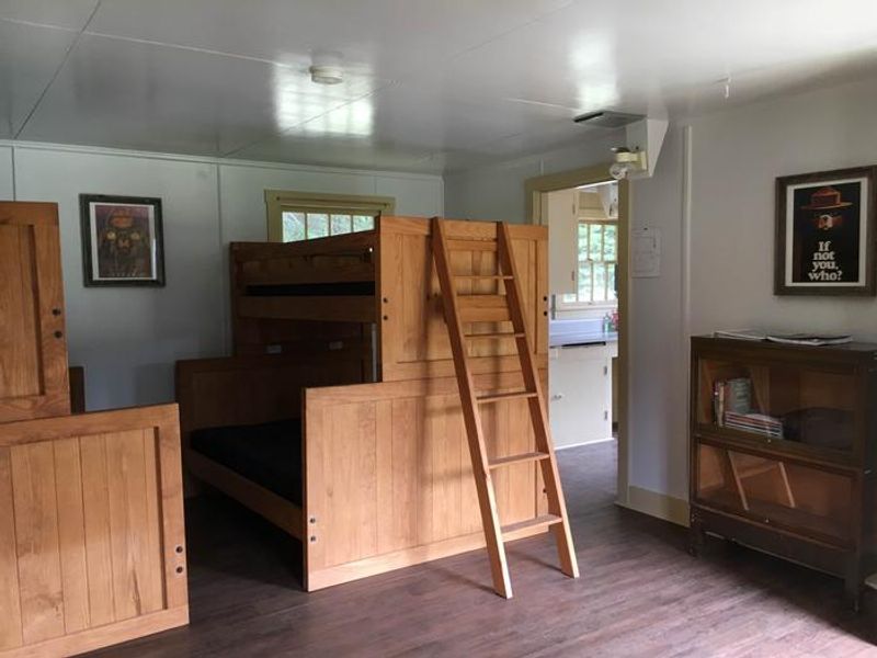
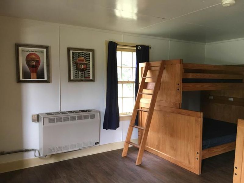
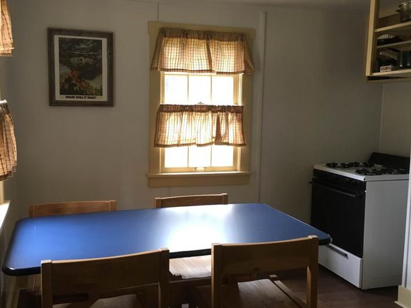
Fry Meadows Guard Station provides a unique opportunity to stay in a historic Forest Service cabin deep within the Umatilla National Forest. Originally established as a ranger station before 1908 as part of the former Wenaha National Forest, the current cabin was built in 1935 by the Civilian Conservation Corps and served as an active guard station until around 1980. The two-room cabin features a combined living room/sleeping area with two full beds and two twin beds with mattresses, plus a kitchen equipped with a propane cook stove, table, chairs, and basic cooking utensils. Both rooms have propane lights. There is no running water or electricity; visitors must bring all water for drinking, cooking, and washing. A vault toilet outhouse is located a short distance from the cabin. The surrounding area is rich in both natural beauty and cultural history, once home to the Nez Perce, Umatilla, Walla Walla, and Cayuse tribes. The nearby Wenaha-Tucannon Wilderness offers over 200 miles of trails for hiking and horseback riding, while the Grande Ronde River provides opportunities for float boating and fishing. Seasonal huckleberry, blackberry, and morel mushroom picking is popular in the area.
Directions
From Elgin, Oregon: Travel northwest on Highway 204 for 1 mile. Turn right (north) onto County Road 40 and go 4 miles. Turn left onto County Road 42 and travel approximately 13 miles towards Palmer Junction. Continue straight onto County Road 43. Just past Palmer Junction, stay left at the Y and go up the hill. Travel 7 miles past Palmer Junction (County Road 43 becomes Forest Service Road 6231 at the forest boundary). Turn left onto Forest Service Road 6235; the cabin entrance is the immediate next left, approximately 300 feet.
Amenities
| Water | No |
| Fires Allowed | — |
| Toilets | Yes |
| Dump Station | No |
| Wifi | No |
| Pets Allowed | Yes |
| Showers | No |
| Electric Hookups | — |
| Water Hookups | — |
| Sewer Hookups | — |
| Camp Store | No |
| Price | $40 |
Vehicle
| Max RV Length | — |
| Max Trailer Length | — |
| Big Rig Friendly | No |
| Pull Through Sites | No |
Contact
| r6_umatilla_public_inquiries@fs.fed.us | |
| Phone | +1 (509) 522-6290 |
Cell Service
| AT&T | None |
| Verizon | Yes |
| T-Mobile | None |
Availability
Photos


Community Posts
No posts yet. Be the first to share your experience!