Entrance sign for Fisherman's Corner North Recreation Area campground

Fishermans Corner

Open

The campground operates seasonally from early May through late October. All sites require reservations through Recreation.gov. Check-in is 2:00 PM and check-out is 12:00 PM.
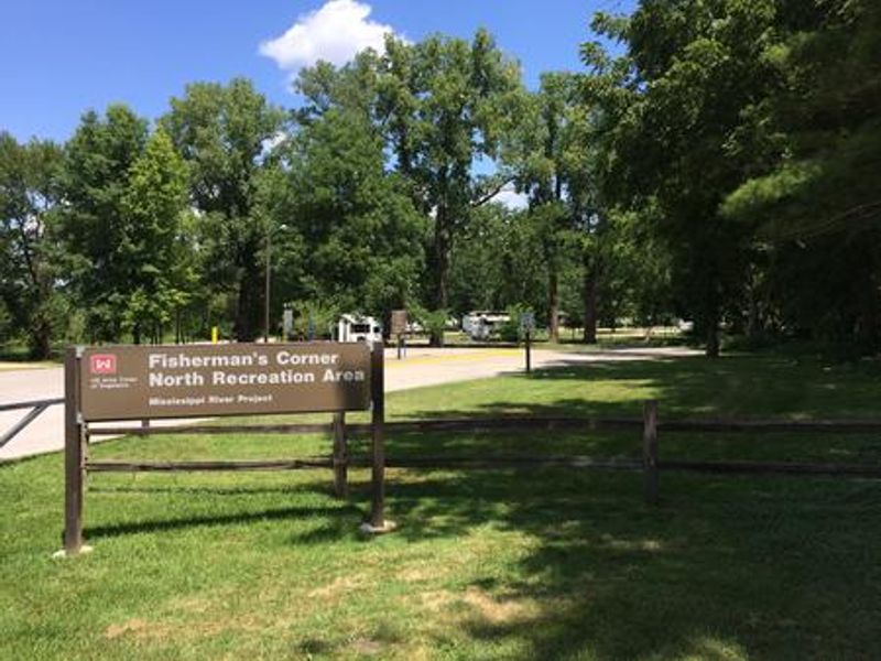
Flood Watch issued June 11 at 10:10AM CDT until June 11 at 7:00PM CDT by NWS Quad Cities IA IL

10:10 AM — 7:00 PM

Several rounds of heavy rain producing thunderstorms will be seen across the watch area. Storms may redevelop over the same areas resulting torrential rainfall and possibly several inches of rain. Flash flooding will be possible through this evening. * WHAT...Flooding caused by excessive rainfall continues to be possible. * WHERE...Portions of Illinois, including the following areas, Bureau, Carroll, Hancock, Henderson, Henry IL, Jo Daviess, McDonough, Mercer, Putnam, Rock Island, Stephenson, Warren and Whiteside, Iowa, including the following areas, Benton, Buchanan, Cedar, Clinton, Delaware, Des Moines, Dubuque, Henry IA, Iowa, Jackson, Jefferson, Johnson, Jones, Keokuk, Lee, Linn, Louisa, Muscatine, Scott, Van Buren and Washington, and northeast Missouri, including the following areas, Clark and Scotland. * WHEN...Until 7 PM CDT this evening. * IMPACTS...Excessive runoff may result in flooding of rivers, creeks, streams, and other low-lying and flood-prone locations. Creeks and streams may rise out of their banks.

Flood Warning issued June 11 at 9:52AM CDT until June 16 at 9:00AM CDT by NWS Quad Cities IA IL

9:52 AM — June 12th, 10:00 AM

...The Flood Warning continues for the following rivers in Iowa... Maquoketa River near Maquoketa affecting Jackson County. Cedar River near Conesville affecting Louisa and Muscatine Counties. Iowa River near Lone Tree affecting Louisa, Washington and Johnson Counties. English River at Kalona affecting Washington and Johnson Counties. Skunk River at Augusta affecting Henry IA, Des Moines and Lee Counties. Wapsipinicon River near De Witt 4S affecting Scott and Clinton Counties. ...The Flood Warning is extended for the following rivers in Illinois... Rock River near Joslin affecting Henry IL, Rock Island and Whiteside Counties. Rock River at Moline affecting Henry IL and Rock Island Counties. .Several rounds of heavy rainfall will produce flooding on several tributary rivers. * WHAT...Minor flooding is forecast. * WHERE...Rock River at Moline. * WHEN...From Saturday morning to late Tuesday morning. * IMPACTS...At 12.5 feet, Water affects some residences in the lower Friendship Farm area. 60th St is under water south of the Green Valley Sports Complex. 56th St along the north side of the river is under water. * ADDITIONAL DETAILS... - At 9:30 AM CDT Thursday the stage was 9.4 feet. - Forecast...The river is expected to rise above flood stage late Saturday morning to a crest of 12.7 feet Sunday morning. It will then fall below flood stage early Tuesday morning. - Flood stage is 12.0 feet.

Flood Warning issued June 11 at 9:52AM CDT until June 15 at 9:00PM CDT by NWS Quad Cities IA IL

9:52 AM — June 12th, 10:00 AM

...The Flood Warning continues for the following rivers in Iowa... Maquoketa River near Maquoketa affecting Jackson County. Cedar River near Conesville affecting Louisa and Muscatine Counties. Iowa River near Lone Tree affecting Louisa, Washington and Johnson Counties. English River at Kalona affecting Washington and Johnson Counties. Skunk River at Augusta affecting Henry IA, Des Moines and Lee Counties. Wapsipinicon River near De Witt 4S affecting Scott and Clinton Counties. ...The Flood Warning is extended for the following rivers in Illinois... Rock River near Joslin affecting Henry IL, Rock Island and Whiteside Counties. Rock River at Moline affecting Henry IL and Rock Island Counties. .Several rounds of heavy rainfall will produce flooding on several tributary rivers. * WHAT...Minor flooding is forecast. * WHERE...Rock River near Joslin. * WHEN...From Saturday morning to late Monday evening. * IMPACTS...At 12.5 feet, Water affects some summer cottages along the river. * ADDITIONAL DETAILS... - At 8:45 AM CDT Thursday the stage was 6.9 feet. - Forecast...The river is expected to rise above flood stage late Saturday morning to a crest of 12.5 feet early Sunday morning. It will then fall below flood stage early Monday afternoon. - Flood stage is 12.0 feet.

Tornado Watch issued June 11 at 7:33AM CDT until June 11 at 3:00PM CDT by NWS Quad Cities IA IL

7:33 AM — 3:00 PM

THE NATIONAL WEATHER SERVICE HAS ISSUED TORNADO WATCH 311 IN EFFECT UNTIL 3 PM CDT THIS AFTERNOON FOR THE FOLLOWING AREAS IN ILLINOIS THIS WATCH INCLUDES 13 COUNTIES IN NORTH CENTRAL ILLINOIS BUREAU PUTNAM IN NORTHWEST ILLINOIS CARROLL HENRY IL JO DAVIESS MERCER ROCK ISLAND STEPHENSON WHITESIDE IN WEST CENTRAL ILLINOIS HANCOCK HENDERSON MCDONOUGH WARREN IN IOWA THIS WATCH INCLUDES 21 COUNTIES IN EAST CENTRAL IOWA BENTON CEDAR CLINTON IOWA JACKSON JOHNSON JONES LINN MUSCATINE SCOTT IN NORTHEAST IOWA BUCHANAN DELAWARE DUBUQUE IN SOUTHEAST IOWA DES MOINES HENRY IA JEFFERSON KEOKUK LEE LOUISA VAN BUREN WASHINGTON IN MISSOURI THIS WATCH INCLUDES 2 COUNTIES IN NORTHEAST MISSOURI CLARK SCOTLAND THIS INCLUDES THE CITIES OF ALEDO, ANAMOSA, BETTENDORF, BURLINGTON, CARTHAGE, CEDAR RAPIDS, CLINTON, CREDIT ISLAND, DAVENPORT, DUBUQUE, FAIRFIELD, FREEPORT, GALENA, GENESEO, HENNEPIN, INDEPENDENCE, IOWA CITY, KAHOKA, KEOKUK, KEOSAUQUA, MACOMB, MANCHESTER, MAQUOKETA, MARENGO, MEMPHIS, MOLINE, MONMOUTH, MOUNT CARROLL, MOUNT PLEASANT, MUSCATINE, OQUAWKA, PRINCETON, ROCK ISLAND, SIGOURNEY, STERLING, TIPTON, VINTON, WAPELLO, AND WASHINGTON.

About

Fishermans Corner offers convenient camping along the Mississippi River near Hampton, Illinois, managed by the U.S. Army Corps of Engineers. The campground provides impressive views of the river and nearby aquatic marsh near Locks and Dam 14, which is home to turtles, waterfowl, and other wildlife. Eagle watching is particularly popular during winter months at the adjacent Elton E. Fawks Bald Eagle Refuge. The facility includes 51 campsites on concrete pads along paved roads. Of these, 46 sites have electric hookups with 20, 30, and 50 amp service, while 5 tent-only sites offer a more primitive experience. Each site includes a picnic table and fire ring. Modern amenities include a shower house with flush toilets, potable water, and two dump stations. While there is no direct river access from the campground itself, the Fishermans Corner Day Use area is a short walk away with fishing access and a canoe/kayak ramp. The Central Trail section of the Mississippi River Trail passes directly in front of the campground, offering miles of walking and biking along the riverbank. Nearby attractions include the John Deere Pavilion (20 minutes) and the Illiniwek Forest Preserve.

Directions

From Interstate 80, take Exit 1 for Highway 84 toward East Moline/Savanna. Travel south on Highway 84 S/2nd Ave for 1.5 miles. The campground entrance will be on the right. From East Moline, travel north on Highway 84; the entrance will be on the left.

Amenities

Water Yes
Fires Allowed Yes
Toilets Yes
Dump Station Yes
Wifi
Pets Allowed Yes
Showers Yes
Electric Hookups Yes
Water Hookups No
Sewer Hookups No
Camp Store
Price $14 - $26

Vehicle

Max RV Length 80ft
Max Trailer Length
Big Rig Friendly Yes
Pull Through Sites No

Contact

Email mvrodmn13@usace.army.mil
Phone +1 (815) 259-3628

Cell Service

AT&T Yes
Verizon Yes
T-Mobile None

Availability

Photos

Entrance sign for Fisherman's Corner North Recreation Area campground
Entrance sign for Fisherman's Corner North Recreation Area campground.

Community Posts

No posts yet. Be the first to share your experience!