Evitts Creek Hiker-biker Campsite
Open year-round for camping. No fee or reservation required. Overnight stays limited to one night per site per trip. Non-potable well water available mid-April through mid-November only.
About
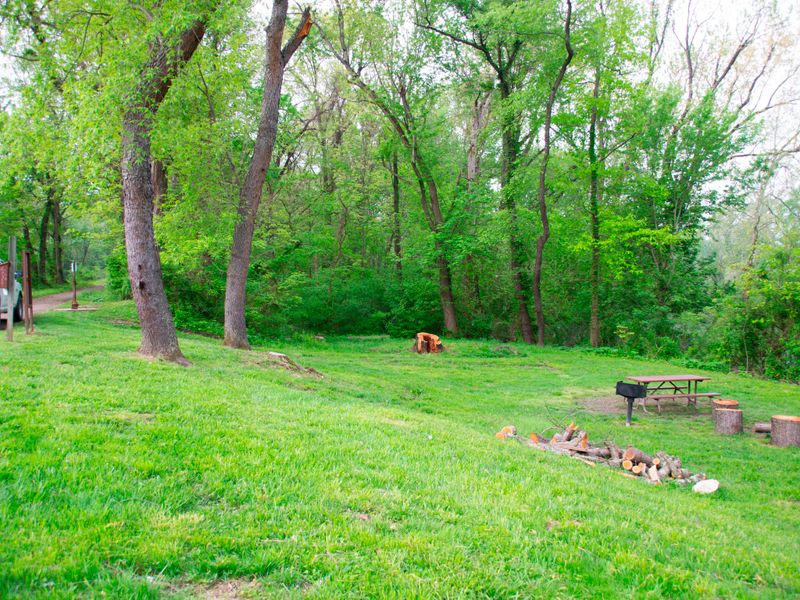
Evitts Creek Hiker-Biker Campsite is one of approximately 30 primitive campsites spaced every 5-7 miles along the 184.5-mile C&O Canal towpath, making it ideal for multi-day hiking and biking trips. Located at Mile 180.1 near the western end of the trail in Allegany County, Maryland, this free campsite operates on a first-come, first-served basis with no reservations accepted. The site provides basic amenities including a chemical toilet, picnic table, and fire pit at each campsite. Non-potable well water is available from mid-April through mid-November but must be filtered, chemically treated, or boiled before drinking or cooking. During winter months, water handles are removed to prevent freeze damage. Campers should be prepared to pack out all trash as the park operates a trash-free policy. Fires are permitted only in provided fire pits using kiln-fired or dried wood. Pets are welcome but must remain leashed at all times. Quiet hours are observed from 10 PM to 6 AM. The site is located 1-5 miles from the nearest parking area and may be subject to flooding after heavy rains due to its proximity to the Potomac River.
Directions
Located at Mile 180.1 on the C&O Canal towpath in Allegany County, Maryland. The site is 1-5 miles from the nearest parking area. Consult the NPS Recreation Guide by Milepost for specific access points.
Nearby Campgrounds
Amenities
| Water | No |
| Fires Allowed | Yes |
| Toilets | Yes |
| Dump Station | No |
| Wifi | — |
| Pets Allowed | Yes |
| Showers | No |
| Electric Hookups | — |
| Water Hookups | — |
| Sewer Hookups | — |
| Camp Store | No |
| Price | $0 |
Vehicle
| Max RV Length | — |
| Max Trailer Length | — |
| Big Rig Friendly | No |
| Pull Through Sites | No |
Contact
| choh_information@nps.gov | |
| Phone | +1 (301) 739-4200 |
Cell Service
| AT&T | Yes |
| Verizon | Yes |
| T-Mobile | Yes |
Photos

Community Posts
No posts yet. Be the first to share your experience!