Potomac Forks Hiker-biker Campsite
Open year-round, first-come first-served with no reservations required. Stays limited to one night per site. Non-potable well water available mid-April through mid-November only; bring your own drinking water or treatment method.
About
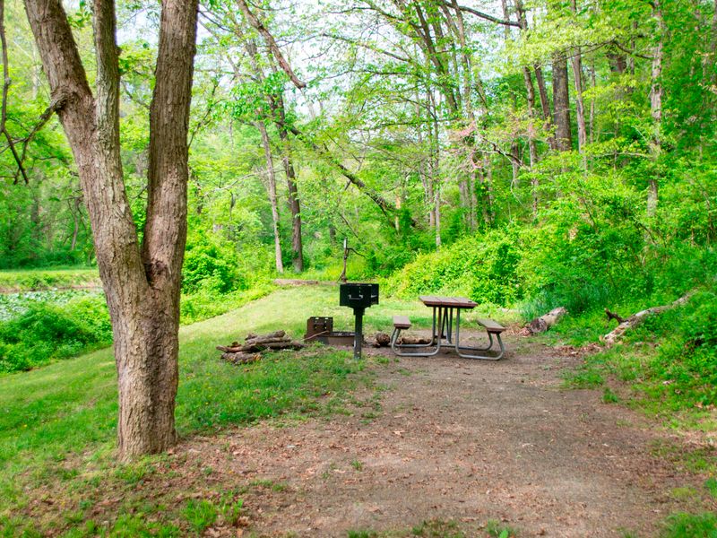
Potomac Forks Hiker-Biker Campsite sits at Mile 164.8 along the Chesapeake and Ohio Canal towpath in Maryland's Allegany County. Part of a network of primitive campsites spaced approximately every 5-7 miles along the 184.5-mile trail, it provides a free overnight option for long-distance hikers and cyclists traversing the historic canal corridor. The site offers basic amenities including a chemical toilet, picnic table, firepit, and non-potable well water. The well water requires filtering, chemical treatment, or boiling before consumption and is only available from mid-April through mid-November when the pumps are operational. During winter months, well handles are removed to prevent freeze damage. Camping is free and operates on a first-come, first-served basis with no reservations. Overnight stays are limited to one night per site per trip, and quiet hours are enforced between 10 PM and 6 AM. Fires must be contained to the provided fire rings or grills, or portable grills positioned off the ground. This is a trash-free park, so campers must pack out all waste. Pets are welcome but must remain leashed at all times.
Directions
The Potomac Forks Hiker-Biker Campsite is located at mile 164.8 along the C&O Canal towpath. Access is primarily via the towpath, suitable for hikers and bikers.
Nearby Campgrounds
Location
Amenities
| Water | No |
| Fires Allowed | Yes |
| Toilets | Yes |
| Dump Station | No |
| Wifi | No |
| Pets Allowed | Yes |
| Showers | No |
| Electric Hookups | — |
| Water Hookups | — |
| Sewer Hookups | — |
| Camp Store | No |
| Price | $0 |
Vehicle
| Max RV Length | — |
| Max Trailer Length | — |
| Big Rig Friendly | No |
| Pull Through Sites | No |
Contact
| choh_information@nps.gov | |
| Phone | +1 (301) 739-4200 |
Cell Service
| AT&T | Yes |
| Verizon | None |
| T-Mobile | Yes |
Photos

Community Posts
No posts yet. Be the first to share your experience!