Pigmans Ferry Hiker-biker Campsite
Open year-round on a first-come first-served basis. No fee or reservations required. Overnight stays limited to one night per site. Non-potable water is available mid-April through mid-November; water is turned off during winter months.
About
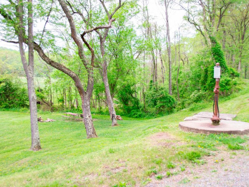
Pigmans Ferry Hiker-Biker Campsite is one of 30 primitive campsites spaced every 5-7 miles along the 184.5-mile C&O Canal towpath in Chesapeake and Ohio Canal National Historical Park. Located at mile 169.1 in Allegany County, Maryland, this free site operates on a first-come first-served basis with no reservations required. Each site accommodates five to ten tents depending on group size. The campsite includes a chemical toilet, picnic table, firepit, and access to a well with non-potable water. All water must be filtered, chemically treated, or boiled before drinking or cooking. Water is turned off from mid-November to mid-April each year. Fires are restricted to the provided firepits and grills or portable grills positioned off the ground, and all coals must be extinguished and removed from the park. This is a trash-free park; campers must pack out all waste. Pets are welcome but must be leashed at all times. Quiet hours are observed from 10 pm to 6 am. Hammocks are permitted using tree straps at least one inch wide.
Directions
Located at mile 169.1 on the C&O Canal towpath. Accessible only by foot, bicycle, or horseback. More information at nps.gov/choh.
Nearby Campgrounds
Amenities
| Water | No |
| Fires Allowed | Yes |
| Toilets | Yes |
| Dump Station | No |
| Wifi | — |
| Pets Allowed | Yes |
| Showers | No |
| Electric Hookups | — |
| Water Hookups | — |
| Sewer Hookups | — |
| Camp Store | No |
| Price | $0 |
Vehicle
| Max RV Length | — |
| Max Trailer Length | — |
| Big Rig Friendly | No |
| Pull Through Sites | No |
Contact
| choh_information@nps.gov | |
| Phone | +1 (301) 739-4200 |
Cell Service
| AT&T | None |
| Verizon | None |
| T-Mobile | Yes |
Photos

Community Posts
No posts yet. Be the first to share your experience!