Open
Open for the season. Potable water is typically available mid-May through late November. FSRD 633 can become muddy and slick during snowmelt or after significant rain; approaching via Ridge Road from Glendo is recommended over the switchbacks from Horseshoe Creek Road. 14-day stay limit.
About
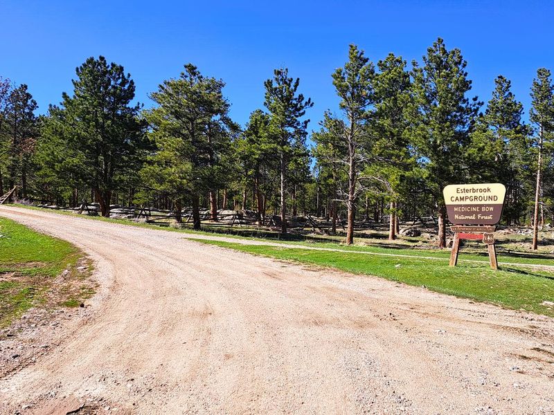
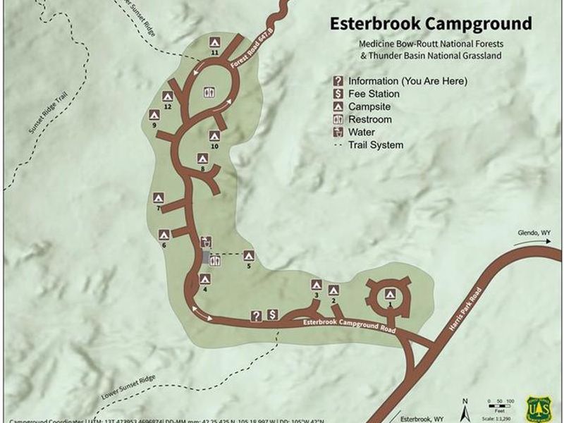
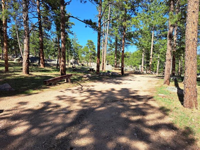
Esterbrook Campground is nestled within a ponderosa pine forest at 6,300 feet elevation along a broad ridge north of Laramie Peak. Managed by the Douglas Ranger District, it serves as a terrific jumping-off point for recreating in the Laramie Peak Unit of the Medicine Bow-Routt National Forest. The 12 campsites are widely separated in a lightly wooded, rocky area, giving each site a dispersed feel.
The campground is popular for OHV riding, hiking, mountain biking, hunting, and fishing. Non-motorized trail access to the Sunset Ridge Trail is available at two points within the campground, while an OHV trailhead is located half a mile down FSRD 633 to access the motorized trail system. Wyoming State OHV stickers are required for driving any Forest Service OHV trails. Fishing opportunities are available nearby at Lower Horseshoe Creek.
Mule deer, elk, black bear, whitetail deer, antelope, bald eagles, bobcat, bighorn sheep, yellow-bellied marmots, and mountain lions inhabit the diverse lands around Laramie Peak. The historic Esterbrook Community Church offers Sunday services nearby.
Directions
From Douglas, take WY 94 for 16.4 miles to a Y intersection with County Road 5/Esterbrook Road. Bear left onto Esterbrook Road and go 10.8 miles to the Esterbrook Work Center at a Y intersection with Forest Route 633. Continue on FR 633 for 0.2 miles through a small community to another Y intersection. Bear left, staying on FR 633, and go 3 miles to the campground.