Engineer Point
The group shelter is currently closed for most dates. The facility operates seasonally with limited overnight availability. Day-use access for boat ramps and picnic areas remains available with a day-use pass.
Flood Watch issued October 9 at 11:39AM CDT until October 11 at 7:00AM CDT by NWS Memphis TN
* WHAT...Flooding caused by excessive rainfall continues to be possible. * WHERE...Portions of North Mississippi, including the following areas, Alcorn, Benton MS, Calhoun, Chickasaw, Coahoma, DeSoto, Itawamba, Lafayette, Lee MS, Marshall, Monroe, Panola, Pontotoc, Prentiss, Quitman, Tallahatchie, Tate, Tippah, Tishomingo, Tunica, Union and Yalobusha and West Tennessee, including the following areas, Benton TN, Carroll, Chester, Crockett, Decatur, Dyer, Fayette, Gibson, Hardeman, Hardin, Haywood, Henderson, Lauderdale, Madison, McNairy, Shelby and Tipton. * WHEN...From late tonight through Sunday morning. * IMPACTS...Excessive runoff may result in flooding of rivers, creeks, streams, and other low-lying and flood-prone locations. * ADDITIONAL DETAILS... - The eventual Remnants of Hurricane Isaias will trek north impacting areas mainly east of the Mississippi River with amounts between 1 and 2.5 inches and localized amounts up to 3 inches of rainfall. - http://www.weather.gov/safety/flood
Wind Advisory issued October 9 at 1:33PM CDT until October 10 at 8:00PM CDT by NWS Memphis TN
* WHAT...Northeast winds 15 to 25 mph with gusts up to 45 mph expected. * WHERE...Portions of East Arkansas, North Mississippi, Southeast Missouri, and West Tennessee. * WHEN...From 4 AM to 8 PM CDT Saturday. * IMPACTS...Gusty winds will blow around unsecured objects. Tree limbs could be blown down and a few power outages may result.
About
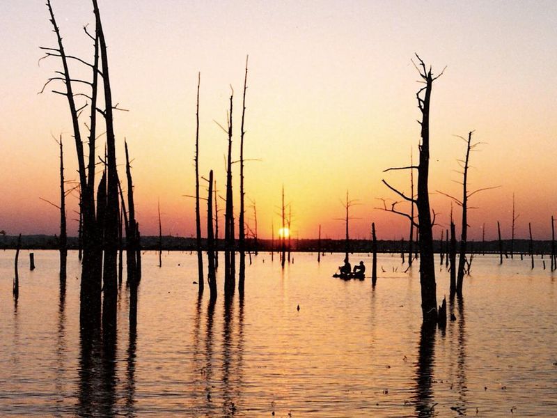
Engineer Point Recreation Area sits on the south end of Sardis Dam, providing access to the 30,000+ acre Sardis Lake in Panola County, Mississippi. The U.S. Army Corps of Engineers manages this facility as part of the larger Sardis Lake recreation system spanning 98,000 acres across Panola, Lafayette, and Marshall counties. The area functions primarily as a day-use site with two boat launching ramps, a courtesy boat dock/pier, fish cleaning station, comfort stations, a group picnic shelter, and individual picnic sites. Visitors use the facility for boating, fishing, swimming, and picnicking. A day-use pass is required for boat ramp and swimming area access. One group shelter with electrical hookups is available for overnight reservation through Recreation.gov at $100 per night. This is not a traditional campground with multiple individual sites; it is a single group facility suitable for larger gatherings. Amplified music and bouncy houses require prior approval from the Sardis Lake Field Office.
Directions
Engineer Point is located on Black Jack Road near Sardis Dam. From Interstate 55 at Batesville, MS, the ramp is approximately 8 miles. From MS Highway 6, it is approximately 5 miles. From Interstate 55 at Sardis, MS, it is approximately 9 miles.
Location
Amenities
| Water | — |
| Fires Allowed | — |
| Toilets | Yes |
| Dump Station | — |
| Wifi | — |
| Pets Allowed | — |
| Showers | — |
| Electric Hookups | Yes |
| Water Hookups | No |
| Sewer Hookups | No |
| Camp Store | — |
| Price | $100 |
Vehicle
| Max RV Length | — |
| Max Trailer Length | — |
| Big Rig Friendly | — |
| Pull Through Sites | No |
Contact
| Phone | +1 (662) 563-4531 |
Cell Service
| AT&T | Yes |
| Verizon | Yes |
| T-Mobile | Yes |
Availability
Photos
Community Posts
No posts yet. Be the first to share your experience!