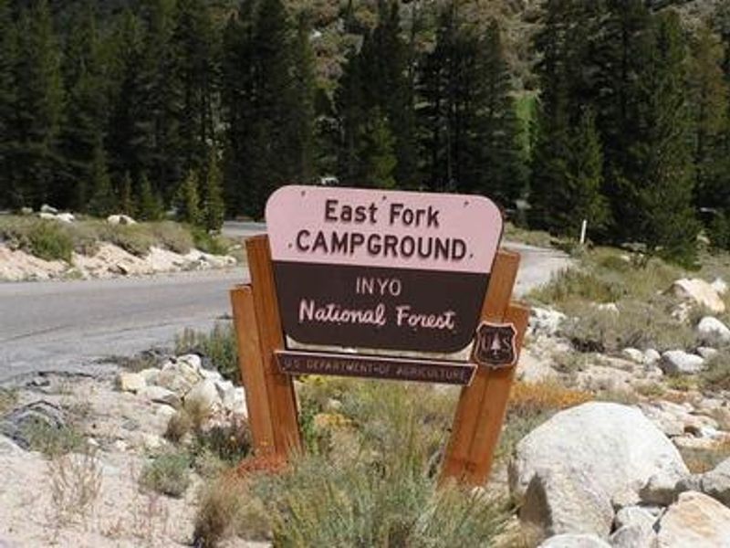
East Fork Campground
Open for the 2026 season. Some sites are first-come, first-served while others are reservable via Recreation.gov. Opening and closing dates vary by weather conditions. Road construction on Rock Creek Road may cause delays.
Flood Watch issued July 20 at 12:17PM PDT until July 21 at 11:00PM PDT by NWS Reno NV
* WHAT...Flash flooding caused by excessive rainfall is possible due to thunderstorms. * WHERE...Portions of east central California, including the following area, Mono County and western Nevada, including the following area, Mineral and Southern Lyon Counties. * WHEN...From Tuesday afternoon through Tuesday evening. * IMPACTS...Excessive runoff may result in flooding of creeks, streams, urban areas, burn scars, and areas near steep terrain. * ADDITIONAL DETAILS... - Deeper monsoonal moisture combined with daytime heating will produce scattered thunderstorms each afternoon and evening through Tuesday. Slower moving storms could redevelop over similar areas, increasing the risk for heavy rainfall capable of producing flash flooding. - http://www.weather.gov/safety/flood
Flood Watch issued July 20 at 12:17PM PDT until July 20 at 11:00PM PDT by NWS Reno NV
* WHAT...Flash flooding caused by excessive rainfall is possible due to thunderstorms. * WHERE...Portions of east central California, including the following area, Mono County and western Nevada, including the following area, Mineral and Southern Lyon Counties. * WHEN...From Tuesday afternoon through Tuesday evening. * IMPACTS...Excessive runoff may result in flooding of creeks, streams, urban areas, burn scars, and areas near steep terrain. * ADDITIONAL DETAILS... - Deeper monsoonal moisture combined with daytime heating will produce scattered thunderstorms each afternoon and evening through Tuesday. Slower moving storms could redevelop over similar areas, increasing the risk for heavy rainfall capable of producing flash flooding. - http://www.weather.gov/safety/flood
National Forest System Roads
Follow California Vehicle Code on National Forest System Roads
About
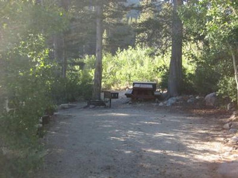
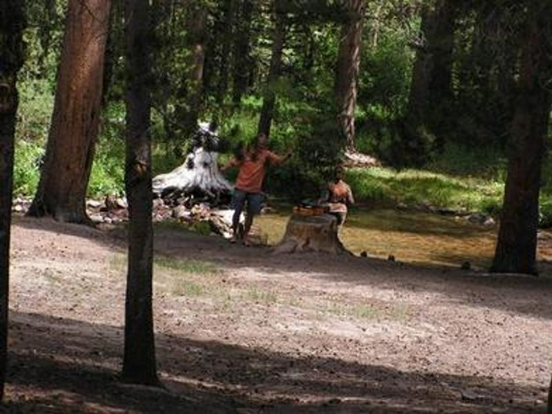
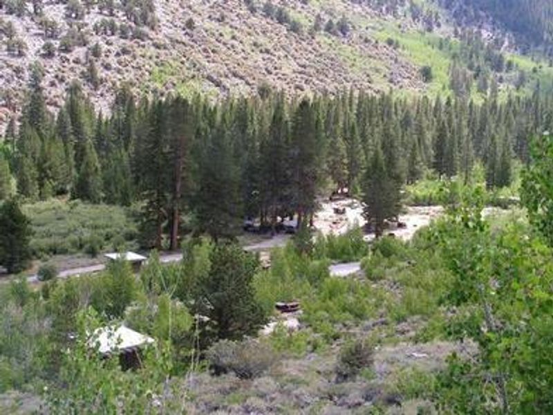
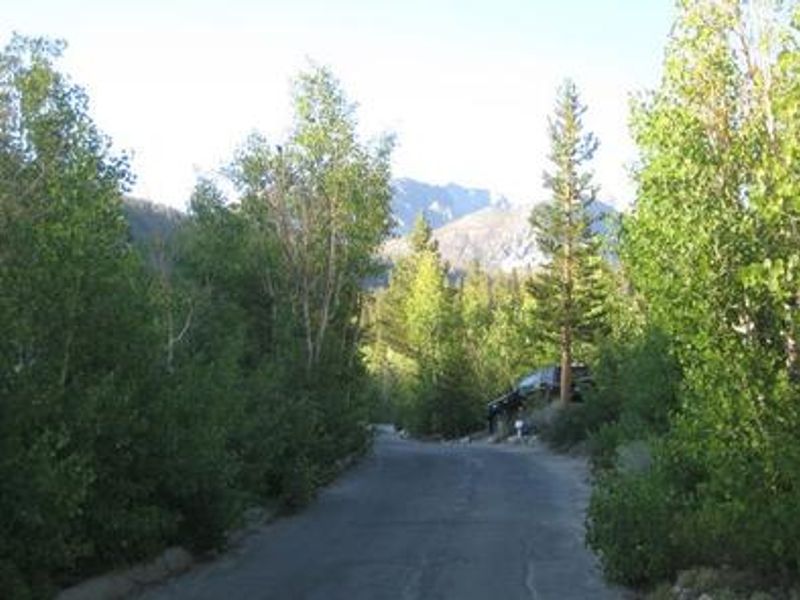
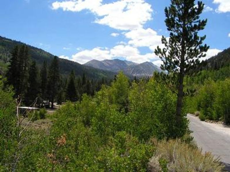
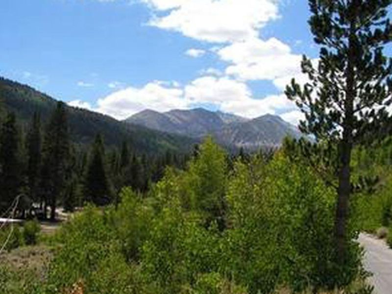
East Fork Campground occupies a scenic stretch of Rock Creek Canyon in the eastern Sierra Nevada at approximately 9,000 feet elevation. The 133-site campground features multiple loops winding through dense stands of pine, fir, and aspen, with many sites tucked under tall trees for shade. Several sites sit along Rock Creek, a cold, clear stream that originates in the John Muir Wilderness and runs 22 miles through the canyon. Rock Creek and the surrounding waterways are renowned for exceptional trout fishing, with catches including brook, brown, rainbow, and stocked Alpers trout. Anglers venturing into the backcountry may encounter golden trout populations. The area also draws hikers and mountain bikers to trails that meander around high-elevation alpine lakes. The campground provides flush toilets, potable water from hand pumps, picnic tables, and mandatory bear-proof food lockers at each site. No hookups, showers, or dump station are available. This is an active bear area requiring all food to be secured in the provided bear boxes when unattended or overnight.
Directions
From Mammoth Lakes, head south on US 395 for approximately 13 miles. Take the Tom's Place exit and follow Rock Creek Road (Forest Service Highway 12) for about 5 miles. The campground is on the left. From Bishop, head north on US 395 for about 30 miles to the Tom's Place exit.
Amenities
| Water | Yes |
| Fires Allowed | — |
| Toilets | Yes |
| Dump Station | No |
| Wifi | No |
| Pets Allowed | Yes |
| Showers | No |
| Electric Hookups | — |
| Water Hookups | — |
| Sewer Hookups | — |
| Camp Store | No |
| Price | $35 |
Vehicle
| Max RV Length | 38ft |
| Max Trailer Length | 38ft |
| Big Rig Friendly | No |
| Pull Through Sites | No |
Contact
| Phone | +1 (760) 873-2500 |
Cell Service
| AT&T | None |
| Verizon | None |
| T-Mobile | None |
Availability
Photos
Community Posts
No posts yet. Be the first to share your experience!