Eagle Creek Overlook Group Site
Open for the 2026 season from May 1 through September 30. Reservations available via Recreation.gov. Entry gate is locked; combination provided in reservation confirmation. Amplified music is prohibited. I-84 and railroad noise may be noticeable.
Heat Advisory issued July 20 at 10:27AM PDT until July 22 at 11:00PM PDT by NWS Portland OR
* WHAT...Temperatures 95 to 98 degrees F expected. * WHERE...Western and Central Columbia River Gorge and the Hood River Valley, Portland Metro Lowlands, Greater Vancouver Metro, Lower Columbia River and Cowlitz River Valleys, and East Central Willamette Valley. * WHEN...From 10 AM Tuesday to 11 PM PDT Wednesday. * IMPACTS...Hot temperatures may cause heat illnesses. * ADDITIONAL DETAILS...Smoke from fires or clouds outside of the region moving into the area could result in cooler daytime high temperatures than currently forecasted.
Alcohol Prohibitions
This Order describes acts that are prohibited upon lands, roads and trails within the National Forest System administered by the Forest Service Pacific Northwest Region in regards to alcoholic beverages.
Aquatic Invasive Species
This Order prohibits 1) possessing, storing, or transporting any aquatic invasive animal species AND 2) prohibits possessing, storing, or transporting any aquatic or riparian invasive plant species - on National Forest System lands in the Pacific Northwest Region as specified in the Order.
About
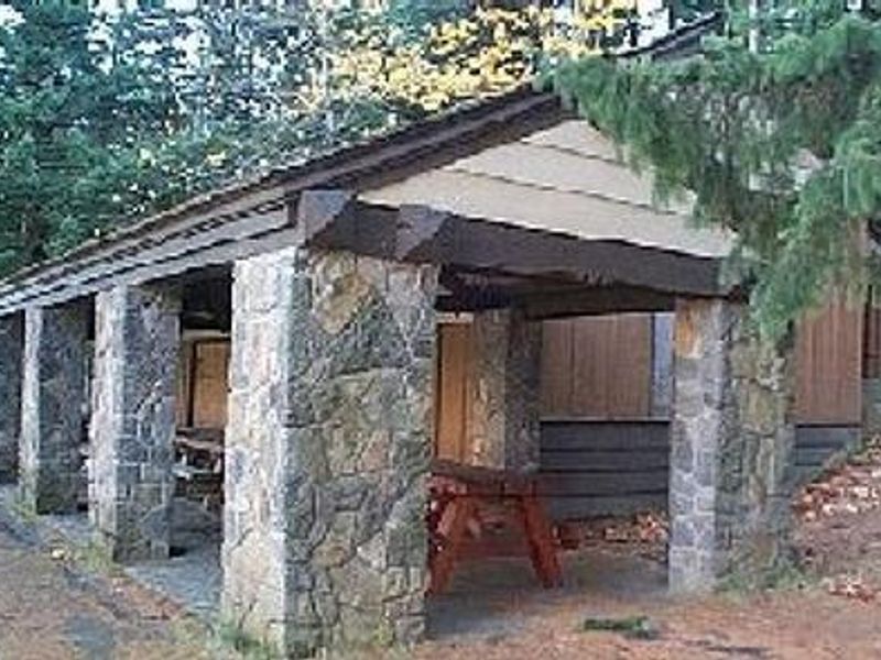
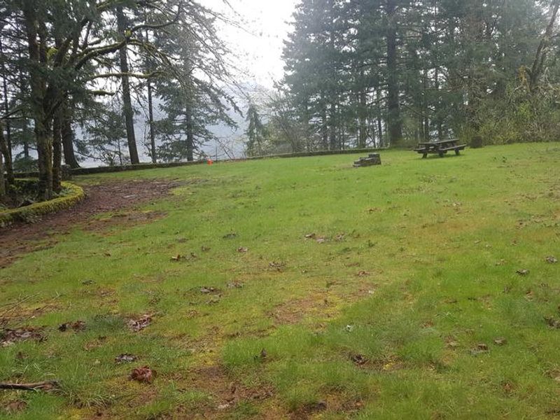
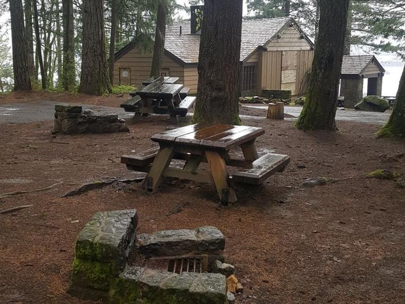
Eagle Creek Overlook Group Site occupies a forested bluff above the Columbia River within the Columbia River Gorge National Scenic Area. Developed by the Civilian Conservation Corps in the 1930s as a viewing point for the Bonneville Dam construction, the site retains its historic CCC masonry and offers sweeping views of the Columbia River and the mountains rising from the gorge on the Washington side. The group site includes a large covered picnic shelter, picnic tables, campfire rings, potable drinking water, and newly remodeled ADA-accessible flush toilets. It can accommodate up to 90 people and approximately 40 vehicles including trailers. RVs up to 40 feet are permitted, though there are no hookups. The railroad trestle at the entrance has an 11'6" clearance. On-site hosts are available during the operating season. The Eagle Creek Trail, one of the most popular trails in the Columbia Gorge, is nearby and features spectacular viewpoints and waterfalls including Punch Bowl Falls, High Bridge, and Tunnel Falls. Bonneville Dam is about a mile west and features sturgeon ponds, fish viewing, and a visitor center. A portion of the historic Columbia River Highway converted to a bike path is accessible from the site.
Directions
From Portland, OR: Travel east on I-84 approximately 41 miles and take exit #41 (Eagle Creek Recreation Area). Stay in the right lane before the tunnel. At the end of the off-ramp, turn left at the stop sign. Turn left again at the Interstate on-ramp (follow sign to Overlook) and proceed under the freeway and railroad tracks to the gate. From Hood River/Cascade Locks: Travel west on I-84 and take exit #40 (Bonneville Dam), as exit #41 has no westbound exit. Turn left at the stop sign, proceed under I-84, then immediately left onto the eastbound freeway entrance. Travel east on I-84 to exit #41 and follow directions above.
Amenities
| Water | Yes |
| Fires Allowed | Yes |
| Toilets | Yes |
| Dump Station | — |
| Wifi | — |
| Pets Allowed | — |
| Showers | No |
| Electric Hookups | — |
| Water Hookups | — |
| Sewer Hookups | — |
| Camp Store | — |
| Price | $75 |
Vehicle
| Max RV Length | 40ft |
| Max Trailer Length | 40ft |
| Big Rig Friendly | Yes |
| Pull Through Sites | No |
Contact
| Phone | +1 (541) 308-1700 |
Cell Service
| AT&T | Yes |
| Verizon | Yes |
| T-Mobile | Yes |
Availability
Photos
Community Posts
No posts yet. Be the first to share your experience!