Brownlee
Open for the season. The campground operates mid-May through late September or early October. First-come, first-served only with no advance reservations. Payment available on-site via Recreation.gov mobile app QR code.
Air Quality Alert issued July 20 at 2:33PM MDT by NWS Boise ID
* WHAT...Air Quality Advisory because of degraded air quality due to wildfire smoke. Air Quality Index is forecast to be Unhealthy. * WHERE...Ada, Canyon, Gem, Payette, and Washington Counties. * WHEN...UNTIL 3 PM MDT WEDNESDAY. * IMPACTS...Everyone may begin to experience health effects; members of sensitive groups may experience more serious health effects.
Air Quality Alert issued July 20 at 2:06PM MDT by NWS Boise ID
* WHAT...Air Quality Advisory because of degraded air quality due to wildfire smoke. Air Quality Index is forecast to be Unhealthy. * WHERE...Ada, Canyon, Gem, Payette, and Washington Counties. * WHEN...UNTIL 3 PM MDT WEDNESDAY. * IMPACTS...Everyone may begin to experience health effects; members of sensitive groups may experience more serious health effects.
Air Quality Alert issued July 20 at 8:21AM MDT by NWS Boise ID
* WHAT...Air Quality Advisory because of degraded air quality. Air Quality Index is forecast to be Unhealthy. * WHERE...Ada, Canyon, Gem, Payette, and Washington Counties. * WHEN...UNTIL 3 PM MDT WEDNESDAY. * IMPACTS...Everyone may begin to experience health effects; members of sensitive groups may experience more serious health effects.
About
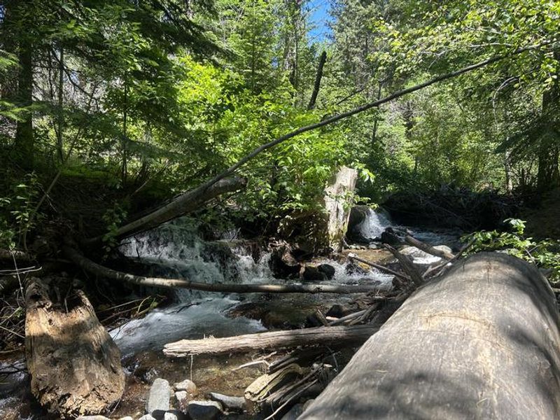
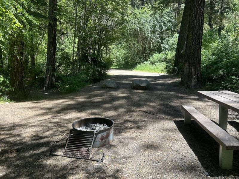
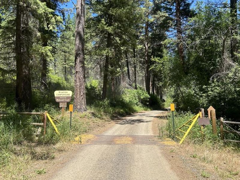
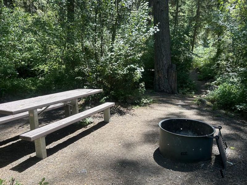
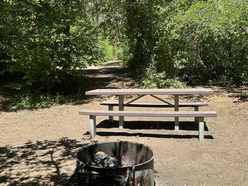
Brownlee Campground sits in a grove of Ponderosa pines that provide welcome shade during hot Idaho summers. The 11-site campground is located just off Highway 71, about 16 miles northwest of Cambridge, making it accessible yet removed enough from the main road to maintain a peaceful atmosphere. The campground operates on a first-come, first-served basis with no advance reservations available. Payment of the $10 nightly fee can be made on-site via the Recreation.gov mobile app's QR code scanning feature, though visitors should download the app before arriving due to limited cell service in the area. Potable water is available from a hand pump, and vault toilets are provided. Each site includes a picnic table and fire ring. The 16-foot maximum limit for RVs means this campground is best suited for tent camping, truck campers, and small trailers. The nearby Brownlee Area offers access to hiking, fishing, and boating on Brownlee Reservoir. Dogs are welcome but should be kept on leash.
Directions
Sixteen miles northwest of Cambridge on Highway 71, then one mile east on Forest Road 044.
Amenities
| Water | Yes |
| Fires Allowed | Yes |
| Toilets | Yes |
| Dump Station | No |
| Wifi | No |
| Pets Allowed | Yes |
| Showers | No |
| Electric Hookups | — |
| Water Hookups | — |
| Sewer Hookups | — |
| Camp Store | No |
| Price | $10 |
Vehicle
| Max RV Length | 16ft |
| Max Trailer Length | 16ft |
| Big Rig Friendly | No |
| Pull Through Sites | No |
Contact
| Phone | +1 (208) 549-4200 |
Cell Service
| AT&T | None |
| Verizon | None |
| T-Mobile | None |
Availability
Photos
Community Posts
No posts yet. Be the first to share your experience!