Barker Recreation Area
The campground is currently closed for the season due to snow and inaccessibility. It typically opens late May and operates through early September. Potable water is only available from Memorial Day through Labor Day. Some sites are reservable through Recreation.gov while others remain first-come, first-served.
Flood Watch issued July 20 at 12:15PM MDT until July 22 at 3:00AM MDT by NWS Salt Lake City UT
* WHAT...Flash flooding caused by excessive rainfall is possible. * WHERE...A portion of Utah, including the following areas, Castle Country, Central Mountains, Eastern Juab/Millard Counties, San Rafael Swell, Sanpete Valley, Sevier Valley, Wasatch Plateau/Book Cliffs, Western Millard and Juab Counties, Bryce Canyon Country, Capitol Reef National Park and Vicinity, Glen Canyon Recreation Area/Lake Powell, South Central Utah, Southern Mountains, Upper Sevier River Valleys, Western Canyonlands, Lower Washington County, Southwest Utah and Zion National Park. This includes recent burn scars such as Cottonwood, Silver King, Forsyth, France Canyon, Monroe Canyon. * WHEN...From Tuesday afternoon through late Tuesday night. * IMPACTS...Excessive rainfall may result in flooding of slot canyons, normally dry washes, slick rock areas, recent burn scars including Forsyth, France Canyon, Cottonwood, Silver King, and Monroe Canyon, and other low-lying and flood-prone locations. Flooding may occur in poor drainage and urban areas. * ADDITIONAL DETAILS... - http://www.weather.gov/safety/flood
Weed Free Hay Order 04-2021-03
Prohibited by this order: Possessing, storing, or transporting non-pelletized hay, straw, or mulch in the Intermountain Region, unless it is certified as weed free by the state where the product originated.
Fireworks and Spark Arrestor Order 04-2021-01
Prohibited by this order: Possessing, discharging, or using any kind of firework or other pyrotechnic device. 36 CFR §261.52(t)Operating or using any internal or external combustion engine without a spark arresting device properly installed, maintained and in effective working order as described…
About
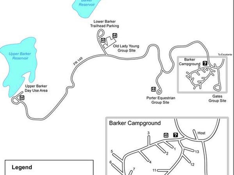
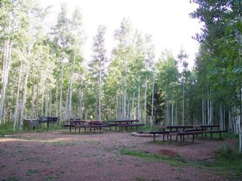
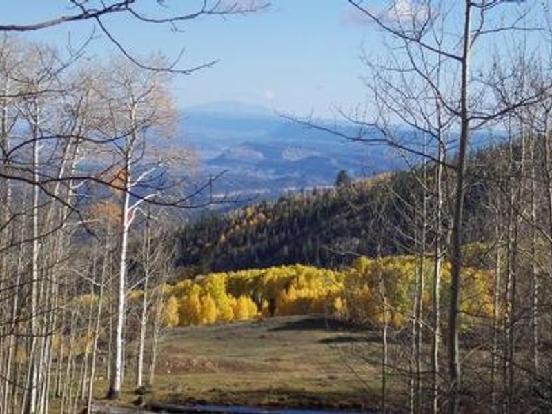
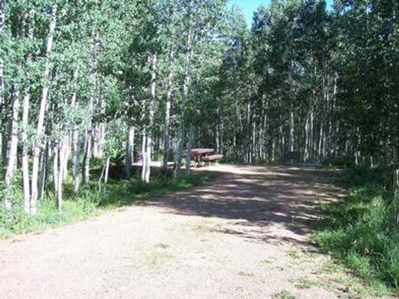
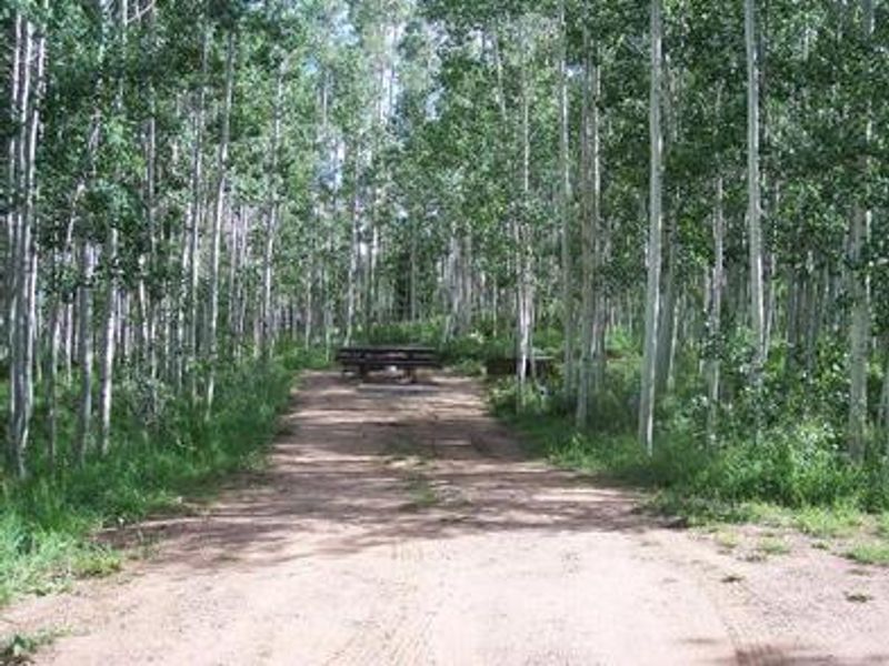
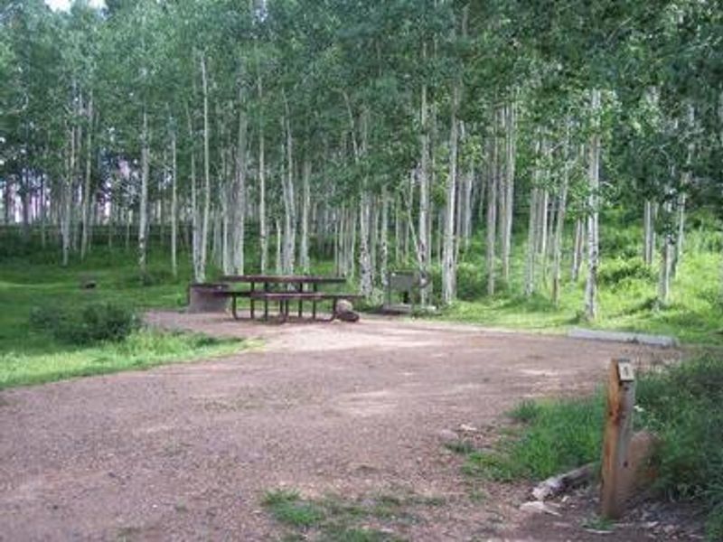
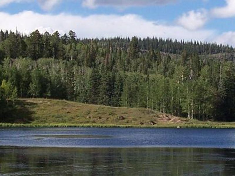
Barker Recreation Area is a developed campground perched at 9,300 feet on Utah's Colorado Plateau within Dixie National Forest. The campground comprises 13 single-family sites and 3 group sites, all set beneath a dense canopy of aspen and spruce. Each site includes a picnic table, fire ring, and bear-proof food storage locker. Vault toilets serve the area, and potable water is available from Memorial Day through Labor Day. Upper Barker Reservoir lies adjacent to the campground and permits non-motorized boats for canoeing, kayaking, and fishing. Rainbow and brook trout populate both Upper and Lower Barker Reservoirs. Floating docks provide fishing access. The Great Western Trail and other hiking, biking, and equestrian trails depart from nearby trailheads, connecting to nine backcountry fishing lakes and offering expansive mountain views. Wildlife is abundant, including black bear, blue grouse, golden eagle, and wild turkey. The area is known for spectacular fall colors and summer wildflowers. Grand Staircase-Escalante National Monument, Bryce Canyon National Park, and Escalante Petrified Forest State Park are all within driving distance.
Directions
From Escalante, drive west on Highway 12 to between mileposts 55 and 56. Turn right on the dirt road and cross the Escalante River. After a short distance, turn right onto Forest Road 149 signed for Barker Campground. Continue 16 miles on FR 149. The final 3.4 miles are steep and single-lane with switchbacks and turnouts.
Nearby Campgrounds
Amenities
| Water | Yes |
| Fires Allowed | Yes |
| Toilets | Yes |
| Dump Station | No |
| Wifi | No |
| Pets Allowed | Yes |
| Showers | No |
| Electric Hookups | — |
| Water Hookups | — |
| Sewer Hookups | — |
| Camp Store | No |
| Price | $18 - $75 |
Vehicle
| Max RV Length | 35ft |
| Max Trailer Length | 35ft |
| Big Rig Friendly | No |
| Pull Through Sites | No |
Contact
| Help.Dixie.Escalante@AmericanLL.com | |
| Phone | +1 (435) 826-5499 |
Cell Service
| AT&T | Yes |
| Verizon | None |
| T-Mobile | None |
Availability
Photos

Community Posts
No posts yet. Be the first to share your experience!