Bald Knob Lookout
The lookout opens for the 2026 season on May 15. Reservations available through Recreation.gov. Note: Due to vandalism and winter storm damage, propane amenities (heat, stove, refrigerator, lights) may have limited availability early in the 2026 season. Forest Road 5520 requires high-clearance 4WD vehicle.
About
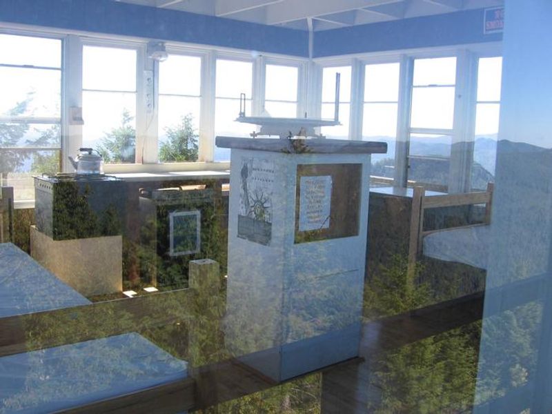
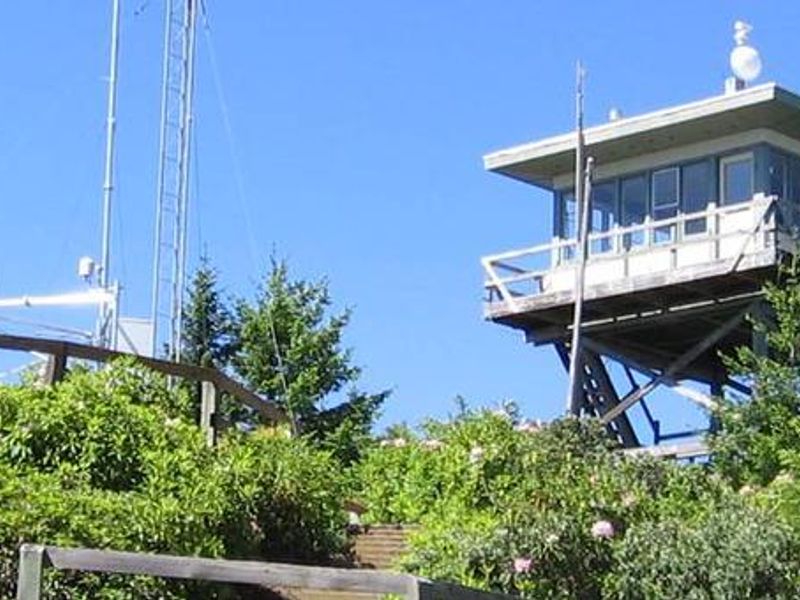
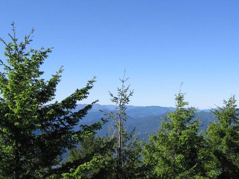
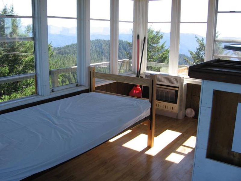
Bald Knob Lookout provides a unique lodging experience at 3,630 feet elevation in Oregon's Rogue River-Siskiyou National Forest. The site was originally developed in 1931 and served as an Aircraft Warning Service observation station during World War II (1942-1944). The Forest Service replaced the original L-4 style lookout with the current flat-top structure in 1963. The 16x16 foot one-room cabin sits atop a 21-foot tower with a catwalk offering 360-degree views overlooking Eden Valley to the north, the Rogue River to the south, and endless forested ridges. On clear nights, the sky fills with stars far from any light pollution. The cabin is equipped with propane stove, heater, refrigerator, and lights, plus furnishings including a single bed, small table, and chairs. Access requires navigating Forest Road 5520 from Powers, approximately 15.5 miles from Highway 242. The road requires high-clearance 4WD due to winter storm damage. The Panther Ridge Trail departs from the facility into the Wild Rogue Wilderness, and the Coquille River Falls Trail is nearby.
Directions
From Powers, OR, drive south on Highway 242 to the Forest boundary. Continue on Forest Road 33 along the South Fork of the Coquille River for approximately 11.5 miles to the junction of Forest Road 3348. Travel up Forest Road 3348 approximately 2 miles to the junction of Forest Road 5520. Turn right (pavement ends). Take Forest Road 5520 for 2 miles, then turn right on Forest Road 5520-020 and follow this spur road approximately 2 miles to a gate. Go through the gate and continue through a second gate to the end of the lookout road.
Location
Amenities
| Water | No |
| Fires Allowed | Yes |
| Toilets | Yes |
| Dump Station | No |
| Wifi | No |
| Pets Allowed | No |
| Showers | No |
| Electric Hookups | — |
| Water Hookups | — |
| Sewer Hookups | — |
| Camp Store | No |
| Price | $65 |
Vehicle
| Max RV Length | — |
| Max Trailer Length | — |
| Big Rig Friendly | No |
| Pull Through Sites | No |
Contact
| Phone | +1 (541) 439-6200 |
Cell Service
| AT&T | None |
| Verizon | None |
| T-Mobile | None |
Availability
Photos

Community Posts
No posts yet. Be the first to share your experience!