Arrow Rock State Historic Site Campground
Open year-round. Full amenities including potable water, modern restrooms, and showers are available April 1 through October 31. During the off-season (November 1 through March 31), water systems and shower facilities are not operational. Camping limited to 15 nights within any 30-day period.
Severe Thunderstorm Watch issued June 11 at 3:30PM CDT until June 11 at 9:00PM CDT by NWS Kansas City/Pleasant Hill MO
SEVERE THUNDERSTORM WATCH 314 REMAINS VALID UNTIL 9 PM CDT THIS EVENING FOR THE FOLLOWING AREAS IN KANSAS THIS WATCH INCLUDES 1 COUNTY IN EAST CENTRAL KANSAS LINN IN MISSOURI THIS WATCH INCLUDES 12 COUNTIES IN CENTRAL MISSOURI COOPER HOWARD PETTIS SALINE IN NORTH CENTRAL MISSOURI CARROLL CHARITON RANDOLPH IN WEST CENTRAL MISSOURI BATES CASS HENRY JOHNSON LAFAYETTE THIS INCLUDES THE CITIES OF ADRIAN, BELTON, BOONVILLE, BRUNSWICK, BUTLER, CARROLLTON, CLINTON, CONCORDIA, FAYETTE, GLASGOW, HARRISONVILLE, HIGGINSVILLE, KEYTESVILLE, LA CYGNE, LEXINGTON, MARSHALL, MOBERLY, MOUND CITY, NEW FRANKLIN, ODESSA, PLEASANT HILL, PLEASANTON, RAYMORE, RICH HILL, SALISBURY, SEDALIA, WARRENSBURG, AND WINDSOR.
Hydrologic Outlook issued June 11 at 11:14AM CDT by NWS Kansas City/Pleasant Hill MO
ESFEAX Missouri River at Glasgow This hydrologic outlook is based on the forecast rainfall for the next 24 hours and estimated runoff from earlier rainfall. Crests may vary if actual rainfall or runoff is greater or less than anticipated. Location: Missouri River at Glasgow Flood stage: 25.0 feet Latest stage: 23.2 feet at 10 AM Thursday Maximum Forecast Stage: 25.6 feet at 1 AM Monday Jun 15 Fld Obs Forecasts Location Stg Stg Day/Time Thu Fri Sat 1pm 1pm 1pm Missouri River Glasgow 25.0 23.2 Thu 10am 23.4 24.8 23.9 Later statements, possibly warnings, may be issued as additional information becomes available.
Flood Warning issued June 11 at 10:11AM CDT until June 16 at 5:30AM CDT by NWS Kansas City/Pleasant Hill MO
...The Flood Warning is extended for the following rivers in Missouri... Missouri River at Waverly affecting Lafayette, Saline and Carroll Counties. Missouri River At Miami affecting Chariton, Saline and Carroll Counties. * WHAT...Minor flooding is forecast. * WHERE...Missouri River at Waverly. * WHEN...Until late Monday night. * ADDITIONAL DETAILS... - At 10:00 AM CDT Thursday the stage was 19.6 feet. - Forecast...The river is expected to rise above flood stage early Sunday morning to a crest of 20.8 feet early Sunday afternoon. It will then fall below flood stage early Monday morning. - Flood stage is 20.0 feet. - http://www.weather.gov/safety/flood
Flood Warning issued June 11 at 10:11AM CDT until June 17 at 4:25AM CDT by NWS Kansas City/Pleasant Hill MO
...The Flood Warning is extended for the following rivers in Missouri... Missouri River at Waverly affecting Lafayette, Saline and Carroll Counties. Missouri River At Miami affecting Chariton, Saline and Carroll Counties. * WHAT...Minor flooding is forecast. * WHERE...Missouri River at Miami. * WHEN...Until late Tuesday night. * IMPACTS...At 18.0 feet, Low-lying rural areas outside of levees begin to flood. * ADDITIONAL DETAILS... - There is no current observed data. - Forecast...The river will fall below flood stage tomorrow morning to 16.5 feet Saturday morning. It will then rise above flood stage early Sunday morning to 20.0 feet early Monday morning. It will fall below flood stage again early Tuesday morning. - Flood stage is 18.0 feet. - http://www.weather.gov/safety/flood
About
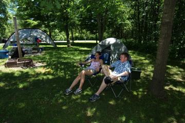
Arrow Rock State Historic Site Campground sits within one of Missouri's most significant historic villages, a well-preserved frontier town that served as a major outfitting point for travelers heading west on the Santa Fe Trail. The campground offers 47 total sites: 12 basic sites, 34 electric sites with 30-amp and 50-amp service, and one sewer/electric/water full-hookup site. Three sites are ADA accessible. Each campsite includes a parking pad, picnic table, grill, and lantern post. Full amenities including potable water, shower houses, and modern restrooms are available during the on-season from April 1 through October 31. During the off-season (November 1 through March 31), basic camping remains available but water systems, showers, and firewood sales are not operational. The campground also features a dump station and woodlot. A special-use camping area accommodates group camping with four picnic tables, three fire pits, and space for multiple tents. Reservations can be made up to 12 months in advance through Missouri State Parks' reservation system. The historic site itself offers walking tours of restored buildings, a visitor center with exhibits on frontier life, and the Lyceum Theatre, one of the oldest professional regional theaters in Missouri.
Directions
From Interstate 70, take Exit 98 (Arrow Rock/Marshall). Head north on Highway 41 for approximately 13 miles to Arrow Rock. The campground is located within Arrow Rock State Historic Site at 39521 Visitor Center Drive, Arrow Rock, MO 65320.
Nearby Campgrounds
Amenities
| Water | Yes |
| Fires Allowed | Yes |
| Toilets | Yes |
| Dump Station | Yes |
| Wifi | — |
| Pets Allowed | Yes |
| Showers | Yes |
| Electric Hookups | Yes |
| Water Hookups | Yes |
| Sewer Hookups | Yes |
| Camp Store | — |
| Price | $15 - $35 |
Vehicle
| Max RV Length | 67ft |
| Max Trailer Length | — |
| Big Rig Friendly | — |
| Pull Through Sites | Yes |
Contact
| moparks@dnr.mo.gov | |
| Phone | +1 (660) 837-3330 |
Cell Service
| AT&T | Yes |
| Verizon | Yes |
| T-Mobile | None |
Availability
Photos
Community Posts
No posts yet. Be the first to share your experience!