Amory Boat Ramp Picnic Shelter
This is a day-use picnic shelter only; overnight camping is not permitted. The facility is open year-round. Restroom is closed November 16 through March 1. A day-use fee applies for vessel launches from March 1 through November 15.
Flood Watch issued October 8 at 11:09PM CDT until October 11 at 7:00AM CDT by NWS Memphis TN
* WHAT...Flooding caused by excessive rainfall continues to be possible. * WHERE...Portions of North Mississippi, including the following areas, Alcorn, Benton MS, Calhoun, Chickasaw, Coahoma, DeSoto, Itawamba, Lafayette, Lee MS, Marshall, Monroe, Panola, Pontotoc, Prentiss, Quitman, Tallahatchie, Tate, Tippah, Tishomingo, Tunica, Union and Yalobusha and West Tennessee, including the following areas, Benton TN, Carroll, Chester, Crockett, Decatur, Dyer, Fayette, Gibson, Hardeman, Hardin, Haywood, Henderson, Lauderdale, Madison, McNairy, Shelby and Tipton. * WHEN...From late Friday night through Sunday morning. * IMPACTS...Excessive runoff may result in flooding of rivers, creeks, streams, and other low-lying and flood-prone locations. * ADDITIONAL DETAILS... - The eventual Remnants of Hurricane Isaias will trek north impacting areas mainly east of the Mississippi River with local amounts up to 3 inches of rainfall. - http://www.weather.gov/safety/flood
About
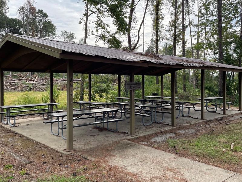
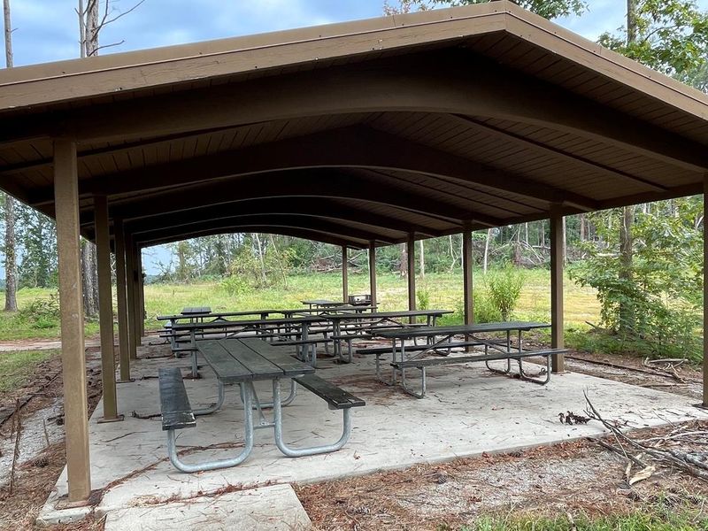
Amory Boat Ramp Picnic Shelter is a day-use recreation area located on the Tennessee-Tombigbee Waterway in Amory, Mississippi. The facility provides a covered picnic shelter equipped with 8 picnic tables and 2 grills, making it suitable for group gatherings and family outings. The site includes a 2-lane boat ramp with a courtesy dock for launching watercraft onto the Tenn-Tom Waterway. A restroom is available on-site, though it closes annually from November 16 through March 1. This location is unstaffed. Important: This is a day-use only facility. Overnight camping is not permitted at this location. The Tennessee-Tombigbee Waterway extends 234 miles connecting the Tennessee River to the Tombigbee River in Alabama, providing access to the Gulf of Mexico.
Directions
From Highway 45 in Aberdeen, Mississippi, travel to the intersection of Commerce and Meridian Streets in the downtown area. From Commerce, turn north on Meridian and cross a railroad track and a bridge. The recreation area is the first right turn after the bridge.
Nearby Campgrounds
Amenities
| Water | — |
| Fires Allowed | — |
| Toilets | Yes |
| Dump Station | No |
| Wifi | — |
| Pets Allowed | — |
| Showers | — |
| Electric Hookups | — |
| Water Hookups | — |
| Sewer Hookups | — |
| Camp Store | No |
Vehicle
| Max RV Length | — |
| Max Trailer Length | — |
| Big Rig Friendly | — |
| Pull Through Sites | No |
Contact
| Phone | +1 (662) 862-5414 |
Cell Service
| AT&T | Yes |
| Verizon | Yes |
| T-Mobile | Yes |
Useful Links
| View on Recreation.gov |
Availability
Photos
Community Posts
No posts yet. Be the first to share your experience!