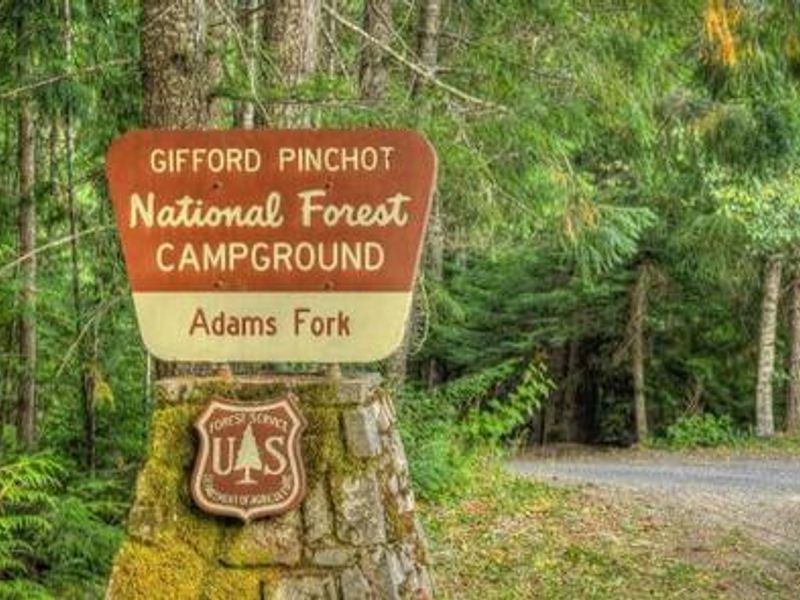
Adams Fork Campground
Open for the 2026 season. The campground operates mid-May through mid-September. Most sites are first-come, first-served with some sites reservable via Recreation.gov. Check-in at 2:00 p.m., check-out at noon. Quiet hours 10:00 p.m. to 6:00 a.m.
Red Flag Warning issued July 22 at 1:49PM PDT until July 23 at 10:00PM PDT by NWS Seattle WA
* AFFECTED AREA...Fire Weather Zone 655 Black Hills and Southwest Interior Lowlands and Fire Weather Zone 659 West Slopes of the Central Cascades Generally above 1500 Feet. * WINDS...West 5 to 10 mph with gusts up to 25 mph. * RELATIVE HUMIDITY...As low as 20 percent. * LIGHTNING...Isolated thunderstorm coverage is possible across the southern Cascade Mountains and portions of southwest Washington. Thunderstorms will develop late Wednesday night and move from south to north across the area. * OUTFLOW WINDS...Any storms that develop will be capable of gusty and erratic outflow winds between 25 and 30 miles per hour. Outflow winds can occur ahead of and behind storms and cause erratic wind directions. * TEMPERATURES...Up to 98. * TIMING...4 PM PDT this afternoon to 10 PM PDT Thursday afternoon. * IMPACTS...Lightning in dry fuels can cause multiple fire starts. Thunderstorms can also bring sudden sharp wind shifts on existing fires, causing rapid changes in a fire's rate of spread and direction of spread. Thunderstorm outflow winds can be a threat for several hours following the start of a new lightning- caused fire. If a fire were to begin, air quality may diminish in the surrounding area. * IMPACTS...Scattered lightning in dry fuels can cause multiple fire starts. Thunderstorms can also bring sudden sharp wind shifts on existing fires, causing rapid changes in a fire's rate of spread and direction of spread. Thunderstorm outflow winds can be a threat for several hours following the start of a new lightning-caused fire. If a fire were to begin, air quality may diminish in the surrounding area.
Alcohol Prohibitions
This Order describes acts that are prohibited upon lands, roads and trails within the National Forest System administered by the Forest Service Pacific Northwest Region in regards to alcoholic beverages.
Aquatic Invasive Species
This Order prohibits 1) possessing, storing, or transporting any aquatic invasive animal species AND 2) prohibits possessing, storing, or transporting any aquatic or riparian invasive plant species - on National Forest System lands in the Pacific Northwest Region as specified in the Order.
About
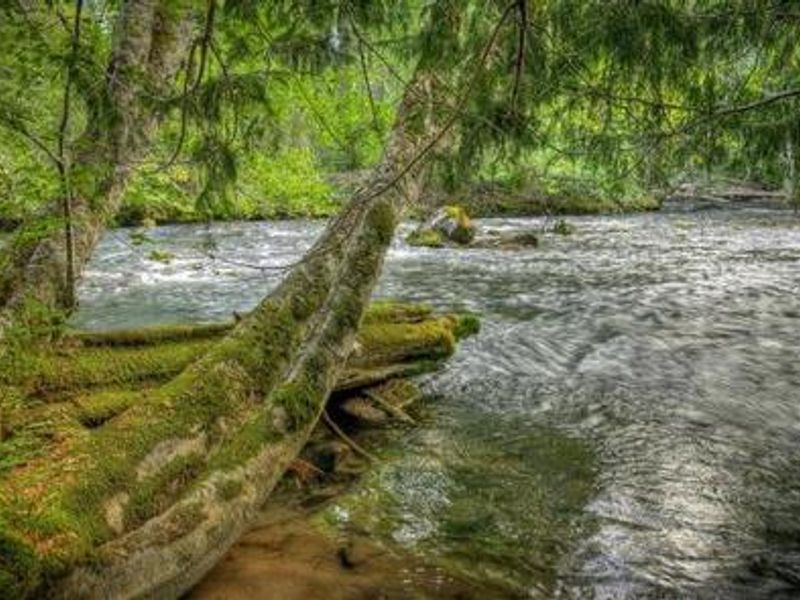
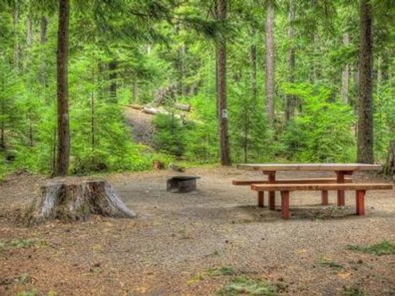
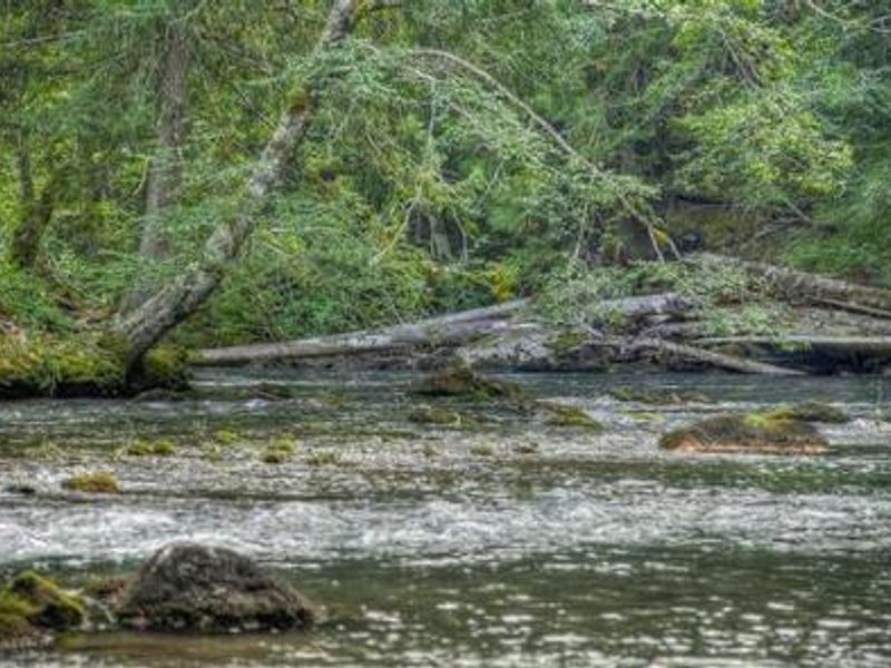
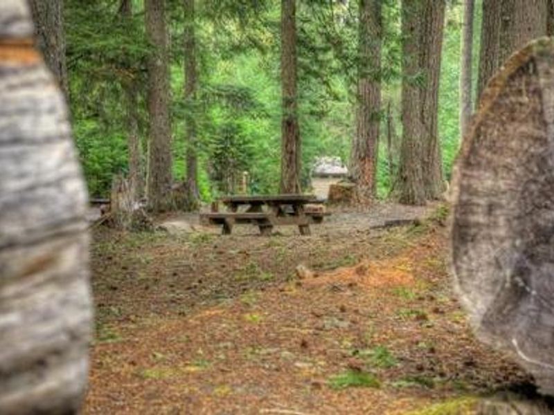
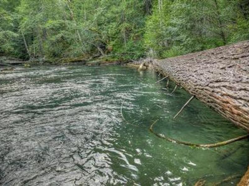
Nestled in the Cowlitz Valley Ranger District of Gifford Pinchot National Forest, Adams Fork Campground offers a forested retreat along the Adams Fork of the Cispus River. The campground provides 24 paved back-in sites including three double sites that can accommodate larger groups of 12-25 campers. Many sites sit directly along the riverbank, and the area features culturally significant historic basket trees used by the Upper Cowlitz Tribe, marked with interpretive signage. The campground serves as an excellent base for exploring the surrounding recreation opportunities. The Valley Trail network offers 50 miles of multi-use trails popular with dirt bikes, ATVs, mountain bikers, and horseback riders, with views of the Cispus River Valley and Tongue Mountain. Anglers can fish for brook trout in the Cispus River. Note that while the campground is frequented by motorized users, OHV riding within the campground itself is prohibited. The nearby town of Randle provides access to the Windy Ridge viewpoint at Mount St. Helens. The campground offers basic amenities including vault toilets and potable water from a hand pump, with a 14-day stay limit enforced.
Directions
From Randle, WA, travel south on State Highway 131 (Forest Roads 23/25). At the Y intersection in 1 mile, veer left onto Forest Road 23. Continue on FR 23 for 18.5 miles, then turn left onto Forest Road 21. Follow FR 21 for 4.6 miles and turn right onto Forest Road 56. The campground is less than 0.25 mile on the left.
Location
Amenities
| Water | Yes |
| Fires Allowed | Yes |
| Toilets | Yes |
| Dump Station | — |
| Wifi | No |
| Pets Allowed | Yes |
| Showers | No |
| Electric Hookups | — |
| Water Hookups | — |
| Sewer Hookups | — |
| Camp Store | No |
| Price | $45 |
Vehicle
| Max RV Length | 42ft |
| Max Trailer Length | 42ft |
| Big Rig Friendly | No |
| Pull Through Sites | No |
Contact
| Phone | +1 (360) 686-3008 |
Cell Service
| AT&T | None |
| Verizon | None |
| T-Mobile | None |
Availability
Photos
Community Posts
No posts yet. Be the first to share your experience!