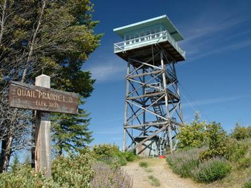
Quail Prairie Lookout
Closed to reservations until further notice. The cab structure collapsed in November 2024 due to wind damage from a severe storm. The tower remains standing but the facility is not available for rental.
About
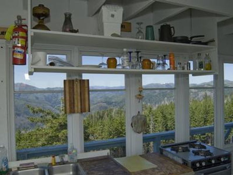
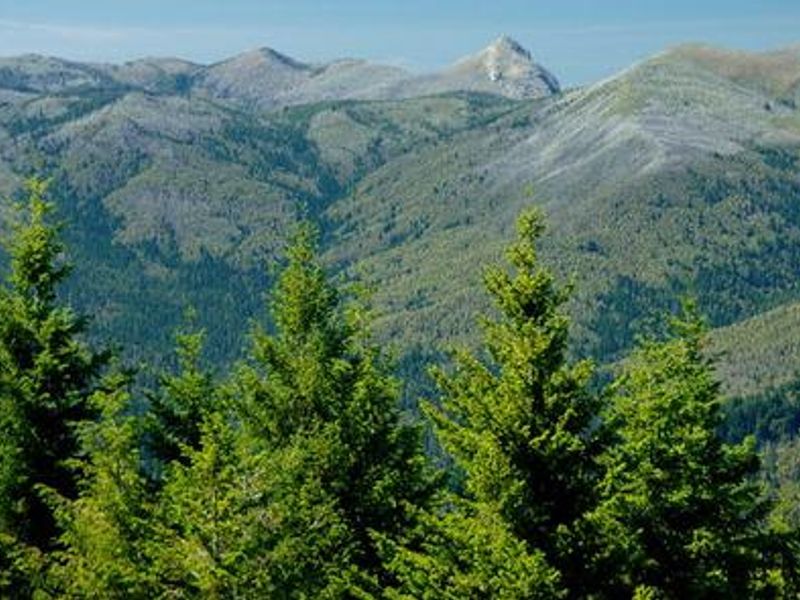
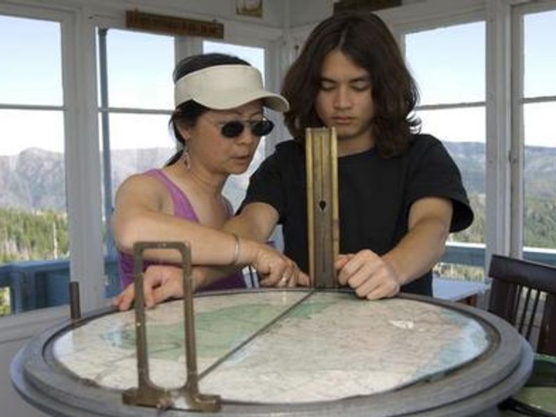
Quail Prairie Lookout stands as one of the last fire lookouts constructed by the southwestern Oregon Forest Service, completed in 1963. The 41-foot timber tower served fire detection duties until the mid-1990s when it was converted for recreational use. Situated in the Rogue River-Siskiyou National Forest near Brookings, the lookout offered guests sweeping panoramic views of the Kalmiopsis Wilderness and the Chetco River drainage below. The lookout's location provided access to the Upper Chetco Trail, the main east-west route through the Kalmiopsis Wilderness, offering challenging backpacking with steep terrain and connections to the Chetco River and its tributaries. The remote setting was ideal for stargazing and observing the diverse plant and wildlife of this geologically and botanically significant area, home to the endemic Kalmiopsis leachiana shrub. The single-room cab was equipped with a bed, table, chairs, wood stove, propane cooking stove, and propane refrigerator. No water or electricity was available; guests had to pack in all water and supplies. A vault toilet was provided at the tower base. Children under 12 were discouraged due to the tower height. Access required navigating 26 miles of narrow gravel Forest Service roads from Brookings.
Directions
From Brookings and U.S. Highway 101, drive east on North Bank Chetco River Road (County Road 784). This becomes Forest Service Road 1376 in approximately 8 miles. Turn left after crossing the South Fork Bridge (16 miles from Brookings). Turn right on Forest Service Road 1917, approximately 1 mile after the bridge. Follow Quail Prairie signs staying on Forest Service Road 1917. The lookout is 3 miles beyond Packer's Cabin. Total distance is 26 miles. Roads are generally one-lane gravel with pullouts.
Amenities
| Water | No |
| Fires Allowed | — |
| Toilets | Yes |
| Dump Station | No |
| Wifi | No |
| Pets Allowed | Yes |
| Showers | No |
| Electric Hookups | — |
| Water Hookups | — |
| Sewer Hookups | — |
| Camp Store | No |
Vehicle
| Max RV Length | — |
| Max Trailer Length | — |
| Big Rig Friendly | No |
| Pull Through Sites | No |
Contact
| Phone | +1 (541) 412-6000 |
Cell Service
| AT&T | None |
| Verizon | None |
| T-Mobile | None |
Photos

Community Posts
No posts yet. Be the first to share your experience!