Acker Rock Lookout
Closed for falcon nesting through June 30. The operating season typically runs August 1 through November 15, depending on snow conditions. The refrigerator is currently non-functional; plan alternate cold food storage.
From Recreation.gov
**Attention Guests** - The refrigerator at Acker Rock Lookout is currently down. Please plan alternate ways to store food that needs to be kept cold. We are sorry for any inconvenience this may cause.
Alcohol Prohibitions
This Order describes acts that are prohibited upon lands, roads and trails within the National Forest System administered by the Forest Service Pacific Northwest Region in regards to alcoholic beverages.
About
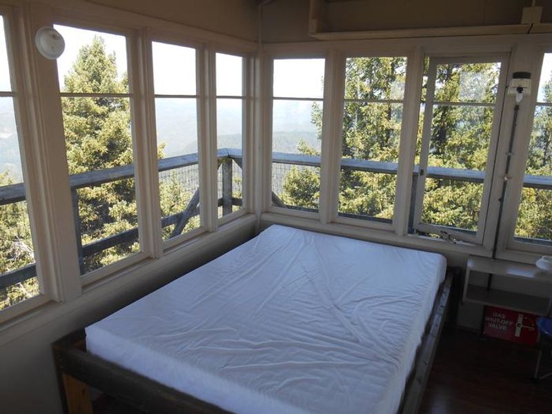
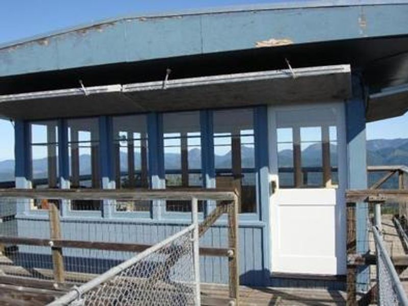
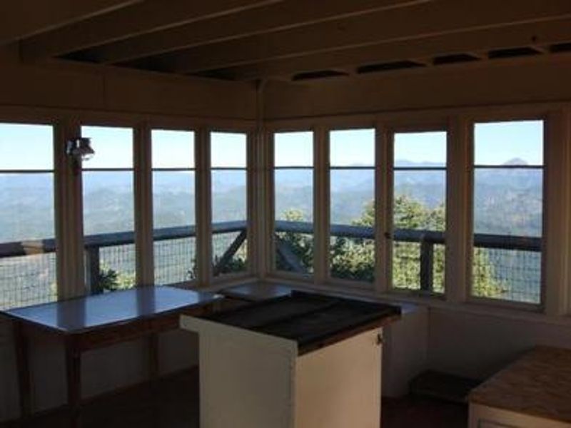
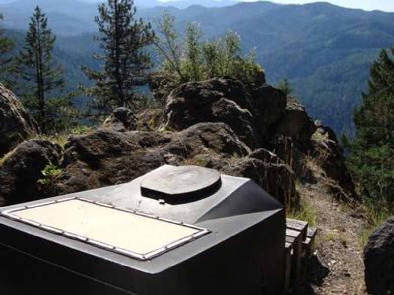
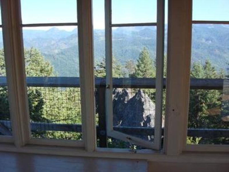
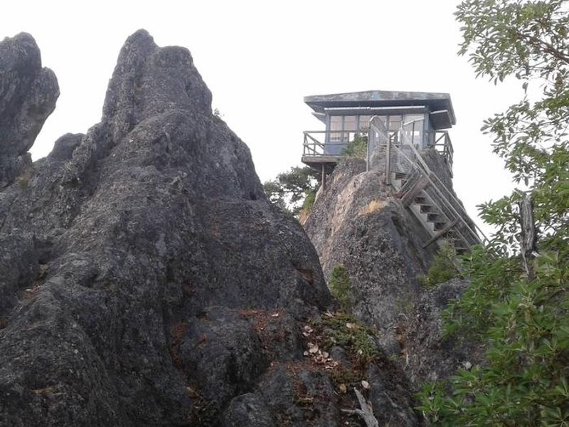
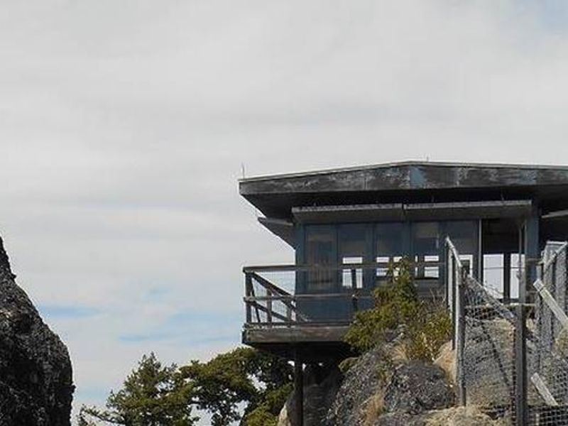
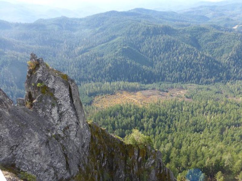
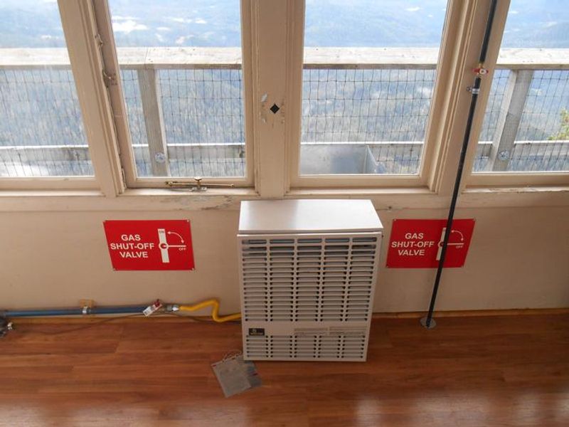
Acker Rock Lookout offers a unique lodging experience in the Umpqua National Forest, perched atop a rocky cliff with sheer drops of several hundred feet on the west and south sides. The historic fire lookout was placed on this magnificent rock formation via helicopter in the 1960s and remains in active fire detection use today. Views encompass the South Umpqua watershed, Rogue-Umpqua Divide, and on clear days extend to mountains on the Willamette, Rogue, and Deschutes River watersheds and Crater Lake Rim. The 12x12 one-room cabin accommodates up to four guests and comes equipped with a single bed with full mattress, small table and chair, propane wall heater, propane lanterns, and a cooking stove with oven. Propane is provided. A composting toilet is available near the lookout. There is no water or electricity at the site; guests must bring all drinking water, food, cooking utensils, sleeping bags, sleeping pads, towels, toilet paper, and garbage bags. Access requires a high-clearance vehicle to reach the trailhead, followed by a moderately steep 0.4-mile hike on Acker Rock Trail #1585. The road has a locked gate; the gate combination is provided with your reservation confirmation.
Directions
From Canyonville, take West 1st Street and turn onto SE 3rd St/OR-227. Continue approximately 23 miles to Tiller. Turn left on Douglas County Road #46/South Umpqua Road, which becomes FS Road #28. Follow for 18.5 miles to Buckeye Creek/FS Road #29. Continue on FS Road #29 for 7 miles to the junction with FS Road #2838. Turn left onto #2838 for 1.5 miles to FS Road #2838-950 spur. Follow for 1.5 miles to the trailhead. The road has a locked gate; combination provided with reservation. Hike 0.4 miles on Acker Rock Trail #1585 to reach the lookout. High-clearance 4WD/AWD vehicle recommended.
Amenities
| Water | No |
| Fires Allowed | Yes |
| Toilets | Yes |
| Dump Station | No |
| Wifi | No |
| Pets Allowed | Yes |
| Showers | No |
| Electric Hookups | — |
| Water Hookups | — |
| Sewer Hookups | — |
| Camp Store | No |
| Price | $40 |
Vehicle
| Max RV Length | — |
| Max Trailer Length | — |
| Big Rig Friendly | No |
| Pull Through Sites | No |
Contact
| Phone | +1 (541) 825-3100 |
Cell Service
| AT&T | None |
| Verizon | None |
| T-Mobile | None |
Availability
Photos

Community Posts
No posts yet. Be the first to share your experience!