Webb Mtn. Lookout Rental
Closed for the season. The lookout typically opens in late June when access roads become passable after snowmelt. Reservations available through Recreation.gov with a 5 consecutive night stay limit.
Northern Region Camping & Target Restrictions, Pallet Prohibition
This order defines the maximum length of occupation at a single location or cumulatively at any number of locations within a calendar year, within the states of Montana, North Dakota, South Dakota, and Idaho
Weed Free Forage & Mulch Products Order for the Northern Region
It is illegal to possess, store or transport straw, hay, grain, seed or other forage or mulch products on Forest Service lands without documentation that the product is certified as “weed free” by a state certification process that meets or exceeds the North American Weed Free Forage standards.
R1-2023-02 - NCDE Food and Wildlife Attractant Storage Order
Northern Continental Divide Ecosystem Food/Wildlife Attractant Storage Order for the Flathead, Lolo, Kootenai, Helena-Lewis and Clark, and Beaverhead-Deerlodge National Forests within the Northern Continental Divide Ecosystem.
About
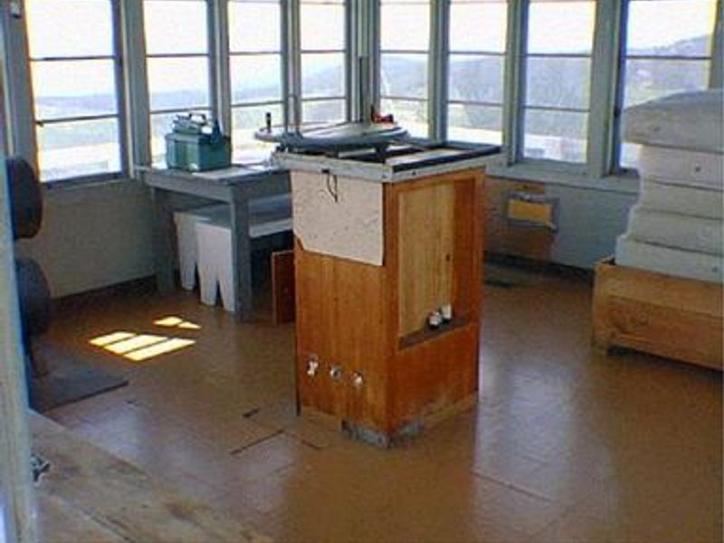
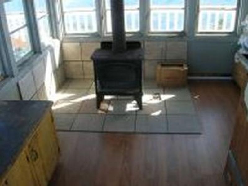
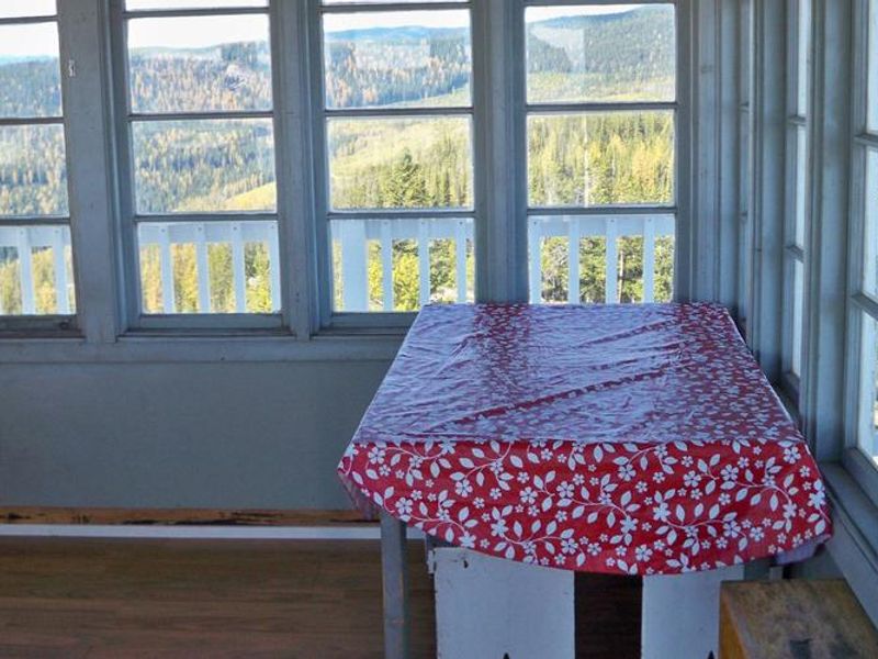
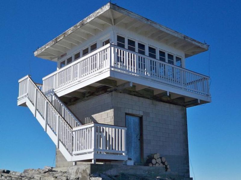
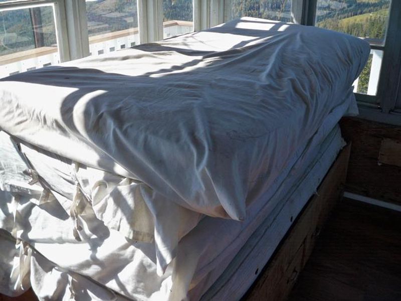
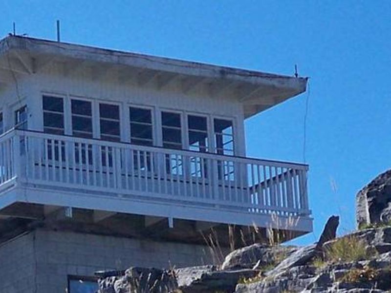
Webb Mountain Lookout is a historic fire lookout built in 1959 and used for over 40 years as an observation point for detecting forest fires. Perched at 5,988 feet atop its namesake mountain in Kootenai National Forest, the 196-square-foot structure rests on a concrete block basement and offers panoramic views through windows on all sides, with a catwalk encircling the cabin. The lookout accommodates up to 5 people with one twin bed frame and 5 mattresses. Amenities include a wood stove for heating, a table with benches, and cleaning gear. An outhouse is located nearby, and a campfire ring with some firewood is provided at the base of the tower. There is no water or electricity; guests must bring drinking water, a cook stove, bedding, lighting, and all supplies. Access roads are well-maintained for most of the route, but the last quarter mile is steep, rocky, and requires high-clearance vehicles. The Pacific Northwest National Scenic Trail is accessible from Webb Mountain, descending to Lake Koocanusa Bridge. The area offers fishing for kokanee salmon, rainbow trout, and cutthroat trout, plus big game hunting opportunities.
Directions
From Eureka, Montana, take Highway 37 south 15 miles to the Koocanusa Bridge. At the west side of the bridge, turn right on Road 92 and proceed to Boulder Creek Road 337. Turn left and follow approximately 8 miles to Webb Mountain on Road 7179. At the ridge crest, turn left. The gate to the lookout is visible at this point. The lookout is about 1 mile beyond the gate. High-clearance vehicle recommended for the last quarter mile.
Amenities
| Water | No |
| Fires Allowed | Yes |
| Toilets | Yes |
| Dump Station | No |
| Wifi | No |
| Pets Allowed | — |
| Showers | No |
| Electric Hookups | — |
| Water Hookups | — |
| Sewer Hookups | — |
| Camp Store | No |
| Price | $45 |
Vehicle
| Max RV Length | 25ft |
| Max Trailer Length | — |
| Big Rig Friendly | No |
| Pull Through Sites | No |
Contact
| Phone | +1 (406) 296-2536 |
Cell Service
| AT&T | Yes |
| Verizon | None |
| T-Mobile | None |
Availability
Photos
Community Posts
No posts yet. Be the first to share your experience!