Mcguire Mtn. Lookout Rental
Currently closed for the season. The lookout typically opens mid-June through the end of September, weather and road conditions permitting. Reservations are available through Recreation.gov with a maximum 5-consecutive-day stay limit.
Northern Region Camping & Target Restrictions, Pallet Prohibition
This order defines the maximum length of occupation at a single location or cumulatively at any number of locations within a calendar year, within the states of Montana, North Dakota, South Dakota, and Idaho
Weed Free Forage & Mulch Products Order for the Northern Region
It is illegal to possess, store or transport straw, hay, grain, seed or other forage or mulch products on Forest Service lands without documentation that the product is certified as “weed free” by a state certification process that meets or exceeds the North American Weed Free Forage standards.
R1-2023-02 - NCDE Food and Wildlife Attractant Storage Order
Northern Continental Divide Ecosystem Food/Wildlife Attractant Storage Order for the Flathead, Lolo, Kootenai, Helena-Lewis and Clark, and Beaverhead-Deerlodge National Forests within the Northern Continental Divide Ecosystem.
About
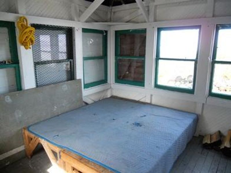
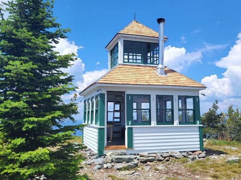
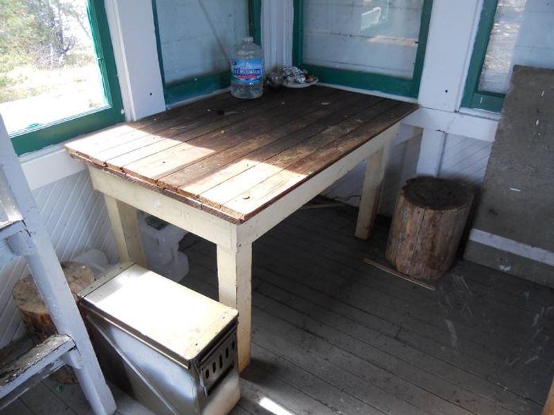
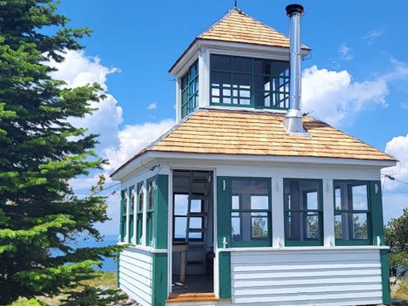
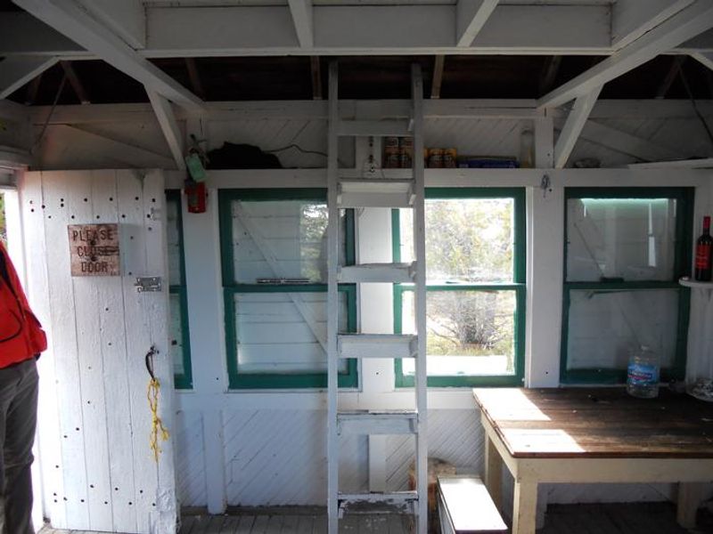
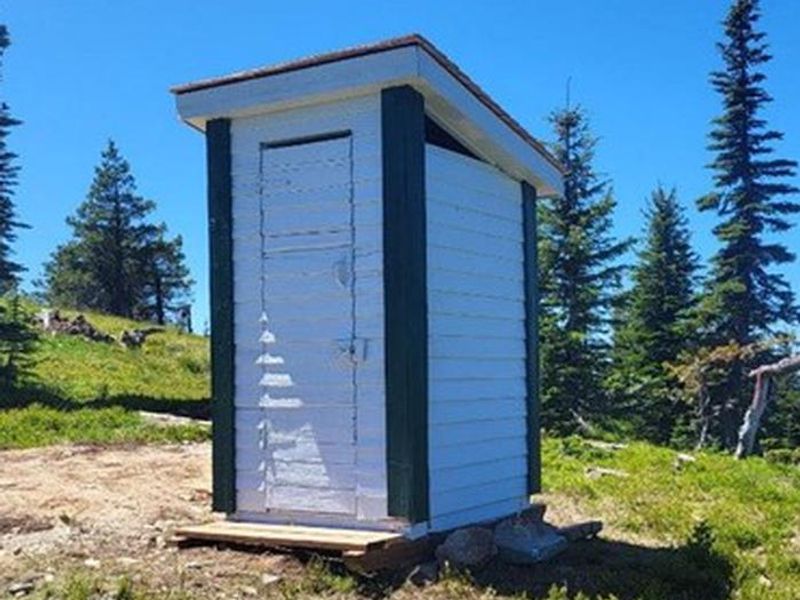
McGuire Mountain Lookout is a historic fire lookout tower that served as an observation point for detecting forest fires from 1923 until it was abandoned around 1944. The structure was renovated between 1983 and 1998 and now operates as a rustic rental cabin managed by the Kootenai National Forest. The 12x12 foot wood-frame cabin features a pyramidal roof with a cupola accessible via an interior ladder. Windows completely surround the structure, providing spectacular 360-degree views of the Cabinet Mountains and Koocanusa Reservoir area. At nearly 7,000 feet elevation, guests enjoy some of the best sunrise and sunset views in the region. The lookout is equipped with a modern wood stove (firewood supplied but not guaranteed), two twin bed boards without mattresses, a table, and a bench. An outdoor pit toilet is provided. There is no water, electricity, or other utilities. Guests must hike 2.5 miles from the Little Sutton Mountain trailhead to reach the lookout, carrying all water, sleeping gear, cooking equipment, and supplies.
Directions
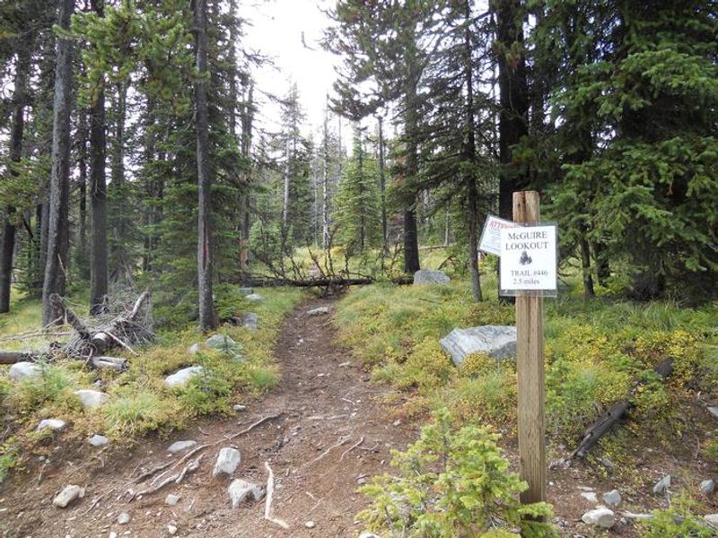
From Eureka, take Othorp Lake Road 854. Stay on this road to Pinkham Creek Road 856 and continue for approximately 13 miles. Turn and follow Sutton Ridge Road 494 west to Little Sutton Mountain, where a sign marks the beginning of the lookout trail. Park at the trailhead and hike approximately 2.5 miles up Trail #446 to reach the lookout.
Amenities
| Water | No |
| Fires Allowed | — |
| Toilets | Yes |
| Dump Station | No |
| Wifi | No |
| Pets Allowed | — |
| Showers | No |
| Electric Hookups | — |
| Water Hookups | — |
| Sewer Hookups | — |
| Camp Store | No |
| Price | $45 |
Vehicle
| Max RV Length | — |
| Max Trailer Length | — |
| Big Rig Friendly | No |
| Pull Through Sites | No |
Contact
| Phone | +1 (406) 296-2536 |
Cell Service
| AT&T | Yes |
| Verizon | Yes |
| T-Mobile | None |
Availability
Photos
Community Posts
No posts yet. Be the first to share your experience!