Wax Ramp

Wax Day Use

Closed

This is a day-use only area with no overnight camping. The site is managed by Wax Marina. For overnight camping, use the adjacent Wax Campground.

Special Weather Statement issued May 22 at 9:14PM EDT by NWS Louisville KY

8:14 PM — 8:45 PM

At 914 PM EDT/814 PM CDT/, Doppler radar was tracking gusty showers along a line extending from 8 miles south of Brandenburg to 8 miles south of Leitchfield. Movement was northeast at 20 mph. HAZARD...Wind gusts up to 40 mph. SOURCE...Radar indicated. IMPACT...Gusty winds could knock down tree limbs and blow around unsecured objects. Locations impacted include... Leitchfield, Irvington, Muldraugh, Clarkson, Dyer, Rock Creek, Saint Paul, Buras, Grahamton, and Sadler.

Special Weather Statement issued May 22 at 8:14PM CDT by NWS Louisville KY

8:14 PM — 8:45 PM

At 814 PM CDT, Doppler radar was tracking gusty showers near Morgantown, moving northeast at 25 mph. HAZARD...Wind gusts up to 40 mph. SOURCE...Radar indicated. IMPACT...Gusty winds could knock down tree limbs and blow around unsecured objects. Locations impacted include... Morgantown, Casey, Lee, Woodbury, Monford, Mining City, Aberdeen, Leetown, Eden, and Brooklyn.

Severe Thunderstorm Warning issued May 22 at 9:13PM EDT until May 22 at 9:45PM EDT by NWS Louisville KY

8:13 PM — 8:45 PM

SVRLMK The National Weather Service in Louisville has issued a * Severe Thunderstorm Warning for... Eastern Grayson County in central Kentucky... Southwestern Hardin County in central Kentucky... * Until 945 PM EDT/845 PM CDT/. * At 912 PM EDT/812 PM CDT/, a severe thunderstorm was located near Leitchfield, moving northeast at 30 mph. HAZARD...Possible Tornado and gusty winds. SOURCE...Radar indicated. IMPACT...Expect damage to roofs, siding, and trees. * Locations impacted include... Leitchfield, Clarkson, Spurrier, Rock Creek, Limp, Saint Paul, Peonia, West Clifty, Grayson Springs, and Solway.

Flood Advisory issued May 22 at 6:52PM CDT until May 22 at 10:00PM CDT by NWS Louisville KY

6:52 PM — 10:00 PM

* WHAT...Flooding caused by excessive rainfall is expected. * WHERE...A portion of central Kentucky, including the following counties, Breckinridge, Grayson and Ohio. * WHEN...Until 1000 PM CDT. * IMPACTS...Minor flooding in low-lying and poor drainage areas. * ADDITIONAL DETAILS... - At 650 PM CDT, Doppler radar indicated heavy rain due to showers and thunderstorms. Minor flooding is ongoing or expected to begin shortly in the advisory area. Between 1 and 2 inches of rain have fallen. - Additional rainfall amounts of 0.5 to 1.5 inches are expected over the area. This additional rain will result in minor flooding. - Some locations that will experience flooding include... Fordsville, Axtel, Glen Dean, Falling Branch, Hinton Hills, Dempster, Hickory Corner, Cannons Point, Mcquady and Rockvale. - http://www.weather.gov/safety/flood

About

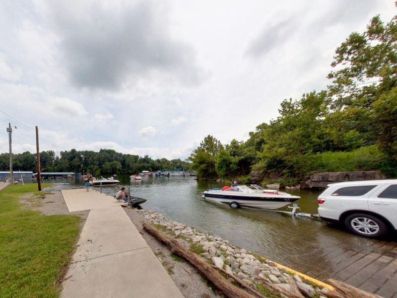
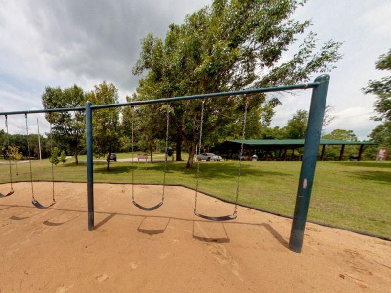
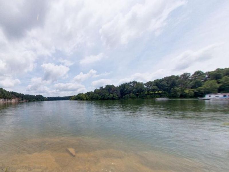
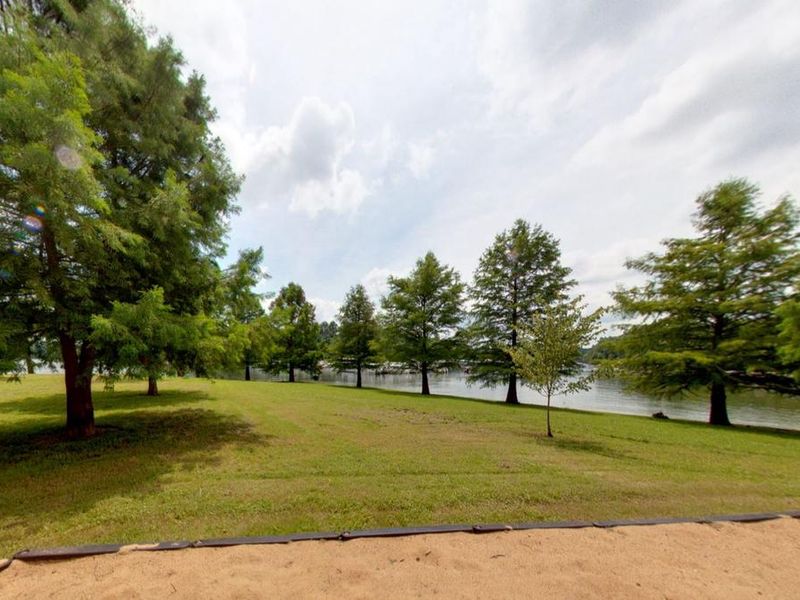
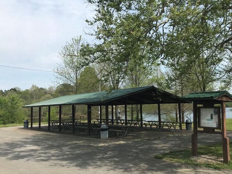
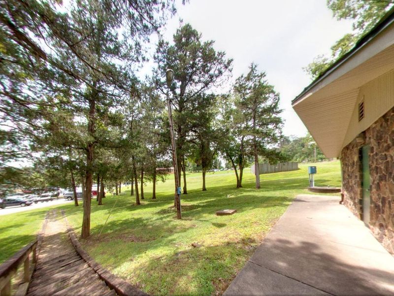
Wax Day Use is a day-use recreation area situated on the shores of Nolin River Lake in the rolling landscape of southern Kentucky. The facility is managed by Wax Marina following a transition from U.S. Army Corps of Engineers Louisville District operations. It provides convenient lake access adjacent to Wax Marina and directly across the street from Wax Campground. The day-use area features a boat ramp with courtesy dock for launching watercraft, a fishing pier for anglers, a playground for families, and a restroom. A group shelter is available for reservation. Nolin Lake, created by Nolin Dam, spans 5,795 acres and is known for its distinctive blue-green water and excellent fishing for catfish, bass, crappie, and walleye. This is a day-use only facility with no overnight camping. Visitors seeking overnight accommodations should consider the adjacent Wax Campground or other campgrounds around Nolin River Lake such as Dog Creek or Moutardier.

Directions

From Louisville, KY: Take I-65 south approximately 59 miles to exit 76. Follow Hwy 224 for approximately 10 miles, turn left on Hwy 479. In approximately 8 miles turn left on Highway 88. The Day Use area is on the left (campground on right). Total distance about 78 miles, driving time about 1 hour 40 minutes. From Bowling Green, KY: Follow US 31W North approximately 14 miles, turn left onto KY 101. In approximately 6 miles, Hwy 101 becomes Hwy 259 North. Follow Hwy 259 North about 22 miles. Stay straight at Hwy 259/226 intersection; follow Hwy 226 about 2 miles. Turn right on Hwy 88 and follow approximately 7 miles. Day Use area on left. Total distance about 51 miles.

Amenities

Water
Fires Allowed
Toilets Yes
Dump Station No
Wifi
Pets Allowed
Showers No
Electric Hookups
Water Hookups
Sewer Hookups
Camp Store No
Price $50

Vehicle

Max RV Length
Max Trailer Length
Big Rig Friendly
Pull Through Sites No

Contact

Email lrl-pagemaster-grn@usace.army.mil
Phone +1 (270) 286-4511

Cell Service

AT&T None
Verizon Yes
T-Mobile None

Availability

Photos

Wax Ramp
Wax Playground and Shelter
Nolin Lake, above Wax Marina
Wax Fishing Pier
Wax below Shelter
Wax Shelter
Wax Restroom

Community Posts

No posts yet. Be the first to share your experience!