Warrior Creek
Open for the 2026 season. Reservations available through Recreation.gov. Swim beach is closed until further notice but camping operations are unaffected. Maximum 14-day stay within any 30-day period. Check-in at 3:00 PM, check-out at noon.
Flood Warning issued October 11 at 5:49AM EDT until October 11 at 8:00AM EDT by NWS Blacksburg VA
* WHAT...Urban areas and small streams flooding caused by excessive rainfall continues. * WHERE...South Central Ashe County in northwestern North Carolina... Watauga County in northwestern North Carolina... Southwestern Wilkes County in northwestern North Carolina... * WHEN...Until 800 AM EDT. * IMPACTS...Flooding of rivers, creeks, streams, and other low-lying and flood-prone locations is imminent or occurring. Streams continue to rise due to excess runoff from earlier rainfall. * ADDITIONAL DETAILS... - At 547 AM EDT, Doppler radar and automated rain gauges indicated light to moderate rainfall. However, flooding is ongoing in the warned area due to between 4 and locally 7 inches of rain that fell since Saturday morning. - This includes the following streams and drainages... Fall Creek, Norris Fork, Flat Branch, Elk Creek, Mill Creek, Dugger Creek, Little Dugger Creek, Laurel Fork, Dutch Creek, Meat Camp Creek, Brushy Fork, Grassy Creek and Left Prong Stony Fork. Additional rainfall amounts up to 0.5 inches are possible in the warned area. - Some locations that will experience flooding include... Boone, Blowing Rock, Deep Gap, Todd, Foscoe, Seven Devils and Aho. - For flooding safety information, please visit http://www.weather.gov/safety/flood
Flood Watch issued October 11 at 12:40AM EDT until October 11 at 8:00PM EDT by NWS Blacksburg VA
* WHAT...Flooding caused by excessive rainfall continues to be possible. * WHERE...Portions of North Carolina, including the following areas, Alleghany NC, Ashe, Surry, Watauga and Wilkes and southwest Virginia, including the following areas, Carroll, Floyd, Grayson and Patrick. * WHEN...Through this evening. * IMPACTS...Excessive runoff may result in flooding of rivers, creeks, streams, and other low-lying and flood-prone locations. Creeks and streams may rise out of their banks. Low-water crossings may be flooded. Storm drains and ditches may become clogged with debris. * ADDITIONAL DETAILS... - As the remnants of Isaias move northward into the lower Ohio Valley, periods of rain will continue. Heavier rainfall will continue in short bursts through the day. Additional rainfall amounts of 1 to 3 inches, along with what has already fallen will keep the threat of flooding around. - http://www.weather.gov/safety/flood
From Recreation.gov
As of now the booking window for reservations will begin on March 1st, 2026, for Bandits Roost and Warrior Creek campground for the time frame of April 15th through April 29th, 2026, only. As of now the booking window for reservations will begin on April 27th, 2026, for Bandits Roost and Warrior Creek campgrounds for the remaining 2026 season. As of now the booking window for reservations will begin on May 11th, 2026, for Fort Hamby Park shelters and campground.
About
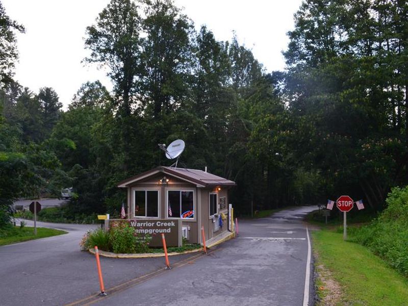
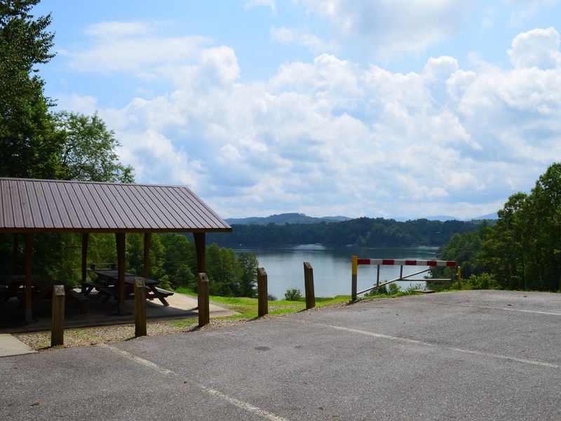
Warrior Creek Campground is operated by the U.S. Army Corps of Engineers on the south shore of the 1,475-acre W. Kerr Scott Reservoir in western North Carolina. The campground provides 61 family campsites on gravel pads accommodating RVs up to 60 feet, plus two group camping areas. Six tent-only sites have electric hookups while the remaining 55 sites offer both electric (50-amp) and water hookups. Facilities include flush and vault toilets, hot showers, potable water, and a dump station. The reservoir offers excellent boating, kayaking, and fishing for channel catfish, largemouth and smallmouth bass, bluegill, and striped bass. Adjacent Keowee Park has a boat ramp and three fishing piers, one ADA accessible. The Warrior Creek Trail system provides 17 miles of single-track trail encircling the campground, recognized by the International Mountain Biking Association as one of the top bike trails in the world. Hikers and trail runners also use the trails extensively. An amphitheater, playground, and basketball court round out the recreation options. The surrounding landscape features mixed hardwood forests of sycamore, poplar, oak, and hickory in the scenic Yadkin River Valley at the eastern edge of the Blue Ridge Mountains. Wildlife includes white-tailed deer, black bear, wild turkey, and various waterfowl.
Directions
From Winston-Salem: Take Highway 421 North approximately 55 miles to Exit 286B, turn left onto Highway 268 and continue for approximately 8 miles. Turn right immediately after crossing the bridge and follow signs to the campground. From Charlotte: Take I-77 North approximately 60 miles, merge onto Highway 421 North towards Wilkesboro/Boone, continue to Exit 286B (approximately 20 miles), turn left onto Highway 268 and continue for approximately 8 miles. Turn right immediately after crossing the bridge and follow signs.
Amenities
| Water | Yes |
| Fires Allowed | Yes |
| Toilets | Yes |
| Dump Station | Yes |
| Wifi | — |
| Pets Allowed | Yes |
| Showers | Yes |
| Electric Hookups | Yes |
| Water Hookups | Yes |
| Sewer Hookups | No |
| Camp Store | — |
| Price | $22 - $85 |
Vehicle
| Max RV Length | 145ft |
| Max Trailer Length | 145ft |
| Big Rig Friendly | Yes |
| Pull Through Sites | No |
Contact
| Phone | +1 (336) 921-2177 |
Cell Service
| AT&T | None |
| Verizon | Yes |
| T-Mobile | None |
Availability
Photos
Community Posts
No posts yet. Be the first to share your experience!