Timber Butte Cabin
Open mid-April through late October. Reservations required via Recreation.gov. Check-in is 2:00 p.m., check-out is 12:00 p.m. Campfires may be prohibited during periods of high fire danger.
Alcohol Prohibitions
This Order describes acts that are prohibited upon lands, roads and trails within the National Forest System administered by the Forest Service Pacific Northwest Region in regards to alcoholic beverages.
Aquatic Invasive Species
This Order prohibits 1) possessing, storing, or transporting any aquatic invasive animal species AND 2) prohibits possessing, storing, or transporting any aquatic or riparian invasive plant species - on National Forest System lands in the Pacific Northwest Region as specified in the Order.
Restrictions on Use of Forage and Mulch Products
This Order prohibits unloading, storing, or using any straw, hay, grain, seed, or other forage or mulch products that are not state-certified weed free on the National Forest System lands, roads or trails in any Closure Area as specific in the Order. Some examples of these include hay bales, hay…
About
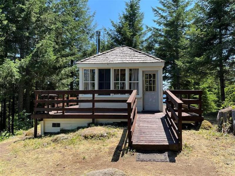
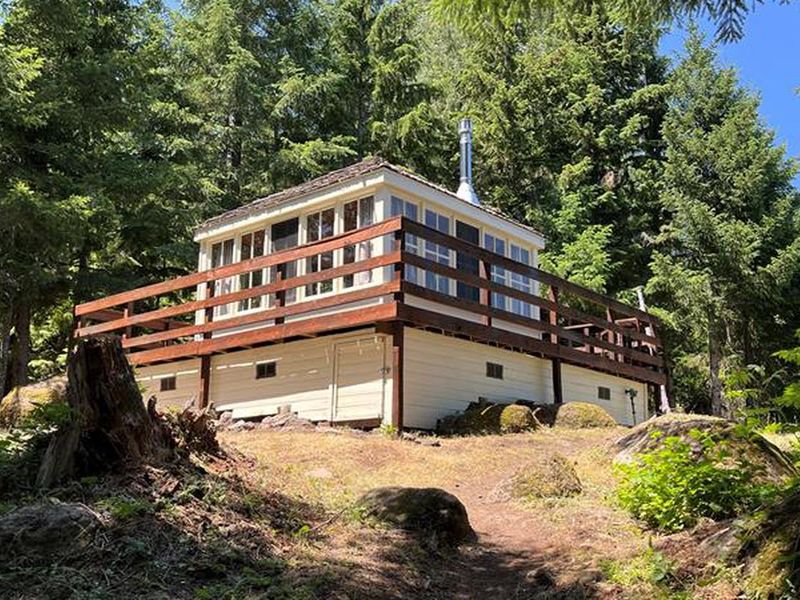
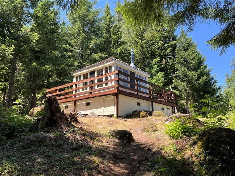
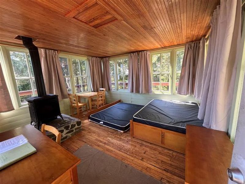
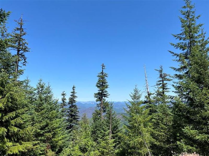
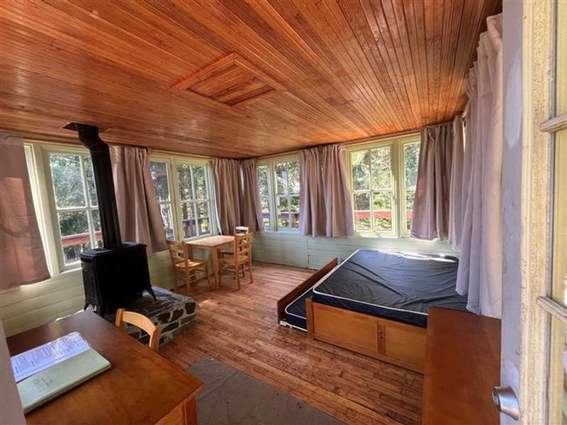
Timber Butte Cabin is a charming replica of the L-4 gabled-style fire lookouts that dotted the Pacific Northwest in the 1930s. Constructed in 2005 through volunteer efforts and a Lane County grant, the 14x14-ft cabin sits at 3,650 feet elevation in the Fall Creek area of Willamette National Forest. The wooden catwalk encircling the structure provides panoramic views of the Cascade Mountains, including Mount Jefferson and the Three Sisters on clear days. The cabin accommodates up to 4 guests with a double bed and sleeping pad. Amenities include a propane heating stove, 3-burner propane cooktop on the deck, dishes, and cookware. Propane is provided. Outside, a picnic table and fire ring are located in a nearby grove. A vault toilet sits approximately 300 feet from the cabin. No potable water or electricity is available. Access requires a high-clearance vehicle for the final mile of brushy forest road. Parking accommodates a maximum of 2 medium vehicles, and guests must walk about 300 feet uphill to reach the cabin. The area offers hiking along the Fall Creek National Recreation Trail, fishing, swimming holes, and access to Lane County's historic covered bridges.
Directions
From I-5, take Highway 58 East (Exit 188) toward Oakridge for 13 miles. Turn left at the Lowell covered bridge (milepost 13). At the 4-way junction in Lowell, turn left onto Boundary Road, then right onto Moss Street for 2 miles to Unity. Turn right onto Big Fall Creek Road (FR 18) and continue to milepost 13. Turn right onto FSR 1821 for approximately 4 miles. Turn right onto FSR 1821-168 for 1 mile, then right onto FSR 1816-175. After 100 yards, turn left onto FSR 1816-131 (gated entrance road). Total distance from Lowell is 19 miles. High-clearance vehicle required for the final brushy mile. Look for white TB signs with directional arrows.
Amenities
| Water | No |
| Fires Allowed | Yes |
| Toilets | Yes |
| Dump Station | No |
| Wifi | No |
| Pets Allowed | No |
| Showers | No |
| Electric Hookups | — |
| Water Hookups | — |
| Sewer Hookups | — |
| Camp Store | No |
| Price | $80 |
Vehicle
| Max RV Length | — |
| Max Trailer Length | — |
| Big Rig Friendly | No |
| Pull Through Sites | No |
Contact
| sm.fs.mfrd@usda.gov | |
| Phone | +1 (541) 782-2283 |
Cell Service
| AT&T | None |
| Verizon | None |
| T-Mobile | None |
Availability
Photos
Community Posts
No posts yet. Be the first to share your experience!