Tie Flume
Closed for the season. The campground operates Memorial Day through Labor Day, weather dependent. Reservations available through Recreation.gov.
Flood Watch issued July 21 at 9:03AM MDT until July 23 at 2:00AM MDT by NWS Billings MT
The combination of a moist and unstable air mass with slow moving thunderstorms capable of producing very heavy rain, will bring a risk of flash flooding Wednesday afternoon and evening. * WHAT...Flash flooding caused by excessive rainfall is possible. * WHERE...Portions of south central Montana, including the following areas, Absaroka/Beartooth Mountains, Beartooth Foothills, Bighorn Canyon, Livingston Area, Northern Carbon, Paradise Valley, Pryor/Northern Bighorn Mountains, Red Lodge Foothills, Southeastern Carbon and Southern Big Horn and north central Wyoming, including the following areas, Northeast Bighorn Mountains and Sheridan Foothills. * WHEN...From Wednesday afternoon through late Wednesday night. * IMPACTS...Excessive runoff may result in flooding of rivers, streams, and other low-lying and flood-prone locations. Recent burn scars, including the Robertson Draw and East Side south of Red Lodge, and the Elk along the eastern slopes of the Bighorn Mountains, are at risk of experiencing flash flooding and debris flows. * ADDITIONAL DETAILS... - Thunderstorms capable of producing very heavy rain are expected Wednesday afternoon and evening. These storms may cause localized flash flooding. - http://www.weather.gov/safety/flood
Wheeled Vehicles in Wilderness
This order describes the prohibition of wheeled vehicles in all National Forest Wilderness Areas of the Rocky Mountain Region and any exceptions thereof.
Weed Free Forage Products
The purpose of this Order is to prevent the introduction or spread of noxious weeds.
About
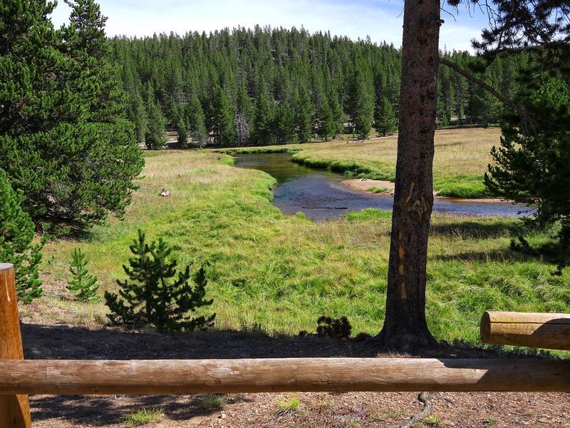
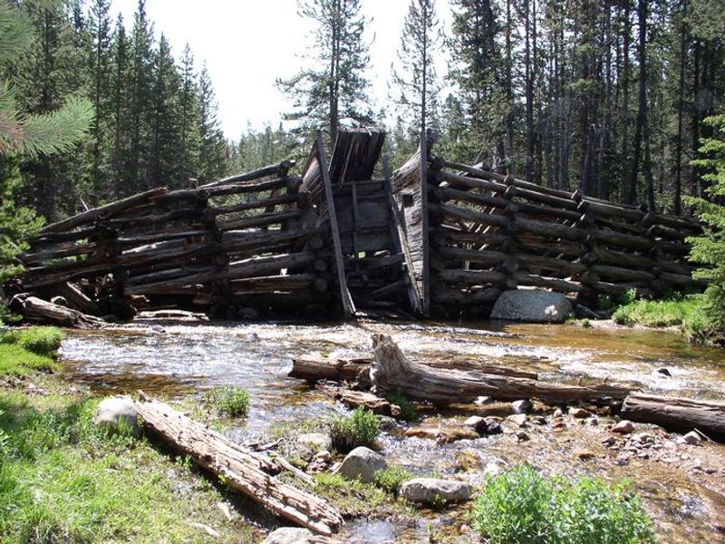
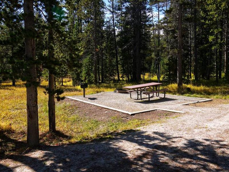
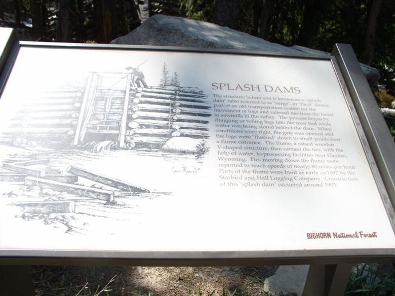
Tie Flume Campground occupies a scenic spot along the South Tongue River in the Bighorn National Forest, where lodgepole pine forests create excellent wildlife habitat beneath peaks rising over 13,000 feet. The campground takes its name from the historic tie flumes used decades ago to transport railroad ties down the river; remnants of the old splash dams can still be found along the riverbanks. The 26 single-family sites accommodate up to 8 people each with two non-towed vehicles allowed per site. Facilities include accessible vault toilets, potable water from a hand pump, and trash collection. Each site has a picnic table and fire ring with grill. Firewood bundles are available for purchase. Nearby Sibley Lake offers non-motorized boating and an accessible fishing dock. The area provides access to diverse hiking trails ranging from creek-side walks to mountain peak treks, many leading into the Cloud Peak Wilderness. Shell Falls Visitor Center lies about 18 miles southwest, featuring interpretive trails and scenic overlooks.
Directions
From Dayton, WY, take Highway 14 west approximately 40 miles to Forest System Road 26. Turn left onto FSR 26 and travel 2.5 miles to the Y intersection with FSR 16. Bear left onto FSR 16 and go 0.2 miles; turn right at the campground sign.
Amenities
| Water | Yes |
| Fires Allowed | Yes |
| Toilets | Yes |
| Dump Station | — |
| Wifi | No |
| Pets Allowed | Yes |
| Showers | No |
| Electric Hookups | — |
| Water Hookups | — |
| Sewer Hookups | — |
| Camp Store | No |
| Price | $20.5 |
Vehicle
| Max RV Length | 80ft |
| Max Trailer Length | 80ft |
| Big Rig Friendly | — |
| Pull Through Sites | No |
Contact
| gccampgrounds13@gmail.com | |
| Phone | +1 (307) 431-7446 |
Cell Service
| AT&T | None |
| Verizon | None |
| T-Mobile | None |
Availability
Photos
Community Posts
No posts yet. Be the first to share your experience!