Tate Branch Campground
Open for the 2026 season from mid-March through October 31. All sites require reservations via Recreation.gov; no first-come, first-served camping is available. 14-day stay limit within any 30-day period.
About
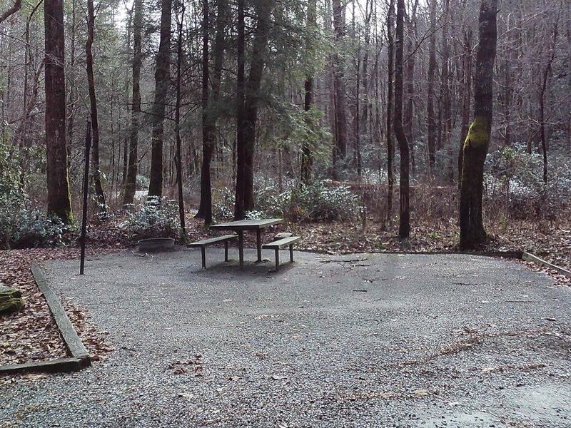
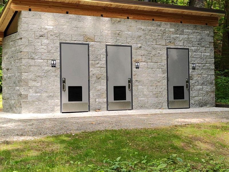
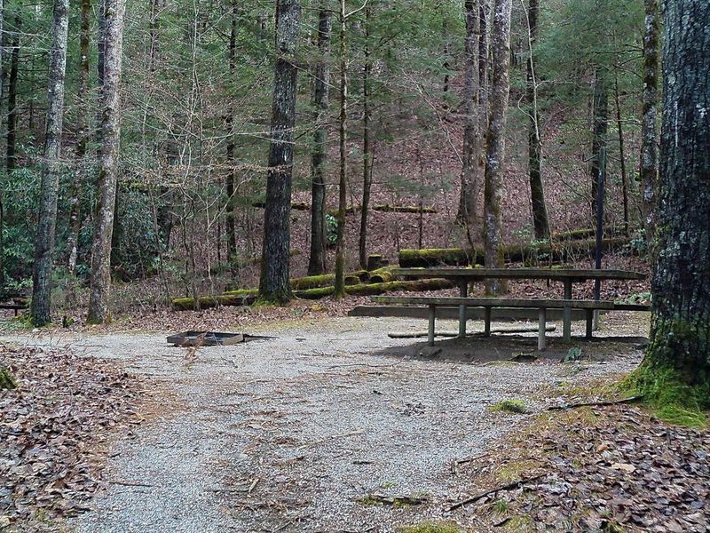
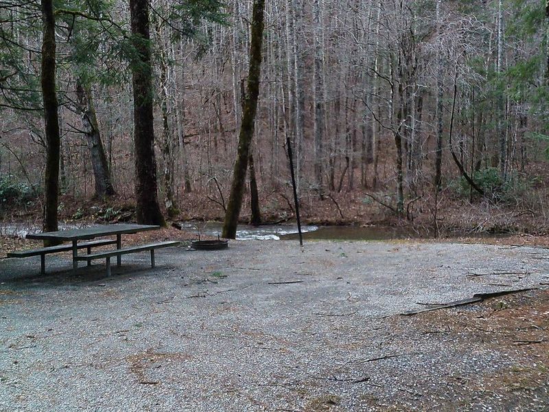
Tate Branch Campground occupies a scenic stretch along the Tallulah River in the North Georgia mountains, surrounded by hardwood forest within the Chattahoochee-Oconee National Forest. The campground features 17 standard campsites and 4 walk-in tent sites, each equipped with a fire ring, picnic table, and lantern post. A toilet building constructed in 2023 serves the campground, with drinking water available from a hand pump located between the toilet facility and campsite #2. The location provides direct access to excellent trout fishing on the Tallulah River (Georgia license and trout stamp required). A short drive up Tallulah River Road through Tate City leads to trailheads for Beech Creek Trail and Buck Creek Trail in the Southern Nantahala Wilderness. For an easier hike, Coleman River Trail lies about 5 miles in the opposite direction. The campground operates seasonally from mid-March through October. All sites require advance reservations through Recreation.gov. Maximum stay is 14 days within any 30-day period. ATVs, UTVs, and golf carts are prohibited. Generator use is limited to 4 hours daily between 6:00 AM and 10:00 PM.
Directions
Take US-76 west from Clayton, Georgia for 8 miles. Turn right (north) on Persimmon Road for 4.2 miles. Turn left (northwest) on Tallulah River Road (Forest Service Road 70) for 4 miles.
Nearby Campgrounds
Amenities
| Water | Yes |
| Fires Allowed | Yes |
| Toilets | Yes |
| Dump Station | No |
| Wifi | No |
| Pets Allowed | — |
| Showers | No |
| Electric Hookups | — |
| Water Hookups | — |
| Sewer Hookups | — |
| Camp Store | No |
| Price | $15 |
Vehicle
| Max RV Length | — |
| Max Trailer Length | — |
| Big Rig Friendly | No |
| Pull Through Sites | No |
Contact
| sm.fs.crrd@usda.gov | |
| Phone | +1 (706) 754-6221 |
Cell Service
| AT&T | None |
| Verizon | None |
| T-Mobile | None |
Useful Links
| View on Recreation.gov | |
| USFS Tate Branch Campground |
Availability
Photos
Community Posts
No posts yet. Be the first to share your experience!