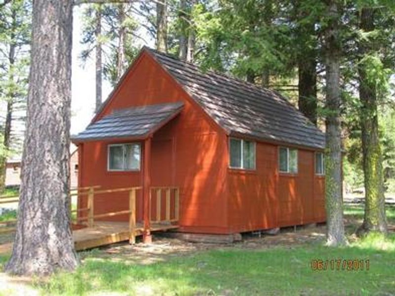
Summit Guard Station Bunkhouse
Open for reservations May 15 through November 14. Automobile access typically available June 1 through November 1. Winter access requires skis, snowshoes, or snowmobile from Meacham Divide/Mt. Emily Sno-Park (approximately 11.3 miles). Maximum stay is 14 consecutive nights.
Air Quality Alert issued July 20 at 7:40PM PDT by NWS Pendleton OR
Oregon Department of Environmental Quality has issued an Air Quality Advisory until 4 PM PDT Wednesday. For the Smoke Air Quality Advisory, wildfires burning in the region combined with forecasted conditions will cause air quality to reach unhealthy levels. Pollutants in smoke can cause burning eyes, runny nose, aggravate heart and lung diseases, and aggravate other serious health problems. Limit outdoor activities and keep children indoors if it is smoky. Please follow medical advice if you have a heart or lung condition. For additional information...please visit the Web site at http://www.oregon.gov/DEQ
Air Quality Alert issued July 20 at 6:03PM PDT by NWS Pendleton OR
Oregon Department of Environmental Quality has issued an Air Quality Advisory until 4 PM PDT Wednesday. For the Smoke Air Quality Advisory, wildfires burning in the region combined with forecasted conditions will cause air quality to reach unhealthy levels. Pollutants in smoke can cause burning eyes, runny nose, aggravate heart and lung diseases, and aggravate other serious health problems. Limit outdoor activities and keep children indoors if it is smoky. Please follow medical advice if you have a heart or lung condition. For additional information...please visit the Web site at http://www.oregon.gov/DEQ
Air Quality Alert issued July 20 at 3:24PM PDT by NWS Pendleton OR
Oregon Department of Environmental Quality has issued an Air Quality Advisory until 4 PM PDT Wednesday. For the Smoke Air Quality Advisory, wildfires burning in the region combined with forecasted conditions will cause air quality to reach unhealthy levels. Pollutants in smoke can cause burning eyes, runny nose, aggravate heart and lung diseases, and aggravate other serious health problems. Limit outdoor activities and keep children indoors if it is smoky. Please follow medical advice if you have a heart or lung condition. For additional information...please visit the Web site at http://www.oregon.gov/DEQ
About
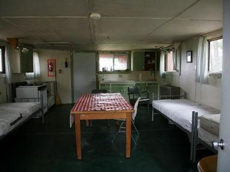
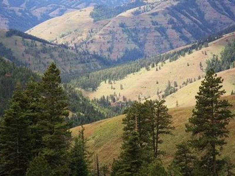
Built by the Civilian Conservation Corps in 1938, Summit Guard Station Bunkhouse sits on a high ridge overlooking Meacham Canyon in Umatilla National Forest, offering spectacular views of the Blue Mountains including Wilbur Mountain, Spring Mountain, and Sugarloaf Mountain. The site was originally the Summit Ranger Station in 1908, when the land was part of the historic Wenaha National Forest. The rustic bunkhouse contains a single multi-use room for cooking, sleeping, and relaxing. It's furnished with a table, four chairs, and four bed frames with mattresses (two full and two twin). Propane lights, a propane heater, and a propane range are provided. There is no water or electricity on site, so visitors must bring ample drinking water and supplies. A vault toilet is located a short distance from the cabin, and tent camping is allowed in the yard. The area is exceptional for bird and wildlife watching, with species including kinglets, sparrows, chickadees, and hummingbirds. Wildflowers such as larkspur, lupine, and orchids bloom in season. The nearby Whitman Route Overlook offers views of Meacham Canyon and the Hell Hole Roadless Area.
Directions
From Pendleton, OR: Take I-84 east for 34 miles to Exit 243 (Mt. Emily Exit). Turn left at the stop sign, cross the freeway overpass, and proceed to where the pavement ends at Forest Service Road 31. Travel FSR 31 for 12.2 miles to the junction with FSR 3113. Turn left onto FSR 3113 and travel 0.8 miles to the access road to Summit Guard Station. Turn left and follow the road to the right. From Weston, OR: Travel 28 miles east on Highway 204. Turn right onto FSR 31 and go 9.4 miles to Ruckel Junction. Continue on FSR 31 for 17 miles to FSR 3113, turn right, and travel 0.8 miles to the access road.
Amenities
| Water | No |
| Fires Allowed | — |
| Toilets | Yes |
| Dump Station | No |
| Wifi | No |
| Pets Allowed | Yes |
| Showers | No |
| Electric Hookups | — |
| Water Hookups | — |
| Sewer Hookups | — |
| Camp Store | No |
| Price | $45 |
Vehicle
| Max RV Length | — |
| Max Trailer Length | — |
| Big Rig Friendly | No |
| Pull Through Sites | No |
Contact
| Phone | +1 (509) 522-6290 |
Cell Service
| AT&T | Yes |
| Verizon | Yes |
| T-Mobile | None |
Availability
Photos
Community Posts
No posts yet. Be the first to share your experience!