Spring Gulch
Open for the 2026 season. Operates early May through late September. Potable water available Memorial Day through Labor Day. First-come, first-served with some sites reservable via Recreation.gov. Camping limited to 16 consecutive nights.
Northern Region Camping & Target Restrictions, Pallet Prohibition
This order defines the maximum length of occupation at a single location or cumulatively at any number of locations within a calendar year, within the states of Montana, North Dakota, South Dakota, and Idaho
Weed Free Forage & Mulch Products Order for the Northern Region
It is illegal to possess, store or transport straw, hay, grain, seed or other forage or mulch products on Forest Service lands without documentation that the product is certified as “weed free” by a state certification process that meets or exceeds the North American Weed Free Forage standards.
Northern and Intermountain Regions Frank Church River of No Return Wilderness
This order implements visitor use requirements for activities within the Restricted Area and on the Restricted Trails, as required by the Frank Church-River of No Return Wilderness Area Management Plan (November 2003).
About
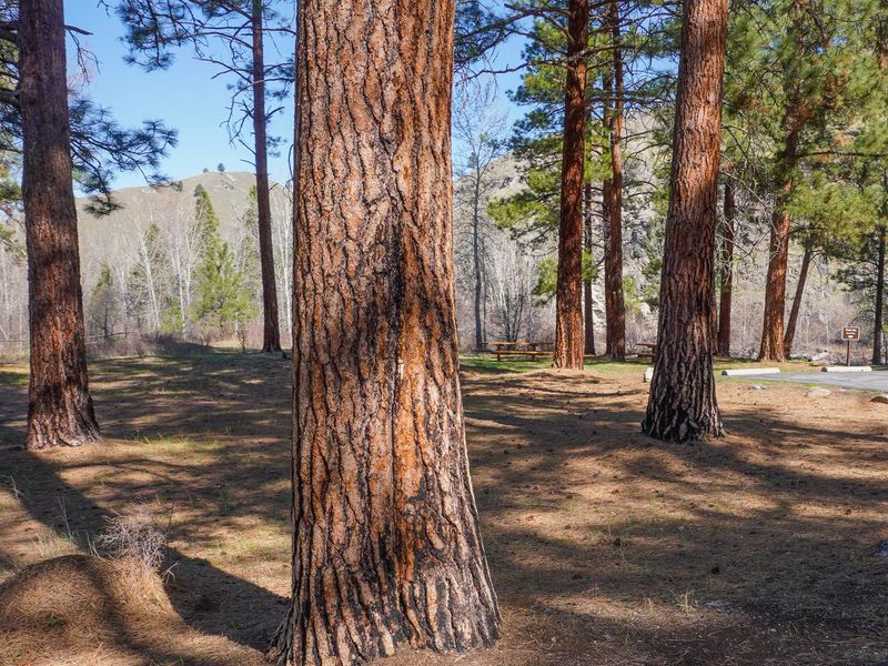
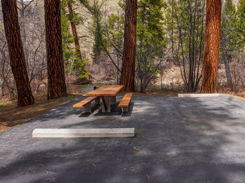
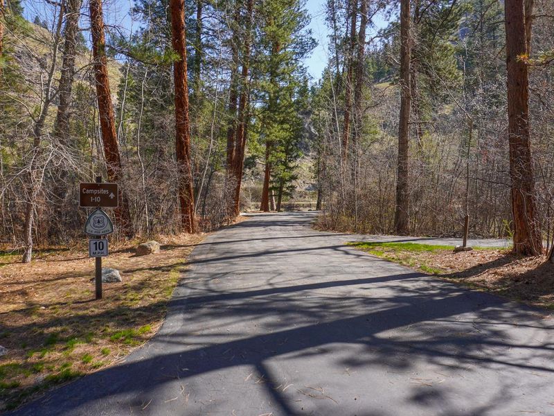
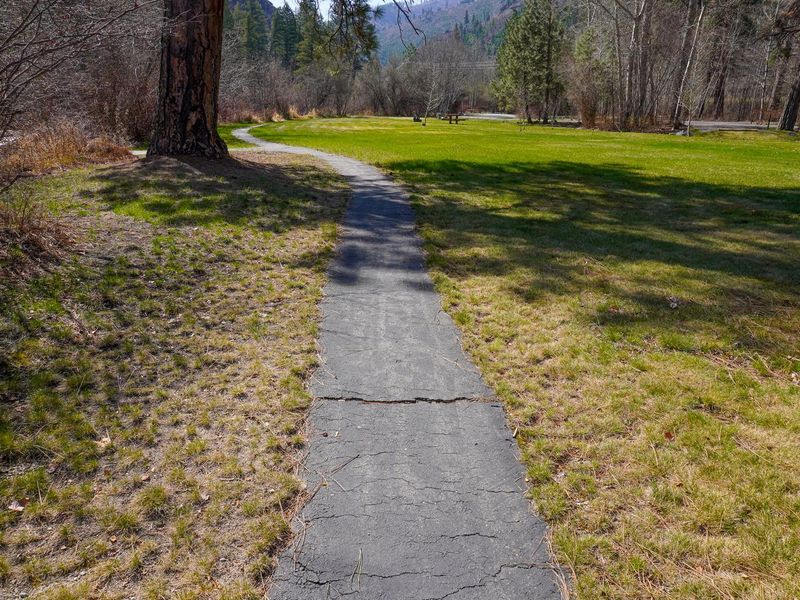
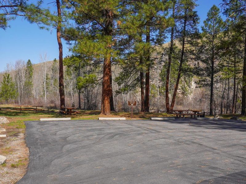
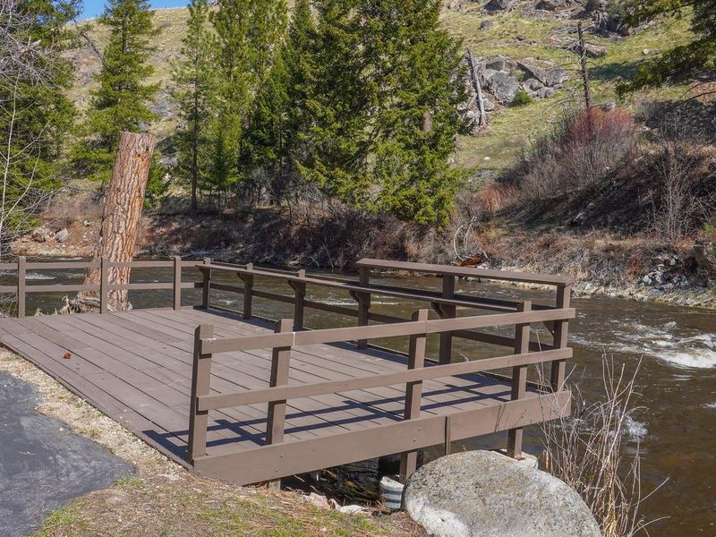
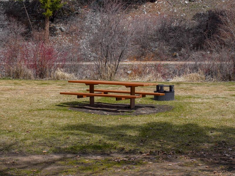
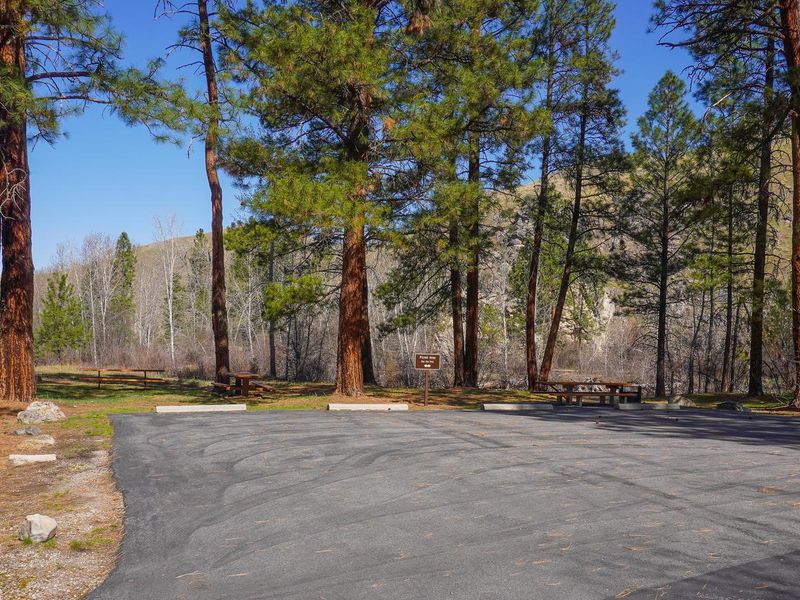
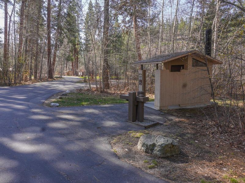
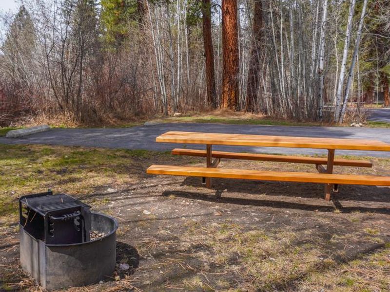
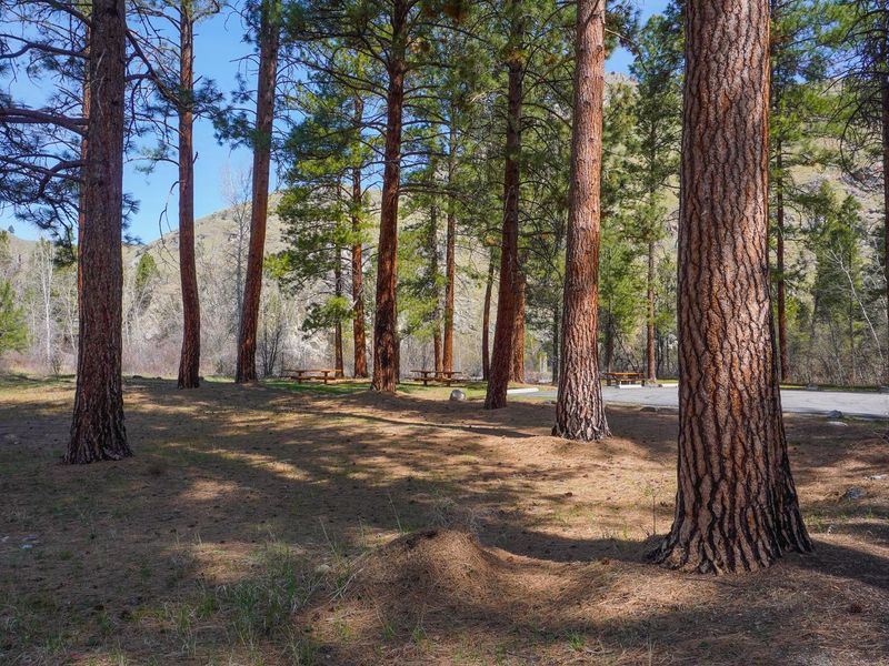
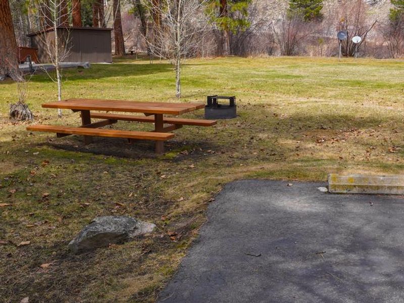
Spring Gulch Campground is located on the banks of the East Fork Bitterroot River in southwestern Montana, approximately 75 miles south of Missoula and 3 miles northwest of Sula. Nestled in a grassy ponderosa pine forest at 4,300 feet elevation, the campground provides easy access from Highway 93 and serves as a comfortable base for exploring the Bitterroot National Forest. The campground hosts 10 standard sites plus one bicycle site, with picnic tables and fire rings at each site. Accessible vault toilets and potable water are provided, with water available Memorial Day through Labor Day. Site #2 is wheelchair accessible, and an accessible fishing pier on the river makes it easy for all visitors to enjoy the excellent cutthroat trout fishing. The campground can accommodate trailers and RVs up to 50 feet, though no hookups are available. Recreational opportunities abound in the area, including hiking, mountain biking, fishing, swimming, and horseback riding. The Continental Divide National Scenic Trail is accessible nearby, and Lost Trail Hot Springs is approximately seven miles south. The small town of Sula offers gas and a post office.
Directions
From Sula, MT head northwest 2.9 miles on Highway 93. The campground is located on the east side of the highway across from Medicine Springs Road #370.
Amenities
| Water | Yes |
| Fires Allowed | Yes |
| Toilets | Yes |
| Dump Station | No |
| Wifi | No |
| Pets Allowed | Yes |
| Showers | No |
| Electric Hookups | — |
| Water Hookups | — |
| Sewer Hookups | — |
| Camp Store | No |
| Price | $15 |
Vehicle
| Max RV Length | 99ft |
| Max Trailer Length | 99ft |
| Big Rig Friendly | No |
| Pull Through Sites | No |
Contact
| Phone | +1 (406) 821-3913 |
Cell Service
| AT&T | None |
| Verizon | None |
| T-Mobile | None |
Availability
Photos

Community Posts
No posts yet. Be the first to share your experience!