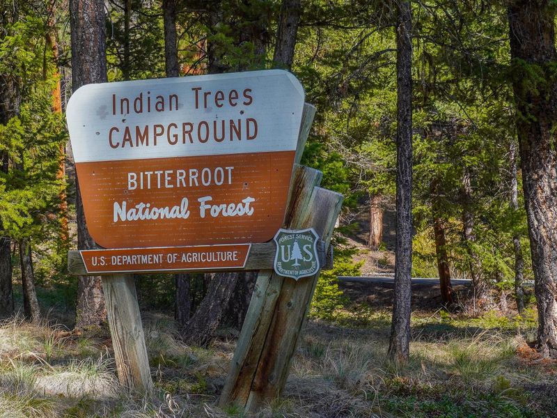
Indian Trees Campground
Open for the season. Some sites reservable via Recreation.gov on a 6-month rolling basis; remaining sites are first-come, first-served. Potable water available May through September. Bitterroot National Forest Food Storage Order in effect. Quiet hours 10pm to 6am. 16-day camping limit.
Northern Region Camping & Target Restrictions, Pallet Prohibition
This order defines the maximum length of occupation at a single location or cumulatively at any number of locations within a calendar year, within the states of Montana, North Dakota, South Dakota, and Idaho
Weed Free Forage & Mulch Products Order for the Northern Region
It is illegal to possess, store or transport straw, hay, grain, seed or other forage or mulch products on Forest Service lands without documentation that the product is certified as “weed free” by a state certification process that meets or exceeds the North American Weed Free Forage standards.
Northern and Intermountain Regions Frank Church River of No Return Wilderness
This order implements visitor use requirements for activities within the Restricted Area and on the Restricted Trails, as required by the Frank Church-River of No Return Wilderness Area Management Plan (November 2003).
About
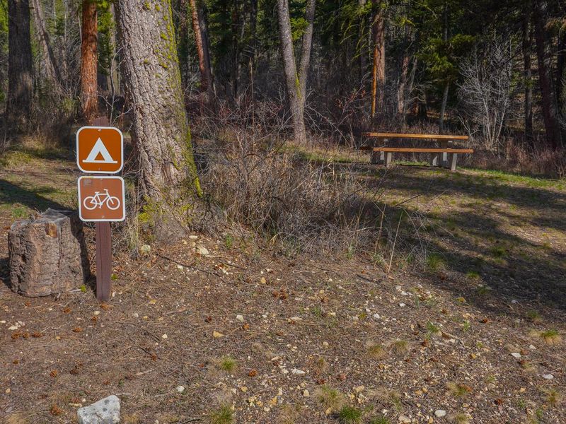
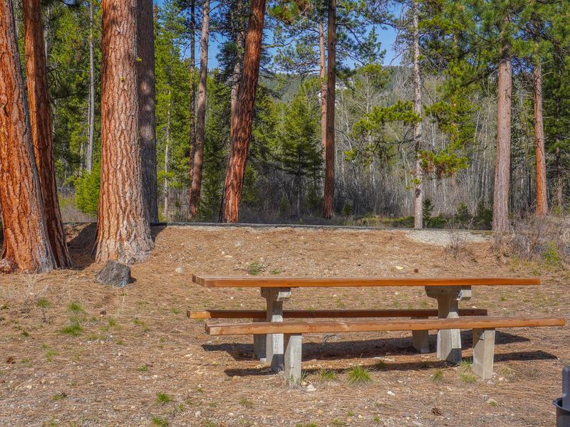
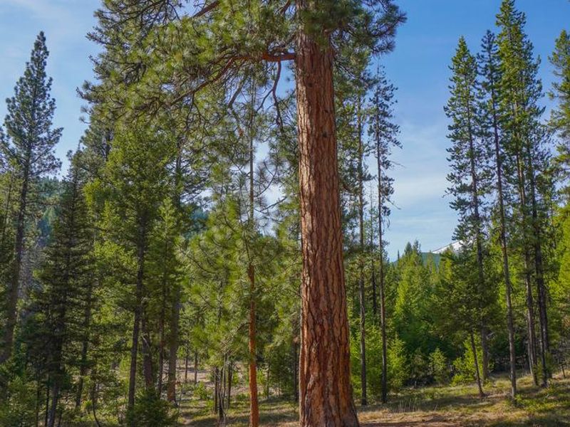
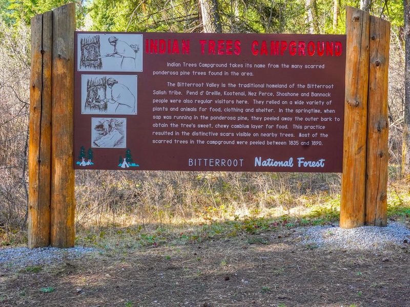
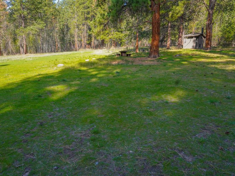
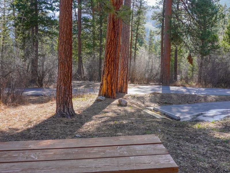
Indian Trees Campground offers a peaceful forest setting in southwest Montana's Bitterroot National Forest, situated at 5,128 feet elevation near the bottom of Lost Trail Pass. The campground gets its name from the numerous scarred ponderosa pine trees in the area, where Native American populations once stripped bark to extract the sweet cambium layer for food. The trees remain historically significant and provide ample shade throughout the campground. The 15 single-family campsites accommodate both tents and RVs up to 50 feet. Most sites hold up to 10 people and two vehicles, with one site accommodating up to 15 people. Site #6 is wheelchair accessible, and Site #2 is designated for bicyclists with a food storage locker. Each site features a picnic table and fire ring with grill. Vault toilets and potable water are provided, with a campground host on-site during the season. Recreational opportunities abound, including hiking, mountain biking, and horseback riding on nearby trails such as the Nez Perce National Historic Trail and Lewis and Clark National Historic Trail. Fishing for cutthroat trout is available in nearby Camp Creek. Lost Trail Hot Springs, a sulfur-free natural hot spring, is located less than half a mile away. A general store and lodging are available at Sula Store, about 5 miles north.
Directions
From Sula, MT head south 5.6 miles on Highway 93. Turn west (right) onto Forest Road 729 and follow for approximately 1 mile. Road to campground is gravel but the campground and parking spurs are paved.
Amenities
| Water | Yes |
| Fires Allowed | Yes |
| Toilets | Yes |
| Dump Station | No |
| Wifi | No |
| Pets Allowed | Yes |
| Showers | No |
| Electric Hookups | — |
| Water Hookups | — |
| Sewer Hookups | — |
| Camp Store | No |
| Price | $15 |
Vehicle
| Max RV Length | 100ft |
| Max Trailer Length | 100ft |
| Big Rig Friendly | Yes |
| Pull Through Sites | No |
Contact
| Phone | +1 (406) 821-3913 |
Cell Service
| AT&T | None |
| Verizon | None |
| T-Mobile | None |
Availability
Photos

Community Posts
No posts yet. Be the first to share your experience!