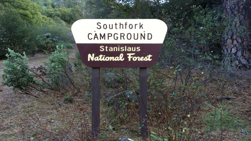
South Fork Campground
Currently closed due to storm damage. Lumsden Road is closed to public access. The site is overgrown and not being maintained. No reopening date announced.
National Forest System Roads
Follow California Vehicle Code on National Forest System Roads
Fireworks and Explosives are always Prohibited
Fireworks and explosives (including explosive targets) are always prohibited on national forest lands. The prohibition of fireworks and exploding targets on national forest system lands is part of a set of permanent fire safety regulations in the Code of Federal Regulations (CFR), listed below.…
Temporary Moderate Hazard Fire Restrictions Stanislaus National Forest
Temporary Moderate Hazard Fire Restrictions Stanislaus National Forest
About
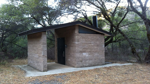
South Fork Campground sits at a low elevation near where the South Fork Tuolumne River meets the Tuolumne Wild and Scenic River, approximately one mile from Lumsden and Lumsden Bridge campgrounds within the Tuolumne-Lumsden Recreation Area of Stanislaus National Forest. The setting offers access to river fishing, day hiking, and non-motorized boating. Each campsite includes a picnic table, bear box, and fire pit with grill. A vault toilet serves the campground. There is no potable water on site; campers can obtain water from the river but must treat it before drinking. The campground does not accept reservations and operates on a first-come, first-served basis when open. Access is via Lumsden Road (Forest Route 1N10), a rough road not recommended for RVs or trailers. The road is seasonally closed December 15 through April 15 and may close during inclement weather. The area was impacted by the Rim Fire, and visitors should use caution around weakened trees and avoid the area during high winds or heavy rain.
Directions
From Groveland, travel approximately 7.5 miles east on Highway 120 to Ferretti Road. Turn left (north) onto Ferretti Road. Travel 1 mile and turn right (east) onto Lumsden Road/Forest Route 1N10. Travel approximately 5.5 miles to the campground on the right (south) side of the road. RVs and trailers are not recommended on Lumsden Road.
Location
Amenities
| Water | No |
| Fires Allowed | Yes |
| Toilets | Yes |
| Dump Station | No |
| Wifi | No |
| Pets Allowed | — |
| Showers | No |
| Electric Hookups | — |
| Water Hookups | — |
| Sewer Hookups | — |
| Camp Store | No |
| Price | $29 |
Vehicle
| Max RV Length | — |
| Max Trailer Length | — |
| Big Rig Friendly | No |
| Pull Through Sites | — |
Contact
| Phone | +1 (209) 532-3671 |
Cell Service
| AT&T | None |
| Verizon | None |
| T-Mobile | None |
Photos

Community Posts
No posts yet. Be the first to share your experience!