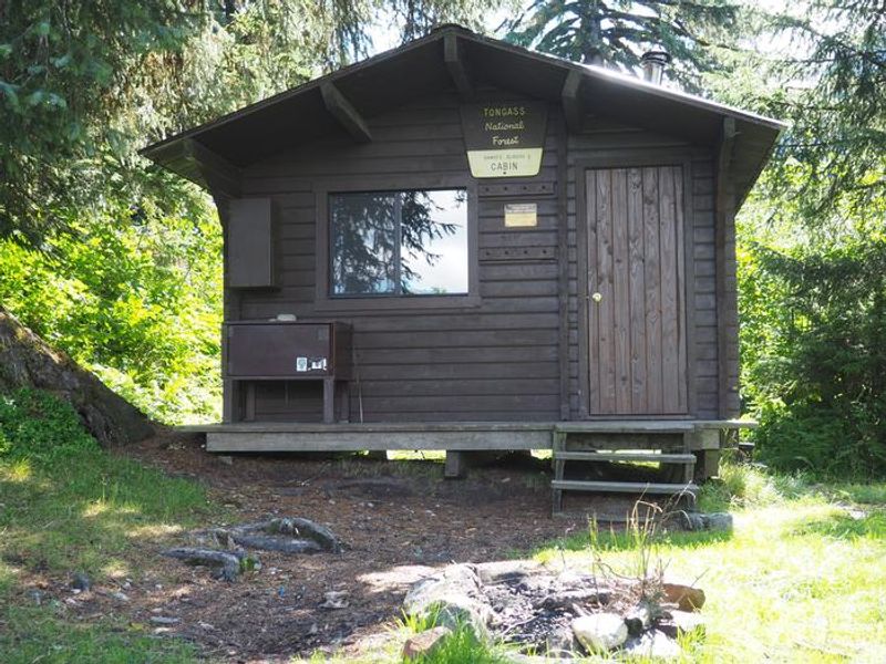
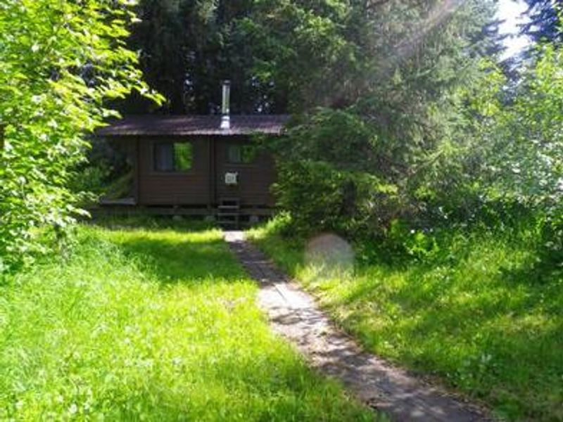
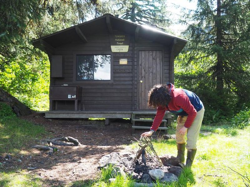
Shakes Slough 1 Cabin
Open and accepting reservations. The Stikine River is typically ice-free May through October. Access requires checking river levels and tide charts; a minimum 14-foot tide is needed to navigate the tide flats by boat.
Regional Order No. 10-01 - Marijuana - Simple Possession
Pursuant to 36 CFR 261.50(a), the following acts are prohibited on the Tongass and Chugach National Forests: Possessing, storing or transporting parts of a cannabis plant, whether growing or not; the seeds thereof; the resin extracted from any part of such plant; including and not limited to…
Regional Order No. 10-00-00-04-01 - Occupancy and Use - Alcohol
TONGASS and CHUGACH NATIONAL FORESTS Regional Office Juneau, Alaska Order No. 10-00-00-04-01REGIONAL ORDEROccupancy and Use Pursuant to 36 CFR 261.50 (a) & (b), the following acts are prohibited on all National Forest System lands, roads, and trails located within and/or administered by the…
Regional Order No. R-10-96-01 - Forest Development Roads and Trails
R-10 SUPPLEMENT 7700-96-1 7730EFFECTIVE 5/17/96 Page 10 of 117731.14 - EXHIBIT 01ORDER NO. R-10-96-01FOREST DEVELOPMENT ROADS AND TRAILSALASKA REGIONPursuant to Title 36, Code of Federal Regulations, Subpart B, Section261. so (a) (b), the following is prohibited on National Forest Developmentroads…
About
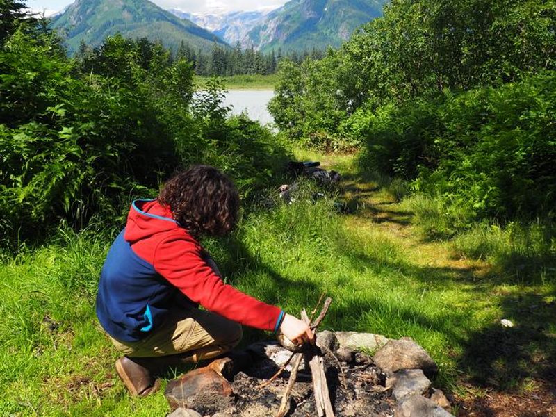
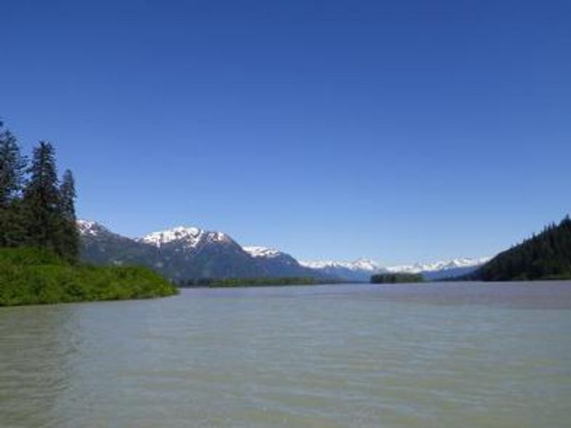
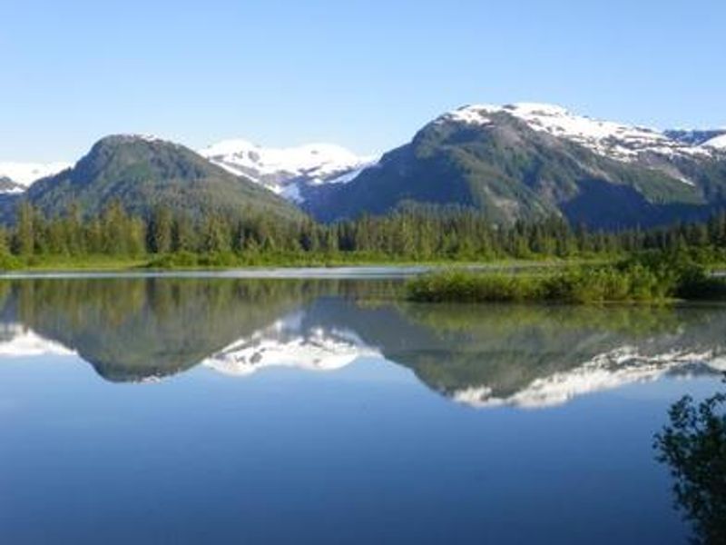
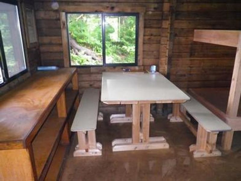
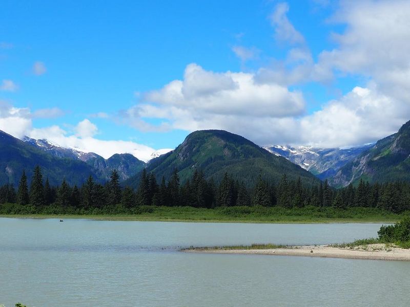
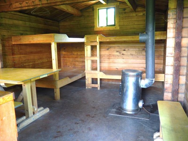
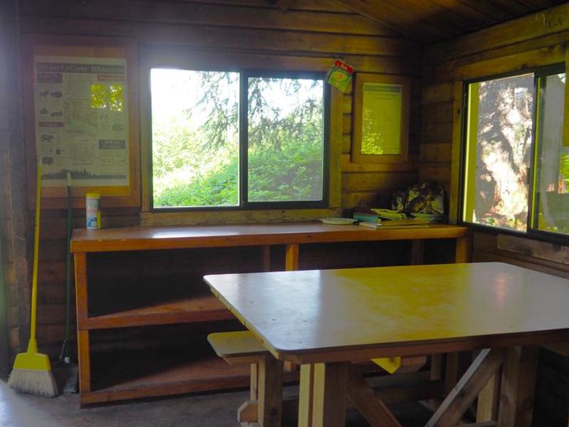
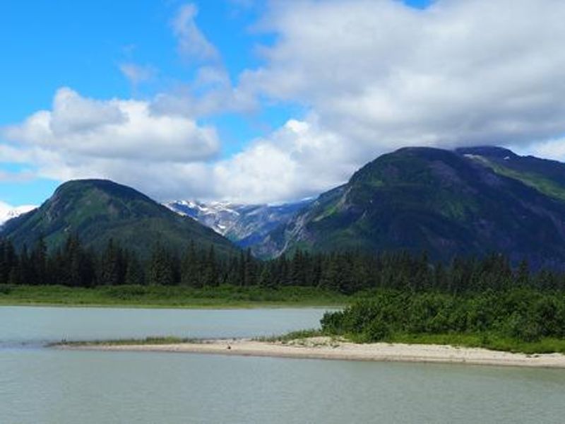
Shakes Slough 1 Cabin makes an excellent basecamp for exploring the Stikine River corridor in the Stikine-LeConte Wilderness. The cabin sits tucked into a stand of spruce trees overlooking Shakes Slough, with views of Popof Glacier, Mount Basargin, and surrounding peaks. A neighboring cabin, Shakes Slough 2, is located within a few hundred feet for groups needing additional capacity. The surrounding area offers exceptional wildlife viewing and recreation. Shakes Lake and Glacier are three miles north, while Chief Shakes Hot Springs can be reached four miles upstream via Hot Springs Slough. Cutthroat trout and Dolly Varden fishing is available June through October. Brown and black bears roam the area, and moose frequent the willow thickets. The Stikine River tide flats are a major stopover for migratory shorebirds and waterfowl. Access requires a float plane (20 miles from Wrangell) or shallow draft boat (25 miles up the Stikine River). A minimum 14-foot tide is required to navigate the tide flats. There is no cell phone service, and helicopter access is prohibited under wilderness regulations.
Directions
From Wrangell, the cabin is 20 miles by float plane or 25 miles by shallow draft boat up the Stikine River. Located on the north shore of the Stikine River at the Shakes Slough entrance. A tide of at least 14 feet is required to navigate the Stikine River tide flats.
Location
Amenities
| Water | No |
| Fires Allowed | — |
| Toilets | Yes |
| Dump Station | No |
| Wifi | No |
| Pets Allowed | — |
| Showers | No |
| Electric Hookups | — |
| Water Hookups | — |
| Sewer Hookups | — |
| Camp Store | No |
| Price | $35 |
Vehicle
| Max RV Length | — |
| Max Trailer Length | — |
| Big Rig Friendly | No |
| Pull Through Sites | No |
Contact
| Phone | +1 (907) 874-2323 |
Cell Service
| AT&T | None |
| Verizon | None |
| T-Mobile | None |
Availability
Photos
Community Posts
No posts yet. Be the first to share your experience!