Mount Flemer Cabin
Open year-round with reservations via Recreation.gov. River access typically ice-free May through October. A tide of 14 feet or higher is required for shallow draft boats to cross the Stikine River flats. Wilderness restrictions apply; helicopter access prohibited.
Regional Order No. 10-01 - Marijuana - Simple Possession
Pursuant to 36 CFR 261.50(a), the following acts are prohibited on the Tongass and Chugach National Forests: Possessing, storing or transporting parts of a cannabis plant, whether growing or not; the seeds thereof; the resin extracted from any part of such plant; including and not limited to…
Regional Order No. 10-00-00-04-01 - Occupancy and Use - Alcohol
TONGASS and CHUGACH NATIONAL FORESTS Regional Office Juneau, Alaska Order No. 10-00-00-04-01REGIONAL ORDEROccupancy and Use Pursuant to 36 CFR 261.50 (a) & (b), the following acts are prohibited on all National Forest System lands, roads, and trails located within and/or administered by the…
Regional Order No. R-10-96-01 - Forest Development Roads and Trails
R-10 SUPPLEMENT 7700-96-1 7730EFFECTIVE 5/17/96 Page 10 of 117731.14 - EXHIBIT 01ORDER NO. R-10-96-01FOREST DEVELOPMENT ROADS AND TRAILSALASKA REGIONPursuant to Title 36, Code of Federal Regulations, Subpart B, Section261. so (a) (b), the following is prohibited on National Forest Developmentroads…
About
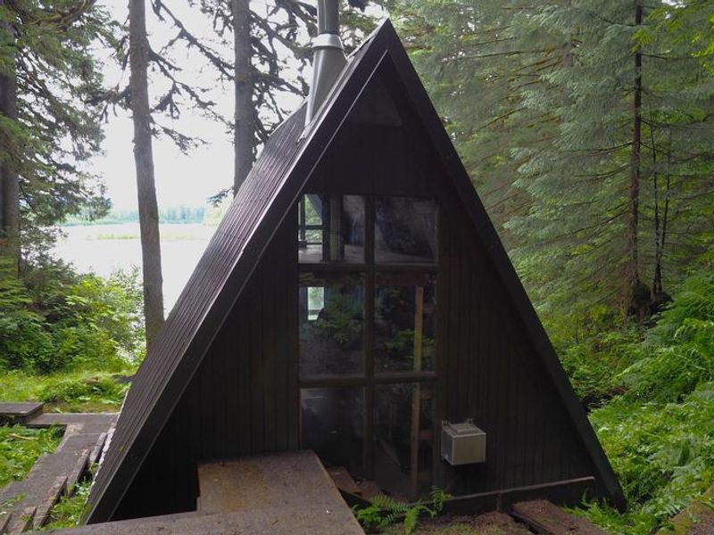
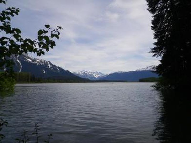
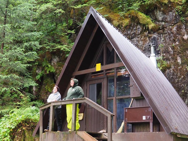
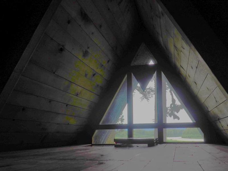
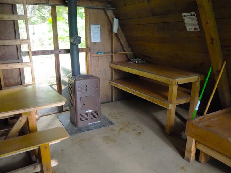
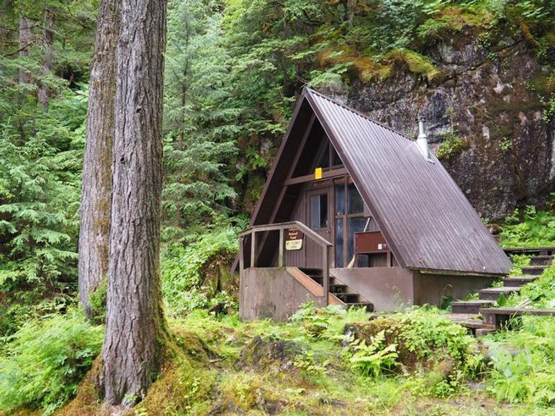
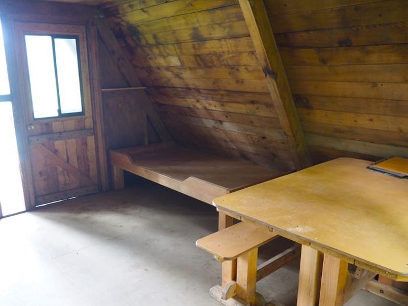
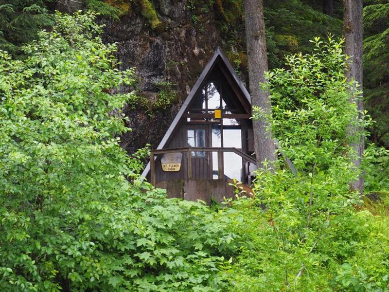
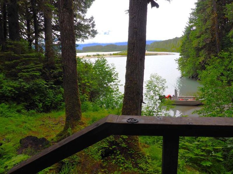
Mount Flemer Cabin sits at the base of its namesake mountain on the banks of the Stikine River, deep within the Stikine-LeConte Wilderness of Alaska's Tongass National Forest. Built in 1963, this classic A-frame cabin offers spectacular views of Elbow and Whitehead Mountains and the granite faces of the Coast Range. The surrounding rainforest of Sitka spruce, western hemlock, and riverside cottonwood provides habitat for brown and black bears, moose, and mountain goats. The cabin accommodates up to seven guests with two single bunks (one with trundle) and a sleeping loft. Amenities include a wooden table with benches, an oil space heater requiring #1 stove oil, and a partially covered front porch with bear-proof food storage. An outhouse is provided. Guests must bring their own stove oil, bedding, cook stove, lanterns, cookware, food, drinking water, toilet paper, garbage bags, and fire extinguisher. This is a premier destination for paddlers floating the Stikine River from Telegraph Creek, BC or the border down to Wrangell. Nearby sloughs and the Kikahe River offer fishing for cutthroat trout and Dolly Varden. The river typically runs ice-free from May through October.
Directions
Access by shallow draft boat from Wrangell, 32 miles northeast up the Stikine River. The cabin is on the south shore of the main channel, approximately 2 miles downriver from the US-Canada border. A short boardwalk trail and staircase provides access from the river. Consult local tide tables; a tide of 14+ feet is required to cross the tide flats. Check conditions with Wrangell Ranger District at (907) 874-2323.
Location
Amenities
| Water | No |
| Fires Allowed | — |
| Toilets | Yes |
| Dump Station | No |
| Wifi | No |
| Pets Allowed | — |
| Showers | No |
| Electric Hookups | — |
| Water Hookups | — |
| Sewer Hookups | — |
| Camp Store | No |
| Price | $35 |
Vehicle
| Max RV Length | — |
| Max Trailer Length | — |
| Big Rig Friendly | No |
| Pull Through Sites | No |
Contact
| Phone | +1 (907) 874-2323 |
Cell Service
| AT&T | None |
| Verizon | None |
| T-Mobile | None |
Availability
Photos

Community Posts
No posts yet. Be the first to share your experience!