North Abutment
Open year-round. The Phase 2 shower house is closed for repairs until further notice. Reservations available through Recreation.gov with 2-night minimum on weekends and 3-night minimum on holiday weekends. Maximum 14-day consecutive stay.
Wind Advisory issued October 10 at 2:33AM CDT until October 10 at 7:00PM CDT by NWS Jackson MS
* WHAT...North winds 20 to 30 mph with gusts up to 40 mph expected. Gusts to 50 mph are possible. * WHERE...Portions of central and south Mississippi and northeast Louisiana. * WHEN...From 1 AM to 7 PM CDT Saturday. * IMPACTS...Gusty winds will blow around unsecured objects. Tree limbs could be blown down and a few power outages may result.
Tropical Cyclone Local Statement issued October 10 at 2:28AM CDT by NWS Jackson MS
HLSJAN This product covers Central Mississippi, Northeast Louisiana, and extreme Southeast Arkansas **Tropical Storm Warning Is Canceled But Gusty Winds Remain A Concern Today** NEW INFORMATION --------------- * CHANGES TO WATCHES AND WARNINGS: - All watches and warnings have been canceled * CURRENT WATCHES AND WARNINGS: - None * STORM INFORMATION: - About 220 miles east-southeast of Jackson MS - 31.5N 86.5W - Storm Intensity 65 mph - Movement North or 355 degrees at 20 mph SITUATION OVERVIEW ------------------ Hurricane Isaias made landfall near Destin yesterday evening and has since weakened to a Post-Tropical Cyclone moving north through the region. Heavy rainfall and gusty winds remain a concern for portions of our forecast area today. A Wind Advisory and a Flash Flood Watch are in effect for those affected areas. POTENTIAL IMPACTS ----------------- * WIND: Little to no impacts are anticipated at this time across Central Mississippi, Northeast Louisiana, and extreme Southeast Arkansas. * FLOODING RAIN: Little to no impacts are anticipated at this time across Central Mississippi, Northeast Louisiana, and extreme Southeast Arkansas. * TORNADOES: Little to no impacts are anticipated at this time across Central Mississippi, Northeast Louisiana, and extreme Southeast Arkansas. PRECAUTIONARY/PREPAREDNESS ACTIONS ---------------------------------- * OTHER PREPAREDNESS INFORMATION: If your home or shelter was damaged, be cautious around electrical wiring, broken glass, jagged metal and wood, and protruding nails and screws. Be alert for any lingering wind gusts which could take down weakened trees and/or power lines, collapse damaged structures, or cause flying debris. * ADDITIONAL SOURCES OF INFORMATION: - For information on appropriate preparations see ready.gov - For information on creating an emergency plan see getagameplan.org - For additional disaster preparedness information see redcross.org NEXT UPDATE ----------- As it pertains to this event...this will be the last local statement issued by the National Weather Service in Jackson MS regarding the effects of tropical cyclone hazards upon the area.
Tropical Cyclone Local Statement issued October 9 at 10:35PM CDT by NWS Jackson MS
HLSJAN This product covers Central Mississippi, Northeast Louisiana, and extreme Southeast Arkansas HURRICANE ISAIAS HAS MADE LANDFALL ON THE FLORIDA COAST NEW INFORMATION --------------- * CHANGES TO WATCHES AND WARNINGS: - None * CURRENT WATCHES AND WARNINGS: - A Tropical Storm Warning is in effect for Choctaw, Clarke, Clay, Forrest, Jasper, Jones, Kemper, Lauderdale, Lowndes, Neshoba, Newton, Noxubee, Oktibbeha, Webster, and Winston * STORM INFORMATION: - About 170 miles east of Hattiesburg MS or about 240 miles east-southeast of Jackson MS - 30.8N 86.5W - Storm Intensity 90 mph - Movement North or 5 degrees at 20 mph SITUATION OVERVIEW ------------------ Hurricane Isaias has made landfall as a hurricane near Destin Florida this evening. Though Isaias will gradually weaken as it moves north across Alabama overnight into Saturday, tropical storm force wind gusts are possible across portions of East and Northeast Mississippi. Gradient wind will increase this evening in southeastern Mississippi, then stronger gusts are expected overnight into Saturday across eastern and northeastern Mississippi. Downed trees and power outages are expected in these areas. Heavy rainfall and flash flooding are also possible, mainly in the Golden Triangle area. Threat has trended overall downward. Conditions will improve late Saturday afternoon into Saturday evening. POTENTIAL IMPACTS ----------------- * WIND: Protect against hazardous wind having possible limited impacts across eastern and northeastern Mississippi. Potential impacts in this area include: - Damage to porches, awnings, carports, sheds, and unanchored mobile homes. Unsecured lightweight objects blown about. - Many large tree limbs broken off. A few trees snapped or uprooted, but with greater numbers in places where trees are shallow rooted. Some fences and roadway signs blown over. - A few roads impassable from debris, particularly within urban or heavily wooded places. Hazardous driving conditions on bridges and other elevated roadways. - Scattered power and communications outages. Elsewhere across Central Mississippi, Northeast Louisiana, and extreme Southeast Arkansas, little to no impact is anticipated. * FLOODING RAIN: Protect against dangerous rainfall flooding having possible significant impacts across the Golden Triangle area. Potential impacts include: - Moderate rainfall flooding may prompt several evacuations and rescues. - Rivers and tributaries may quickly become swollen with swifter currents and overspill their banks in a few places, especially in usually vulnerable spots. Small streams, creeks, canals, and ditches overflow. - Flood waters can enter some structures or weaken foundations. Several places may experience expanded areas of rapid inundation at underpasses, low-lying spots, and poor drainage areas. Some streets and parking lots take on moving water as storm drains and retention ponds overflow. Driving conditions become hazardous. Some road and bridge closures. Protect against locally hazardous rainfall flooding having possible limited impacts across East Mississippi. PRECAUTIONARY/PREPAREDNESS ACTIONS ---------------------------------- * EVACUATIONS: Follow the advice of local officials. * OTHER PREPAREDNESS INFORMATION: Now is the time to complete all preparations to protect life and property in accordance with your emergency plan. Ensure you are in a safe location before the onset of strong winds or possible flooding. Closely monitor weather.gov, NOAA Weather radio or local news outlets for official storm information. Be ready to adapt to possible changes to the forecast. Ensure you have multiple ways to receive weather warnings. * ADDITIONAL SOURCES OF INFORMATION: - For information on appropriate preparations see ready.gov - For information on creating an emergency plan see getagameplan.org - For additional disaster preparedness information see redcross.org NEXT UPDATE ----------- The next local statement will be issued by the National Weather Service in Jackson MS around 4 AM, or sooner if conditions warrant.
About
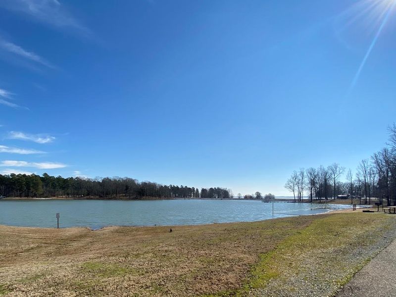
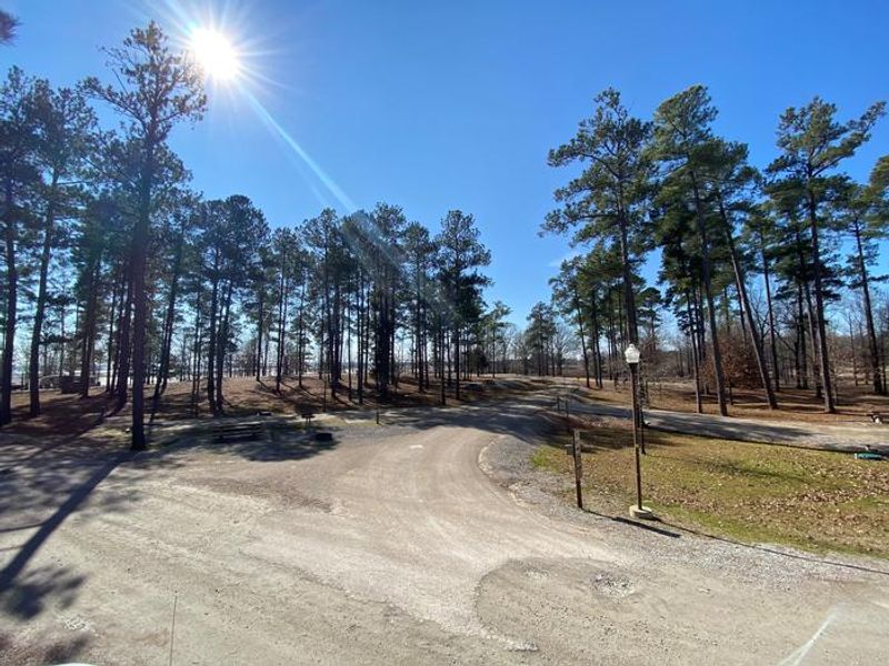
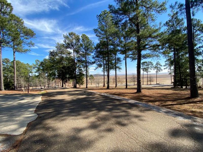
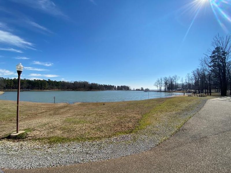
North Abutment Campground is a well-developed Army Corps of Engineers facility located on the north shore of Grenada Lake in Mississippi. The campground features 88 RV sites, each with a concrete parking apron, 50-amp electric service, and water hookups. Sites 2-88 also include sewer connections. The campground offers both back-in and pull-through configurations to accommodate various RV setups. Within the campground lies a 17-acre lake stocked with bream, largemouth bass, and catfish, complete with a swimming beach for campers. Grenada Lake itself is a 35,820-acre reservoir with 148 miles of shoreline, offering excellent boating and fishing opportunities. Boat ramps are adjacent to the camping area. The campground operates year-round with reservations through Recreation.gov. A 2-night minimum applies on weekends and 3-night minimum on holiday weekends. The maximum stay is 14 consecutive days before a mandatory 14-day absence. Nearby attractions include the Haserway Wetland Demonstration Area with its 1.5-mile interpretive trail, and the city of Grenada is just five miles away.
Directions
From I-55, take the Grenada exit on Highway 8 east through the City of Grenada for approximately three miles, then turn left on Scenic Loop 333. Follow Scenic Loop 333 across the dam and take the second road to the right at the north end of the dam.
Location
Amenities
| Water | Yes |
| Fires Allowed | Yes |
| Toilets | Yes |
| Dump Station | Yes |
| Wifi | — |
| Pets Allowed | Yes |
| Showers | Yes |
| Electric Hookups | Yes |
| Water Hookups | Yes |
| Sewer Hookups | Yes |
| Camp Store | — |
| Price | $30 |
Vehicle
| Max RV Length | 70ft |
| Max Trailer Length | 70ft |
| Big Rig Friendly | No |
| Pull Through Sites | No |
Contact
| Phone | +1 (662) 226-5911 |
Cell Service
| AT&T | Yes |
| Verizon | None |
| T-Mobile | Yes |
Availability
Photos
Community Posts
No posts yet. Be the first to share your experience!