Mestaa’ėhehe Mountain Fire Lookout
Open year-round. Reservations required via Recreation.gov. Summer access is a 1-mile hike from the parking area off Forest Road 192.1. Winter access requires parking along Highway 103 and hiking or skiing 2-3 miles to the lookout. No refunds for weather conditions. Not recommended for children.
Flood Advisory issued July 20 at 6:05PM MDT until July 20 at 7:30PM MDT by NWS Denver CO
* WHAT...Small stream flooding caused by excessive rainfall continues. * WHERE...Northwestern Clear Creek County in central Colorado... Central Summit County in central Colorado... South Central Grand County in north central Colorado... * WHEN...Until 730 PM MDT. * IMPACTS...Minor flooding in low-lying and poor drainage areas. Rises in small streams and normally dry creeks. * ADDITIONAL DETAILS... - At 605 PM MDT, Doppler radar and automated rain gauges indicated heavy rain due to thunderstorms. This may cause small stream flooding. Between 1 and 2 inches of rain have fallen. - Some locations that will experience flooding include... Silverthorne, Berthoud Falls and Berthoud Pass.
Wheeled Vehicles in Wilderness
This order describes the prohibition of wheeled vehicles in all National Forest Wilderness Areas of the Rocky Mountain Region and any exceptions thereof.
Weed Free Forage Products
The purpose of this Order is to prevent the introduction or spread of noxious weeds.
About
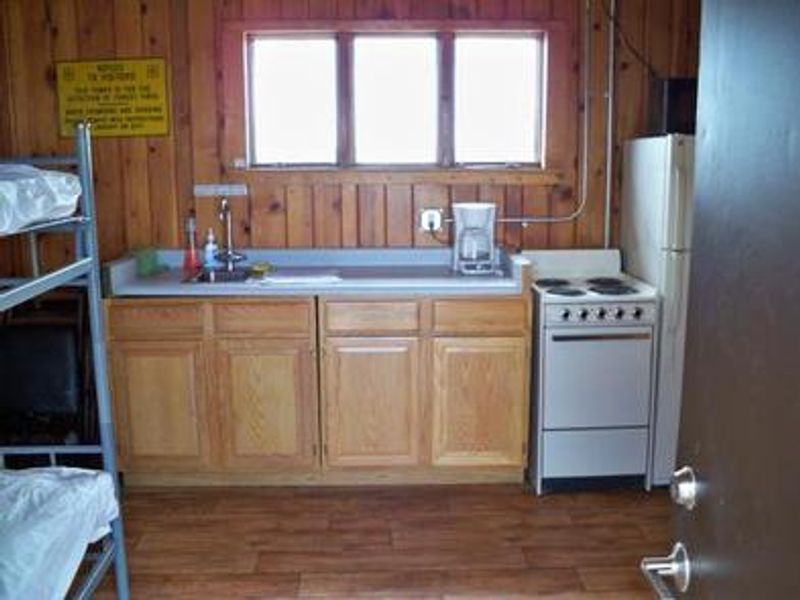
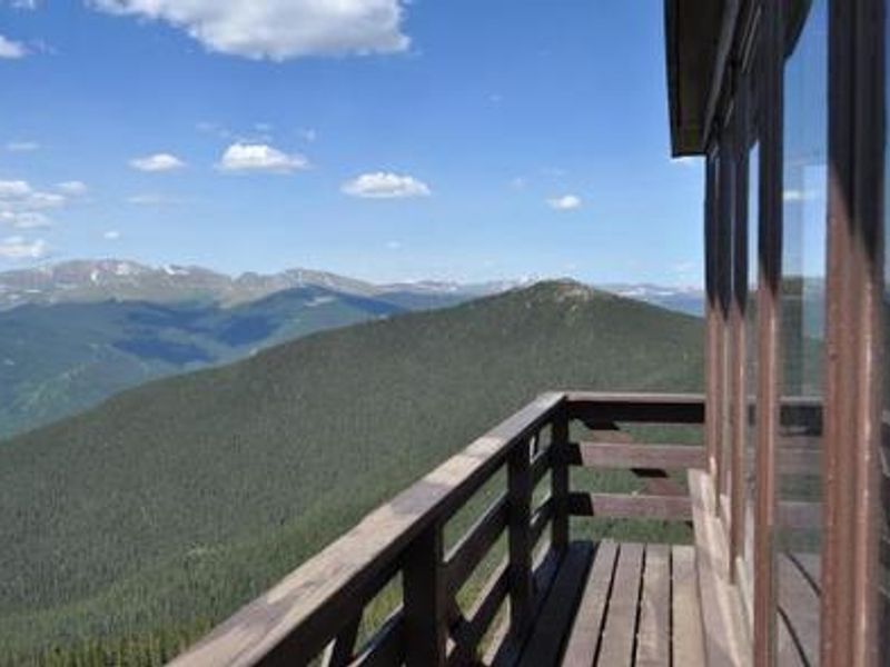
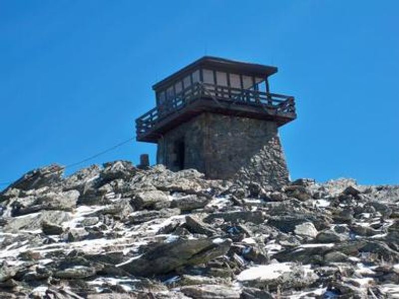
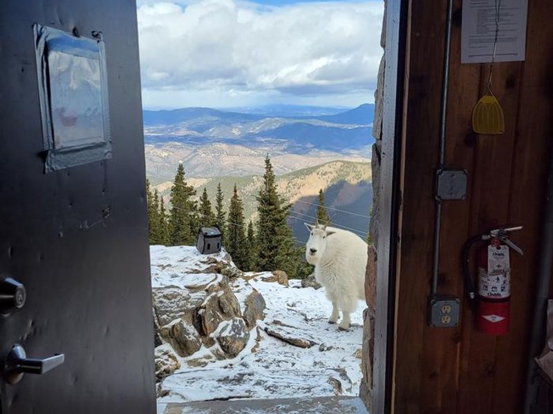
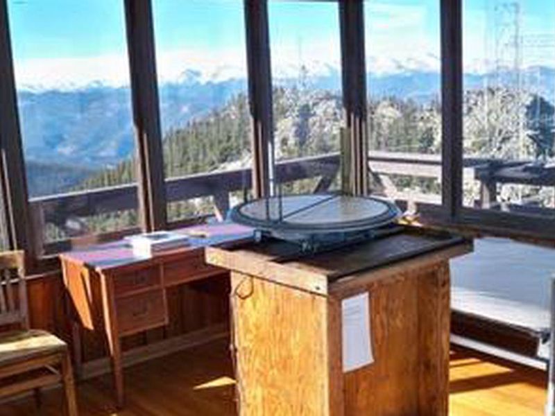
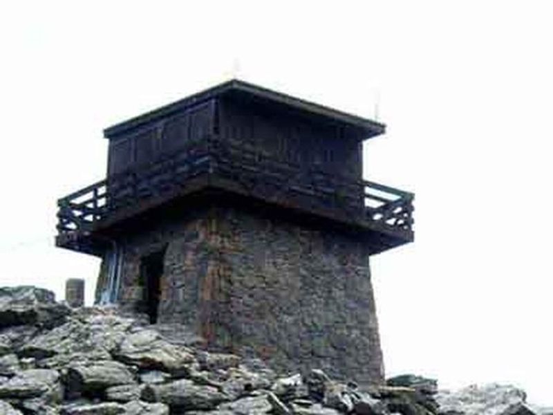
The Mestaa'ėhehe Mountain Fire Lookout (pronounced mess-taw-HAY) offers a rare opportunity to stay in a historic granite fire tower built by the Civilian Conservation Corps in the 1940s. Located at the summit of Mestaa'ėhehe Mountain in Clear Creek County, the lookout sits at over 11,000 feet elevation on an active communications site. The cab measures 14 feet by 14 feet with windows lining all four walls, providing 360-degree views from Denver and the Great Plains to Mount Blue Sky, Pikes Peak, and Longs Peak. The lookout accommodates up to four guests and comes equipped with an electric stove, refrigerator, two small wall heaters plus a space heater, beds, table and chairs, cookware, and dishes. An exterior incinerating toilet serves as the restroom facility. There is no potable water available; visitors must pack in all drinking water. Tent camping is not permitted at the site. Access requires hiking approximately one mile from the parking area in summer or 2-3 miles in winter when the lower road access is closed. Winter visitors should be prepared to snowshoe or cross-country ski and bring emergency winter camping gear in case of storms or power outages. Summer temperatures average 70°F but can drop to 30°F at night. Lightning storms are frequent; guests should remain inside and avoid touching metal furnishings during storms.
Directions
From Idaho Springs and I-70, take Exit 240 (Colorado Highway 103) and drive south over the bridge for 19 miles. Turn right onto Forest Road 192.1 (dirt road) and continue one mile to the parking area before a locked gate. Hike one mile up the road past the gate to the lookout. Winter: Park at the pulloff or along the right shoulder of Highway 103 and hike/ski approximately 2-3 miles to the lookout.
Amenities
| Water | No |
| Fires Allowed | — |
| Toilets | Yes |
| Dump Station | No |
| Wifi | — |
| Pets Allowed | No |
| Showers | No |
| Electric Hookups | — |
| Water Hookups | — |
| Sewer Hookups | — |
| Camp Store | No |
| Price | $80 |
Vehicle
| Max RV Length | — |
| Max Trailer Length | — |
| Big Rig Friendly | No |
| Pull Through Sites | No |
Contact
| Phone | +1 (303) 567-4382 |
Cell Service
| AT&T | Yes |
| Verizon | Yes |
| T-Mobile | Yes |
Availability
Photos
Community Posts
No posts yet. Be the first to share your experience!