Meadow Peak Lookout
Currently closed for the season. The lookout typically opens mid-June through late September, weather and road conditions permitting. Reservations are available through Recreation.gov. A mandatory food storage order is in effect requiring bear-resistant containers or closed vehicle storage for all food and garbage.
Northern Region Camping & Target Restrictions, Pallet Prohibition
This order defines the maximum length of occupation at a single location or cumulatively at any number of locations within a calendar year, within the states of Montana, North Dakota, South Dakota, and Idaho
Weed Free Forage & Mulch Products Order for the Northern Region
It is illegal to possess, store or transport straw, hay, grain, seed or other forage or mulch products on Forest Service lands without documentation that the product is certified as “weed free” by a state certification process that meets or exceeds the North American Weed Free Forage standards.
R1-2023-02 - NCDE Food and Wildlife Attractant Storage Order
Northern Continental Divide Ecosystem Food/Wildlife Attractant Storage Order for the Flathead, Lolo, Kootenai, Helena-Lewis and Clark, and Beaverhead-Deerlodge National Forests within the Northern Continental Divide Ecosystem.
About
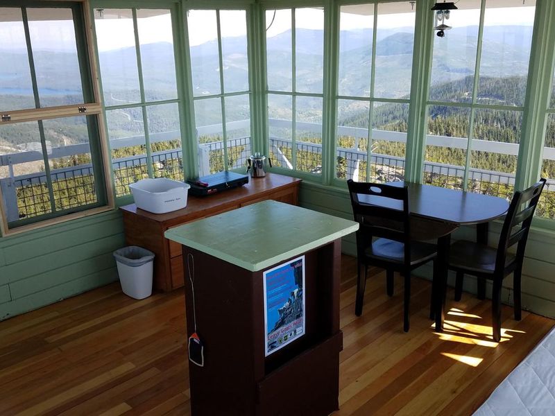
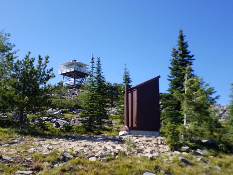
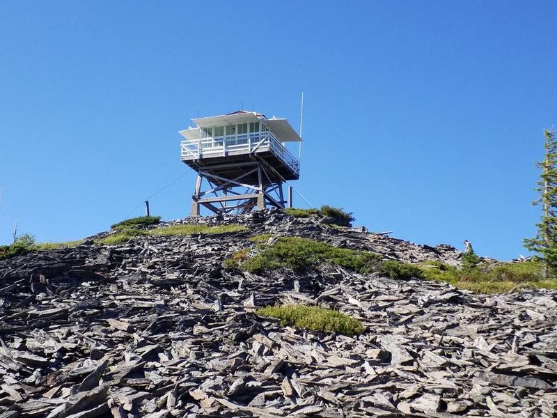
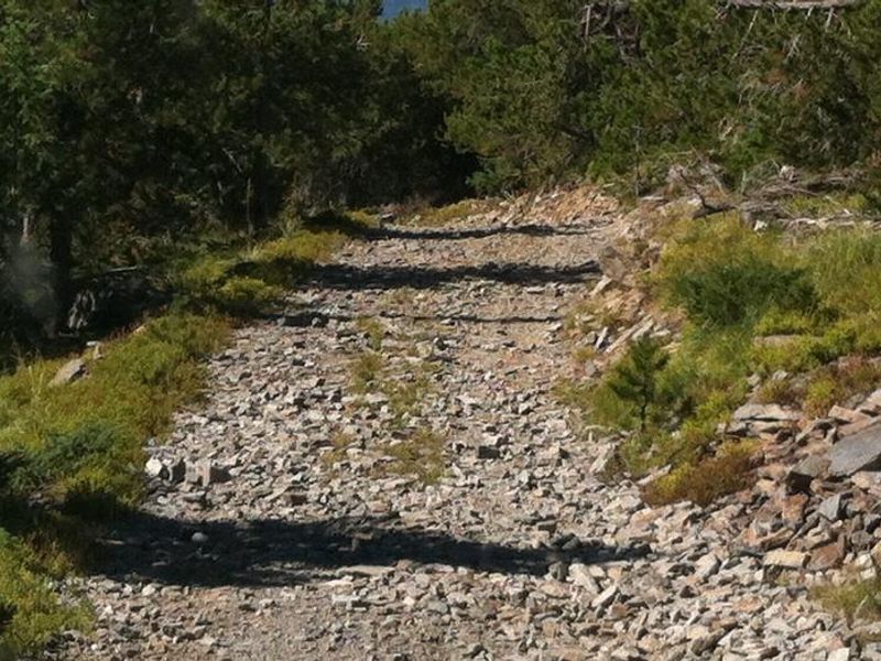
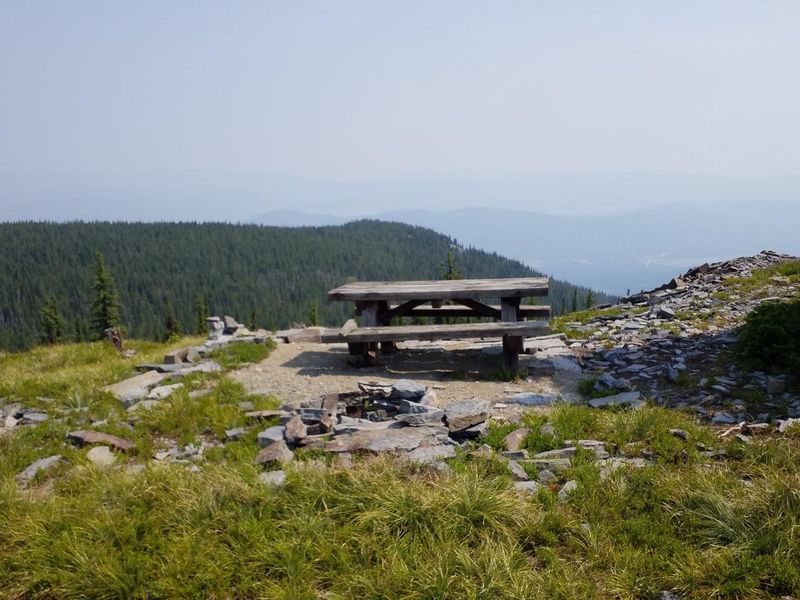
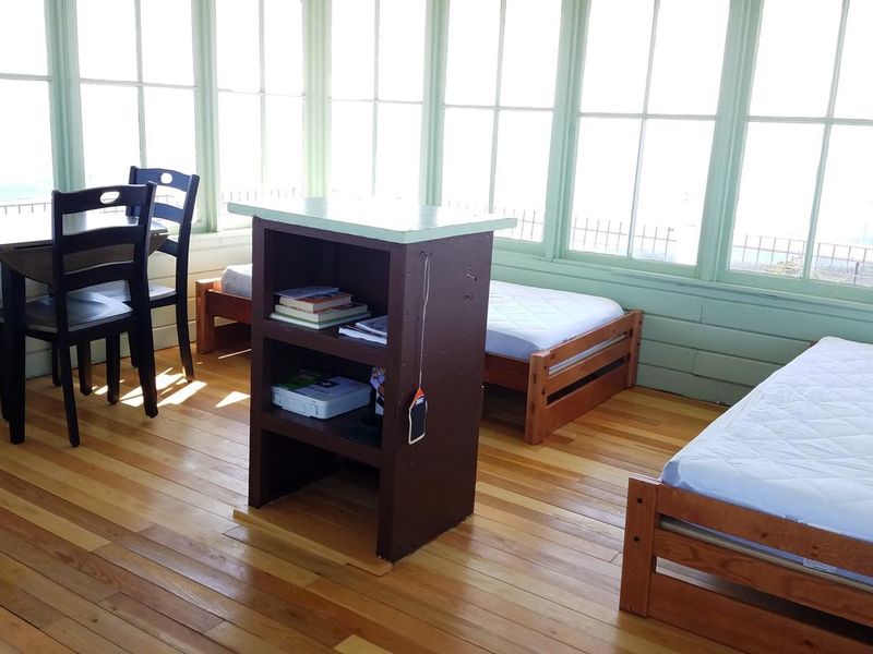
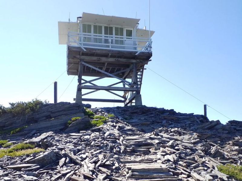
Meadow Peak Lookout sits atop its namesake mountain at an elevation of 6,710 feet in the Kootenai National Forest. The current 10-foot L-4 style lookout was built in 1957 and served as an active fire observation post until the 1990s. It was placed on the National Historic Lookout Register in 2000. The 225-square-foot cabin features two twin beds with mattresses, a two-burner propane cooktop, table and chairs, and basic cooking utensils. A catwalk encircles the structure. The lookout is located in the Purcell Range of the Rocky Mountains and offers panoramic views of densely forested peaks, the Cabinet Mountains Wilderness, Lower Thompson Lake, and McGregor Lake. The area supports populations of deer, elk, moose, grizzly bears, black bears, wolves, and mountain lions. Clear nights provide exceptional stargazing opportunities. Cell service is available at the lookout. Access is via Forest Road 511, approximately 8.7 miles from Highway 2. The road is steep, narrow, and contains sharp rocks and loose material. A high-clearance 4WD vehicle with aggressive off-road tires is required. The drive takes 45 minutes to an hour from the highway. A vault toilet outhouse is located near the tower, and an outdoor campfire ring is available. Guests must pack out all trash and call the ranger district for the lock combination before arrival.
Directions
From Libby, follow Highway 2 East for approximately 40 miles. Near mile post 80, turn left onto Meadow Peak Lookout Road 511. Follow Road 511 for approximately 8.7 miles to the lookout. The road is steep, narrow, and rough with sharp rocks and loose material. A high-clearance 4WD vehicle with aggressive off-road tires is required. Allow 45 minutes to 1 hour for the 8.7-mile drive.
Location
Amenities
| Water | No |
| Fires Allowed | Yes |
| Toilets | Yes |
| Dump Station | No |
| Wifi | No |
| Pets Allowed | Yes |
| Showers | No |
| Electric Hookups | — |
| Water Hookups | — |
| Sewer Hookups | — |
| Camp Store | No |
| Price | $45 |
Vehicle
| Max RV Length | — |
| Max Trailer Length | — |
| Big Rig Friendly | No |
| Pull Through Sites | No |
Contact
| SM.FS.knfcontactus@usda.gov | |
| Phone | +1 (406) 293-7773 |
Cell Service
| AT&T | Yes |
| Verizon | Yes |
| T-Mobile | None |
Availability
Photos


Community Posts
No posts yet. Be the first to share your experience!