Max V. Shaul State Park
Open for the 2026 season from May 22 through October 11. Reservations accepted up to 9 months in advance via ReserveAmerica. Walk-in registration available for campsites. Maximum stay is 14 continuous nights. Quiet hours 10 PM to 7 AM.
About
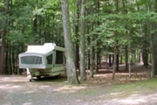
Max V. Shaul State Park offers a tranquil camping experience in the scenic Schoharie Valley, approximately 6 miles south of Middleburgh along Route 30. The campground features 30 wooded tent and trailer sites, each equipped with a fire pit and picnic table. Modern restroom facilities with showers are available, making it suitable for families and those who appreciate basic comforts while camping. The park sits at the base of Toepath Mountain and provides access to hiking trails, a playground, and ball fields for volleyball, basketball, and softball. Anglers can walk through the ball fields to reach Schoharie Creek for fishing. A group campsite accommodating up to 35 people is available by reservation, and a pavilion can be rented for day-use events. This is a primitive campground with no hookups or dump station, so RV campers should plan accordingly. The quiet atmosphere and wooded setting make it a good choice for tent campers and those with self-contained trailers seeking a low-key getaway in upstate New York.
Directions
Located on Route 30 approximately 6 miles south of Middleburgh in Schoharie County. The park is in the hamlet of Fultonham.
Nearby Campgrounds
Amenities
| Water | Yes |
| Fires Allowed | Yes |
| Toilets | Yes |
| Dump Station | No |
| Wifi | — |
| Pets Allowed | Yes |
| Showers | Yes |
| Electric Hookups | — |
| Water Hookups | — |
| Sewer Hookups | — |
| Camp Store | — |
| Price | $17 - $75 |
Vehicle
| Max RV Length | 35ft |
| Max Trailer Length | — |
| Big Rig Friendly | No |
| Pull Through Sites | Yes |
Contact
| Phone | +1 (518) 827-4711 |
Cell Service
| AT&T | Yes |
| Verizon | Yes |
| T-Mobile | None |
Useful Links
| NYS Parks Official Page | |
| ReserveAmerica Campground Details |
Availability
Photos
Community Posts
No posts yet. Be the first to share your experience!