Lookout Butte Lookout
Closed indefinitely due to structural deficiencies discovered in the tower. Facility engineers have determined the structure is unsound and the lookout is closed to all use until repairs can be completed.
From Recreation.gov
Lookout Butte lookout is currently closed due to the discovery of structural deficiencies in the tower. For public safety, the tower and surrounding area are closed to the public until repairs can be completed.
About
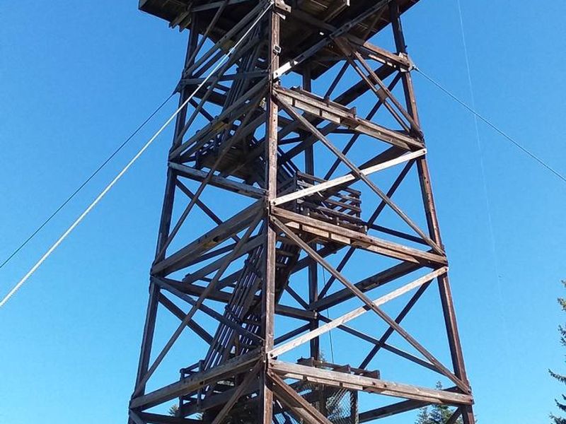
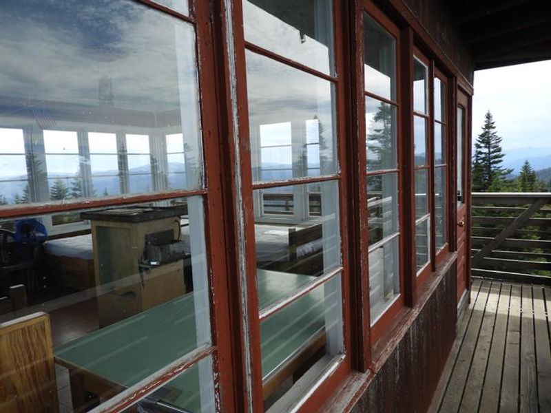
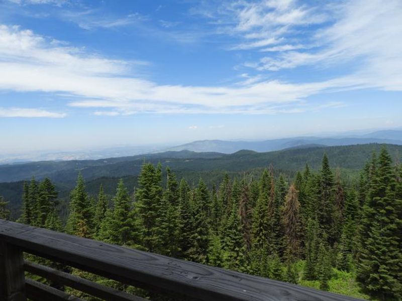
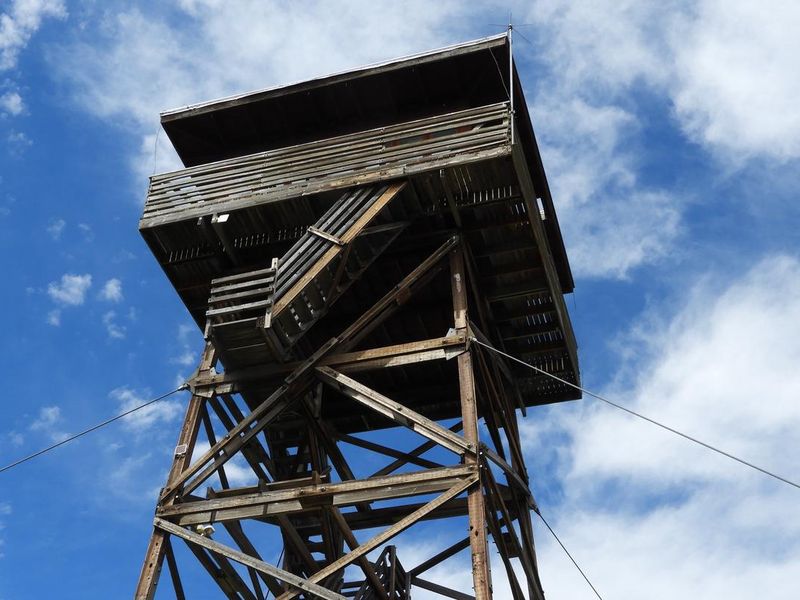
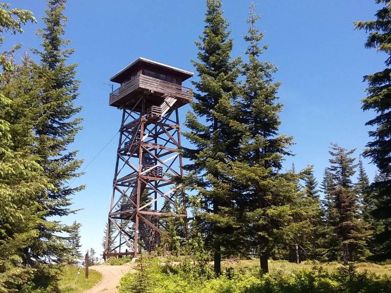
Lookout Butte has been home to three fire lookout towers since 1923. The original 45-foot tower was just a standing platform before a cabin was added a few years later. A 50-foot tower replaced it in 1935, and the current 60-foot wooden tower was built alongside in 1962. Today, this tower is available for overnight rental, offering a unique backcountry lodging experience with panoramic views from both the interior single-room cabin and the exterior catwalk. The lookout sits at 5,869 feet elevation with sweeping vistas of the Selway Crags in the Selway-Bitterroot Wilderness, the Seven Devils Mountain Range, Coolwater Ridge, Pilot Knob Lookout, and the Lochsa and Selway River drainages. The cabin sleeps four with two twin beds (foam mattresses) and two cots, and is equipped with a propane stove and oven, table and chairs, and basic cleaning supplies. A pit toilet is located downhill from the tower, and a campfire ring sits at the base. Guests must bring their own drinking water and pack out all trash. Access requires a high-clearance vehicle for the rough, outsloped final stretch; trailers are not recommended. Cell phone coverage is unreliable. Small children are discouraged due to the height hazards inherent in the tower, and guests must climb five flights of stairs to reach the cabin.
Directions
From Lowell, Idaho (Highway 12, milepost 97), cross the Selway Bridge, drive 3.5 miles and cross the Swiftwater Bridge on your right. Follow the signs 13 miles (about 1 hour) to the lookout. Alternative route: From Highway 12, cross the Middle Fork of the Clearwater River at the bridge above Kooskia (MP 74), turn left onto County Road 1842 toward Kooskia National Fish Hatchery. Pass the hatchery approximately 3.5 miles, stay left on County Route 286 for approximately 5 miles until it converts to Forest Road 286. Follow FR 286 for 8 miles to the junction with FR 470, stay right for 1.5 miles to the junction with FR 1129, turn left. Travel 1.3 miles and the signed spur road to the lookout is on the right, about 1/8 mile up. The final segment is rough and requires high clearance.
Amenities
| Water | No |
| Fires Allowed | Yes |
| Toilets | Yes |
| Dump Station | No |
| Wifi | No |
| Pets Allowed | Yes |
| Showers | No |
| Electric Hookups | — |
| Water Hookups | — |
| Sewer Hookups | — |
| Camp Store | No |
| Price | $40 |
Vehicle
| Max RV Length | — |
| Max Trailer Length | — |
| Big Rig Friendly | No |
| Pull Through Sites | No |
Contact
| Phone | +1 (208) 926-4258 |
Cell Service
| AT&T | None |
| Verizon | None |
| T-Mobile | None |
Availability
Photos
Community Posts
No posts yet. Be the first to share your experience!