Liz Creek Cabin
Closed for the season. Typically operates July 1 through October 1. Reservations available through Recreation.gov.
About
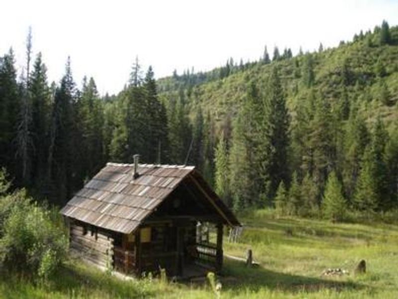
Liz Creek Cabin was built in 1929 as a backcountry guard station and is eligible for the National Register of Historic Places. Following an extensive restoration completed in 2014, this remote cabin is now available as a public rental. Situated at 3,500 feet elevation at the confluence of Liz and Weitas Creeks, the cabin offers panoramic views of old growth conifer mixed with massive cedar snags from the 1910 fires, steep mountainsides filled with huckleberry and mountain maple, and beaver-dammed creeks teeming with native flora and fauna. The small single-room cabin features a loft sleeping area, covered porch, woodstove for heating, outdoor table, and exterior fire ring. A vault toilet outhouse is located a short distance from the cabin. There is no electricity, potable water, or garbage service. Guests must bring all supplies including drinking water or treat creek water, and pack out all trash. Access to Liz Creek Cabin is via US Highway 12 to FSR 107, then 16 miles of single-lane gravel roads requiring high-clearance 4x4 vehicles, followed by Trail #20 for approximately 11 miles. The final 1.5 miles from the Weitas Creek pack bridge to the cabin is closed to ATVs and UTVs, requiring travel by hiking, horseback, or motorcycle only.
Directions
From US Highway 12, locate FSR 107 at mile marker 139.7 (approximately 25 miles west of Powell, Idaho). Follow FSR 107 twelve miles north to Saddle Camp Junction with roads FSR 500/FSR 587. Take a hard left on FSR 500 heading west. Follow FSR 500 four miles to the 12 Mile Saddle trailhead of Trail #20. Follow the motorized multi-use trail 9.5 miles to the pack bridge crossing at Weitas Creek, then continue 1.5 miles to the cabin. The final 1.5 miles is closed to ATV/UTV traffic; access by hiking, horseback, or motorcycle only. High-clearance 4x4 vehicle required.
Location
Amenities
| Water | No |
| Fires Allowed | Yes |
| Toilets | Yes |
| Dump Station | No |
| Wifi | No |
| Pets Allowed | Yes |
| Showers | No |
| Electric Hookups | — |
| Water Hookups | — |
| Sewer Hookups | — |
| Camp Store | No |
| Price | $40 |
Vehicle
| Max RV Length | — |
| Max Trailer Length | — |
| Big Rig Friendly | No |
| Pull Through Sites | No |
Contact
| Phone | +1 (208) 476-8267 |
Cell Service
| AT&T | None |
| Verizon | None |
| T-Mobile | None |
Availability
Photos
Community Posts
No posts yet. Be the first to share your experience!