Castle Butte Lookout
Currently closed for the season. The lookout typically opens in early July when the Lolo Motorway becomes passable after snowmelt. Reservations are made through Recreation.gov.
About
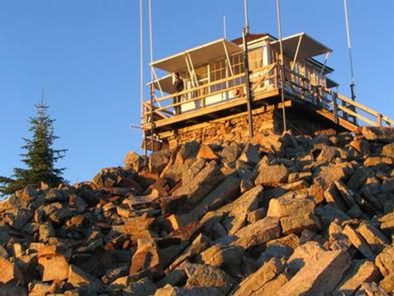
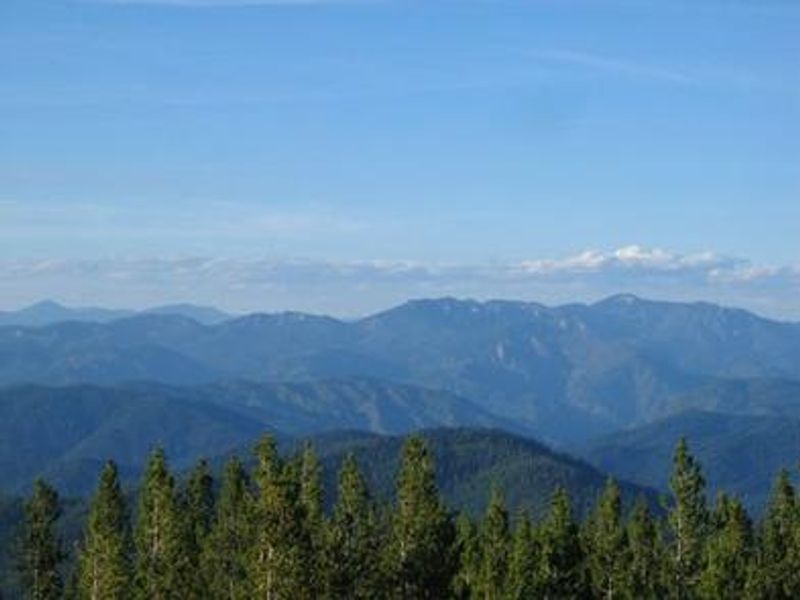
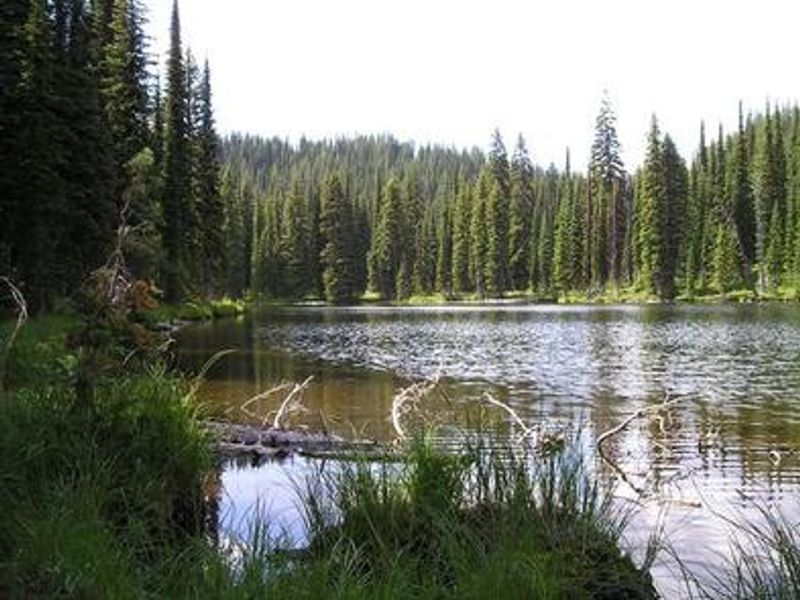
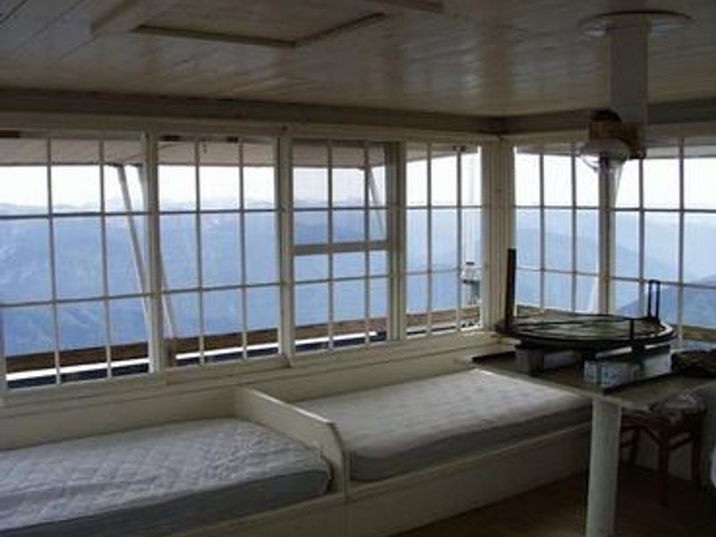
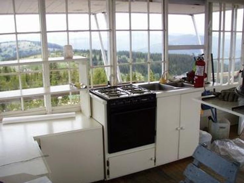
Originally built in 1916, replaced in 1928, and rebuilt as a lookout in 1950, Castle Butte Lookout sits at 6,659 feet above sea level in the Nez Perce-Clearwater National Forests. The cabin offers breathtaking 360-degree panoramic views of the Selway-Bitterroot Wilderness, the Seven Devils Mountains, the Great Burn area, and the deep canyons of the North Fork Clearwater River drainage. Wildlife enthusiasts may spot eagles, bears, moose, elk, deer, and mountain goats. The lookout houses up to four guests with two twin beds with foam mattresses, two cots, a table with two chairs. Propane-powered cooking stove, heater, and lights are provided. A vault toilet is located in a separate building. Guests must bring their own water, bedding, cookware, toilet paper, garbage bags, and emergency lighting. There is no electricity, cell service, or nearby water source. Access is via the historic Lolo Motorway, a primitive single-lane road constructed by the Civilian Conservation Corps in the 1930s. The road is not suitable for large RVs, vehicles with low ground clearance, or trailers. Guests must walk approximately 100 feet up steep, rocky terrain to reach the lookout. The nearest services and payphone are 45 miles away in Powell, Idaho.
Directions
From Kooskia, ID: Take US Highway 12 east for about 65 miles and turn left onto Forest Service Road 107/Gravey Creek Road. Drive about 6 miles, then take a slight right on Road 107. In about 3 miles, turn left toward Lolo Motorway. Take the first right onto Lolo Motorway and drive about 9.5 miles until it becomes Forest Road 561. From Missoula, MT: Take US Highway 12 west for about 75 miles and turn right onto Road 107/Gravey Creek Road, then follow the same route. High-clearance vehicle required. Not suitable for RVs, trailers, or low-clearance vehicles.
Location
Amenities
| Water | No |
| Fires Allowed | — |
| Toilets | Yes |
| Dump Station | No |
| Wifi | No |
| Pets Allowed | Yes |
| Showers | No |
| Electric Hookups | — |
| Water Hookups | — |
| Sewer Hookups | — |
| Camp Store | No |
| Price | $45 |
Vehicle
| Max RV Length | — |
| Max Trailer Length | — |
| Big Rig Friendly | No |
| Pull Through Sites | No |
Contact
| Phone | +1 (208) 926-4258 |
Cell Service
| AT&T | None |
| Verizon | None |
| T-Mobile | None |
Availability
Photos
Community Posts
No posts yet. Be the first to share your experience!