Lake Havasu Shoreline Sites
Open year-round on a first-come, first-served basis. 14-day stay limit. Day use $10, overnight $10 additional for up to 6 people.
Extreme Heat Warning issued August 8 at 2:08PM MST until August 9 at 8:00PM MST by NWS Phoenix AZ
* WHAT...Dangerously hot conditions. Afternoon temperatures 108 to 115. Major Heat Risk. * WHERE...In Arizona, La Paz and Yuma counties. In California, Palo Verde Valley. * WHEN...Until 8 PM MST /8 PM PDT/ Sunday. * IMPACTS...Heat related illnesses increase significantly during extreme heat events. Overexposure can cause heat cramps and heat exhaustion to develop and, without intervention, can lead to heat stroke.
Special Weather Statement issued August 8 at 9:47PM MST by NWS Phoenix AZ
At 946 PM MST, Doppler radar was tracking a strong thunderstorm 17 miles northwest of Tonopah, moving west at 35 mph. HAZARD...Wind gusts of 50 to 55 mph. SOURCE...Radar indicated. IMPACT...Gusty winds could knock down tree limbs and blow around unsecured objects. This storm will remain over mainly rural areas of east central La Paz and Maricopa Counties. This includes AZ Interstate 10 between mile markers 50 and 84.
Dust Advisory issued August 8 at 9:28PM MST until August 8 at 10:30PM MST by NWS Phoenix AZ
The National Weather Service in Phoenix has issued a * Dust Advisory for... East central La Paz County in west central Arizona... Northeastern Yuma County in southwestern Arizona... Maricopa County in south central Arizona... * Until 1030 PM MST. * At 928 PM MST, a wall of dust was along a line extending from 10 miles southeast of Vicksburg Junction to 15 miles west of Tonopah to near Palo Verde, moving southwest at 40 mph. HAZARD...Less than one mile visibility with strong wind in excess of 40 mph. SOURCE...Doppler radar. IMPACT...Hazardous travel. * This includes the following highways... AZ Interstate 10 between mile markers 35 and 122. US Highway 60 between mile markers 36 and 66. AZ Route 72 between mile markers 41 and 49. Locations impacted include... Buckeye, Tonopah, Palo Verde, Salome, Brenda, Perryville, White Tank Mountain Park, Liberty, Painted Rock Dam, Vicksburg Junction, Wenden, Vicksburg, Palo Verde Nuclear Generation Station, Wintersburg, and Harcuvar.
About
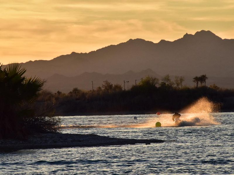
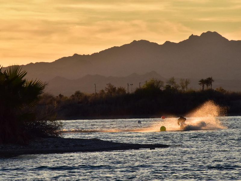
The Lake Havasu Shoreline Sites consist of 73 boat-access campsites managed by the BLM Lake Havasu Field Office, scattered along 20 miles of the Arizona shore of Lake Havasu. These primitive sites are accessible only by boat or limited hiking trails, offering a secluded desert lake camping experience. Each campsite includes a picnic table, barbecue grill, and trash receptacle. The majority of sites also feature a restroom and shade structure, providing basic comfort in the desert environment. Campers should bring their own potable water as none is available on-site. Sites operate on a first-come, first-served basis with a 14-day stay limit. Day use costs $10, with an additional $10 for overnight camping for up to 6 people. Additional guests are $2 each, and children under 16 are free. An annual pass is available for $100. Passes can be purchased through Recreation.gov, YourPassNow, on-site iron ranger deposit boxes, or the Lake Havasu Field Office.
Directions
These are boat-access only campsites along the Arizona shore of Lake Havasu. Access requires a boat launch from Lake Havasu City or other area boat ramps.
Amenities
| Water | No |
| Fires Allowed | Yes |
| Toilets | Yes |
| Dump Station | — |
| Wifi | No |
| Pets Allowed | Yes |
| Showers | No |
| Electric Hookups | — |
| Water Hookups | — |
| Sewer Hookups | — |
| Camp Store | No |
| Price | $10 - $20 |
Vehicle
| Max RV Length | — |
| Max Trailer Length | — |
| Big Rig Friendly | No |
| Pull Through Sites | No |
Contact
| Phone | +1 (928) 505-1200 |
Cell Service
| AT&T | Yes |
| Verizon | Yes |
| T-Mobile | None |
Photos
Community Posts
No posts yet. Be the first to share your experience!