Lake Harriet
The campground opens May 22, 2026 for the season and operates through the second full weekend of September. Reservations are available via Recreation.gov.
Alcohol Prohibitions
This Order describes acts that are prohibited upon lands, roads and trails within the National Forest System administered by the Forest Service Pacific Northwest Region in regards to alcoholic beverages.
Aquatic Invasive Species
This Order prohibits 1) possessing, storing, or transporting any aquatic invasive animal species AND 2) prohibits possessing, storing, or transporting any aquatic or riparian invasive plant species - on National Forest System lands in the Pacific Northwest Region as specified in the Order.
Restrictions on Use of Forage and Mulch Products
This Order prohibits unloading, storing, or using any straw, hay, grain, seed, or other forage or mulch products that are not state-certified weed free on the National Forest System lands, roads or trails in any Closure Area as specific in the Order. Some examples of these include hay bales, hay…
About
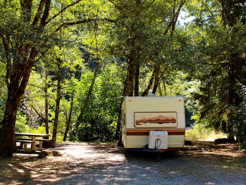
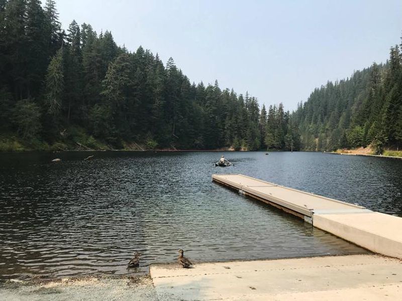
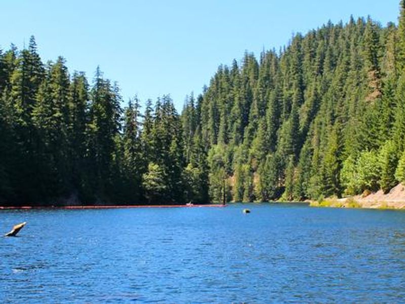
Lake Harriet Campground occupies a scenic location on the eastern shore of crystal-clear Lake Harriet, nestled in a narrow, heavily forested canyon at approximately 2,000 feet elevation in Mt. Hood National Forest. The 22-acre lake sits where the Oak Grove Fork of the Clackamas River flows into it, creating excellent habitat for rainbow, cutthroat, and brown trout. The campground provides 8 single-family sites, each equipped with a picnic table and fire ring with grill. Accessible vault toilets and potable water from a hand pump are available. A boat ramp and ADA-accessible fishing dock provide easy lake access. Boating and canoeing are popular, with a 10 mph speed limit in effect. Nearby recreation includes hiking in the Bull of the Woods Wilderness to the south, fishing on the Oak Grove Fork of the Clackamas River for steelhead and salmon, and mountain biking on primitive forest roads. The Ripplebrook Ranger Station, about 6 miles west, offers a general store and visitor center.
Directions
From Estacada, take OR-224/Clackamas Highway east for 26 miles to the old Ripplebrook Guard Station. Cross the bridge and turn left on Forest Service Road 57 toward Timothy Lake. Travel 5 miles, cross the concrete bridge, then turn left onto Forest Service Road 4630 (narrow gravel road) and continue to Lake Harriet Campground.
Amenities
| Water | Yes |
| Fires Allowed | Yes |
| Toilets | Yes |
| Dump Station | No |
| Wifi | No |
| Pets Allowed | Yes |
| Showers | No |
| Electric Hookups | — |
| Water Hookups | — |
| Sewer Hookups | — |
| Camp Store | No |
| Price | $28 |
Vehicle
| Max RV Length | 30ft |
| Max Trailer Length | 30ft |
| Big Rig Friendly | No |
| Pull Through Sites | No |
Contact
| Phone | +1 (503) 464-8515 |
Cell Service
| AT&T | None |
| Verizon | None |
| T-Mobile | None |
Availability
Photos
Community Posts
No posts yet. Be the first to share your experience!