Ken's Lake Campground
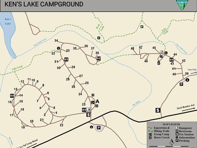
Loop B is open year-round first-come, first-served. Loop A is reservation-only through Recreation.gov when open, but closes during low-use seasons (summer and winter; exact dates vary annually). No potable water available on-site.
Flood Watch issued October 10 at 3:44PM MDT until October 12 at 6:00PM MDT by NWS Salt Lake City UT
* WHAT...Flooding caused by excessive rainfall continues to be possible. * WHERE...A portion of Utah, including the following areas, Western Millard and Juab Counties, Bear Lake and Bear River Valley, Cache Valley/Utah Portion, Eastern Box Elder County, Great Salt Lake Desert and Mountains, Northern Wasatch Front, Salt Lake Valley, Tooele and Rush Valleys, Utah Valley, Wasatch Back, Wasatch Mountains I-80 North, Wasatch Mountains South of I-80, Western Uinta Basin and Western Uinta Mountains. This includes recent burn scars such as Rocky Canyon. * WHEN...From midnight MDT tonight through Monday afternoon. * IMPACTS...Excessive runoff may result in flooding of rivers, creeks, streams, and recent burn scars. Flooding may occur in poor drainage and urban areas. Extensive street flooding and flooding of creeks and rivers are possible. * ADDITIONAL DETAILS... - Moisture associated with the remnants of Tropical Storm Rachel will move into northern Utah this weekend producing a prolonged rainfall event. In particular, moisture interacting with a frontal boundary across far northern Utah may yield locally heavier rainfall totals compared to other locations. As a result, areal flooding is expected across northern Utah this weekend. - http://www.weather.gov/safety/flood
Wind Advisory issued October 10 at 9:47PM MDT until October 11 at 6:00AM MDT by NWS Salt Lake City UT
* WHAT...South winds 20 to 30 mph with gusts up to 50 mph. * WHERE...The Wasatch Front, Great Salt Lake Desert and Mountains, Tooele and Rush Valleys, Cache Valley/Utah Portion, Wasatch Back, Bear Lake and Bear River Valley, and Sanpete Valley. * WHEN...Until 6 AM MDT Sunday. * IMPACTS...Gusty winds will blow around unsecured objects and a few power outages may result.
About
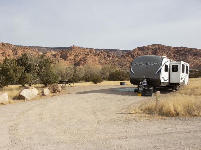
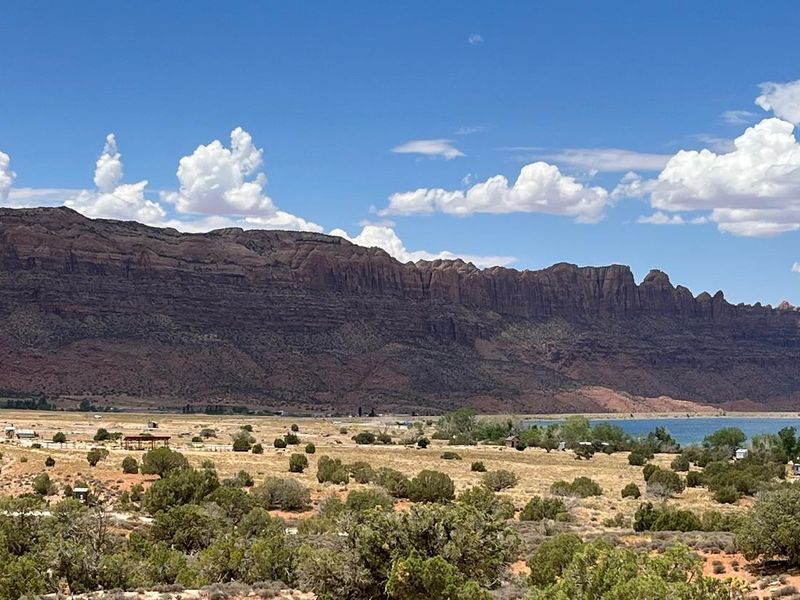
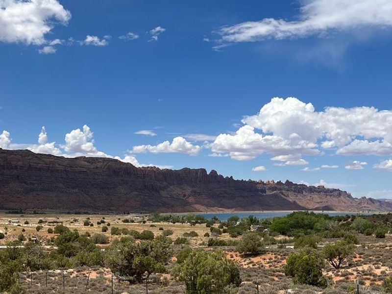
Ken's Lake Campground sits within the Ken's Lake Recreation Area, a BLM-managed site featuring a man-made reservoir, day use area with boat ramp, and over 3 miles of hiking and equestrian trails. The campground is surrounded by red rock fins to the east, sagebrush flats to the south and west, and the reservoir to the north, with distant views of the La Sal Mountains and Moab Rim. The campground consists of two loops with distinct characteristics. Loop A has no vegetation for shade and is popular with visitors bringing large motorhomes and trailers; it operates by reservation only through Recreation.gov during the open season. Loop B remains open year-round and features smaller sites with juniper and cottonwood trees providing shade and privacy, available first-come, first-served. Each campsite includes a gravel parking pad for two vehicles, a picnic table, and a fire ring with proximity to vault toilets and trash receptacles. Campers should bring their own drinking water as none is available on-site. The south end of the Steel Bender Jeep Safari Route runs adjacent to the campground, making it popular with OHV users. Summer temperatures can exceed 100°F while winter lows drop below freezing.
Directions
From Moab, drive south on Highway 191 approximately 8 miles until you see signs for Ken's Lake. Turn left off the highway and follow signs to the lake. The campground is just beyond the turn to the lake. Loop A is in the first campground loop and Loop B is the second loop.
Amenities
| Water | No |
| Fires Allowed | Yes |
| Toilets | Yes |
| Dump Station | No |
| Wifi | No |
| Pets Allowed | — |
| Showers | No |
| Electric Hookups | — |
| Water Hookups | — |
| Sewer Hookups | — |
| Camp Store | No |
| Price | $20 |
Vehicle
| Max RV Length | — |
| Max Trailer Length | — |
| Big Rig Friendly | Yes |
| Pull Through Sites | No |
Contact
| blm_ut_mb_mail@blm.gov | |
| Phone | +1 (435) 259-2100 |
Cell Service
| AT&T | Yes |
| Verizon | None |
| T-Mobile | None |
Useful Links
| View on Recreation.gov | |
| BLM Ken's Lake Campground |
Availability
Photos
Community Posts
No posts yet. Be the first to share your experience!