Hornet Lookout
Currently closed for the season. Opens June 15 and operates through October 15. Road may be impassable in early-to-mid summer due to lingering snow. Reservations available via Recreation.gov.
Northern Region Camping & Target Restrictions, Pallet Prohibition
This order defines the maximum length of occupation at a single location or cumulatively at any number of locations within a calendar year, within the states of Montana, North Dakota, South Dakota, and Idaho
Weed Free Forage & Mulch Products Order for the Northern Region
It is illegal to possess, store or transport straw, hay, grain, seed or other forage or mulch products on Forest Service lands without documentation that the product is certified as “weed free” by a state certification process that meets or exceeds the North American Weed Free Forage standards.
R1-2023-02 - NCDE Food and Wildlife Attractant Storage Order
Northern Continental Divide Ecosystem Food/Wildlife Attractant Storage Order for the Flathead, Lolo, Kootenai, Helena-Lewis and Clark, and Beaverhead-Deerlodge National Forests within the Northern Continental Divide Ecosystem.
About
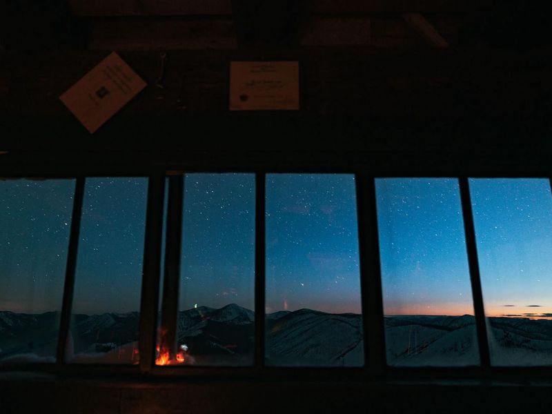
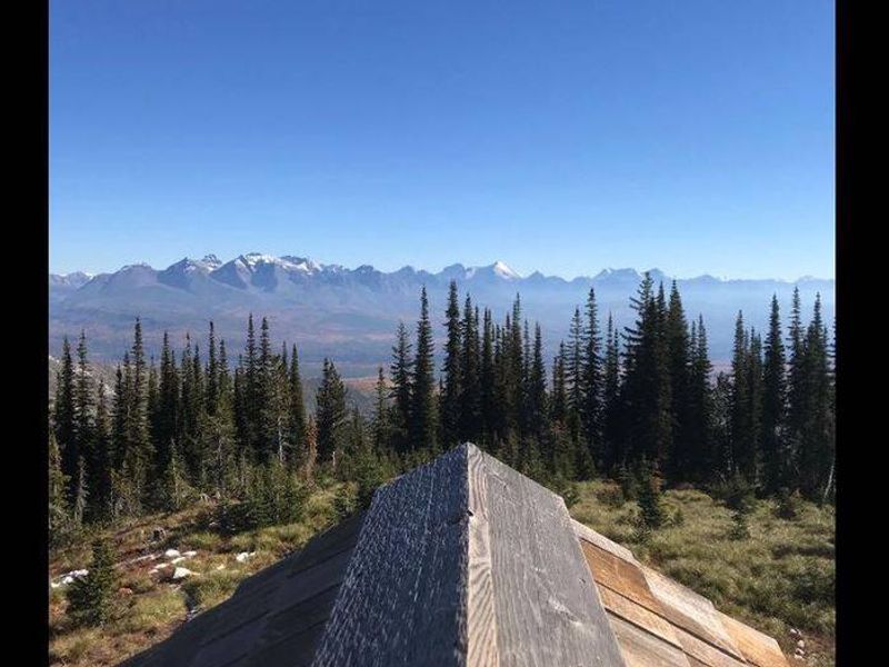
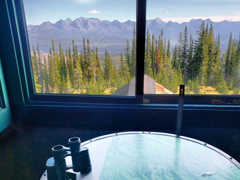
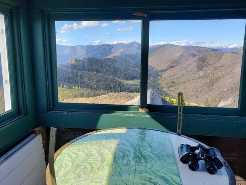
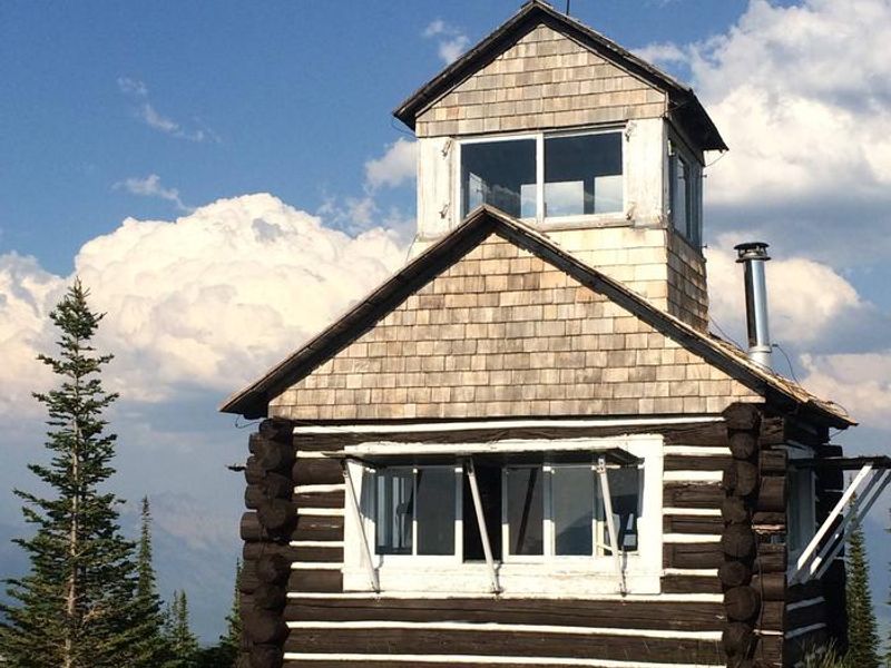
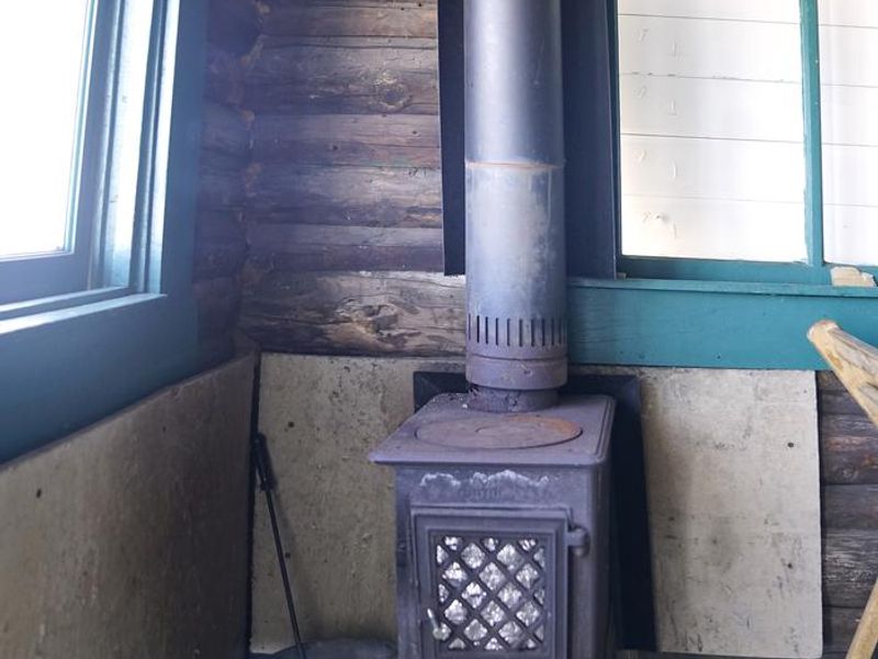
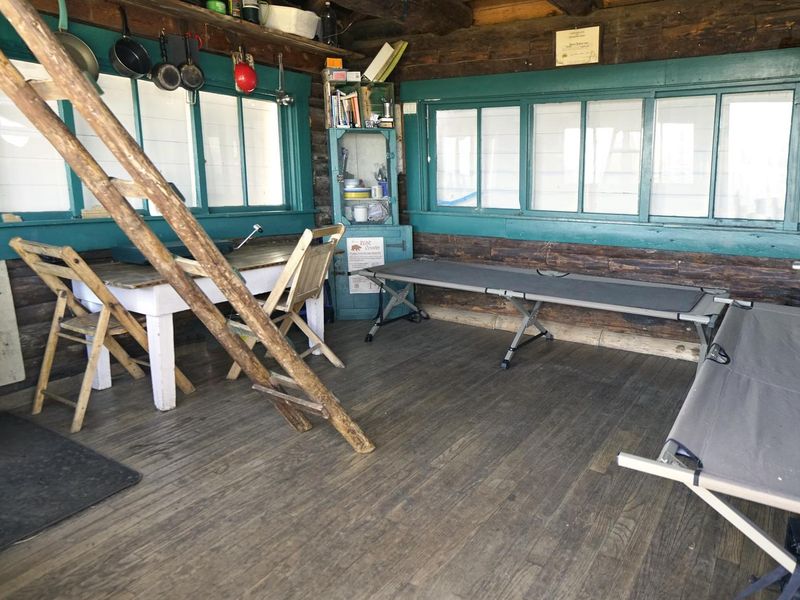
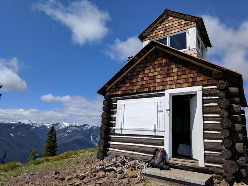
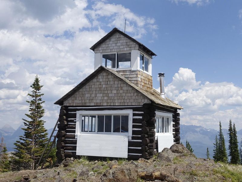
Hornet Lookout is a historic fire lookout cabin built in 1922, situated atop Hornet Peak at 6,744 feet in the Flathead National Forest. The rustic two-story structure originally served to detect forest fires in the North Fork area. The ground level provides living space with two cots, a propane cook stove, propane lantern, and a small wood stove for heat. The upper loft offers unobstructed 360-degree views of the surrounding terrain, including Glacier National Park and Kintla Lake on clear days. The lookout is located 45 miles north of Columbia Falls and requires a one-mile hike from the trailhead. A 2003 wildfire charred the surrounding area, but wildflowers and bear grass have made a comeback. Bears frequent the area, so bear-proof containers are essential. The Glacier View Ranger District is bordered on the east by the Wild and Scenic North Fork of the Flathead River and Glacier National Park, with Canada to the north. Guests must bring their own bedding, water, first aid kit, food, and garbage bags as there is no potable water and trash must be packed out. A hand saw is provided to gather nearby firewood for the wood stove. Maximum stay is three consecutive nights with a total of seven days per calendar year.
Directions
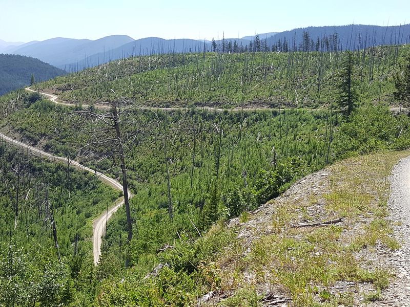
From Columbia Falls, take Nucleus Avenue north through town and turn east on Railroad Street. At the stop sign, the road becomes North Fork Road (County Road 486). Continue 45 miles north and over the railroad overpass. Turn left (west) on Whale Creek Road 318 and drive 4 miles, then turn right on narrow Hornet Road 9805 and go 5.2 miles to the trailhead of Hornet Trail 349. Hike approximately one mile to the lookout.
Amenities
| Water | No |
| Fires Allowed | Yes |
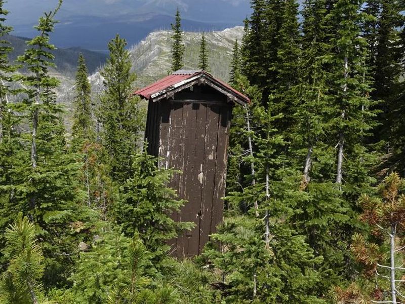
| Toilets | Yes |
| Dump Station | No |
| Wifi | No |
| Pets Allowed | Yes |
| Showers | No |
| Electric Hookups | — |
| Water Hookups | — |
| Sewer Hookups | — |
| Camp Store | No |
| Price | $40 |
Vehicle
| Max RV Length | — |
| Max Trailer Length | — |
| Big Rig Friendly | No |
| Pull Through Sites | No |
Contact
| Phone | +1 (406) 387-3800 |
Cell Service
| AT&T | None |
| Verizon | Yes |
| T-Mobile | None |
Availability
Photos
Community Posts
No posts yet. Be the first to share your experience!