Wurtz Cabin
Open year-round for reservations through Recreation.gov. Maximum stay is 3 consecutive nights and 7 days per calendar year. Check-in is 2:00 PM and check-out is 12:00 PM. The gravel North Fork Road is only intermittently plowed in winter; four-wheel drive and chains are recommended for winter access.
Northern Region Camping & Target Restrictions, Pallet Prohibition
This order defines the maximum length of occupation at a single location or cumulatively at any number of locations within a calendar year, within the states of Montana, North Dakota, South Dakota, and Idaho
Weed Free Forage & Mulch Products Order for the Northern Region
It is illegal to possess, store or transport straw, hay, grain, seed or other forage or mulch products on Forest Service lands without documentation that the product is certified as “weed free” by a state certification process that meets or exceeds the North American Weed Free Forage standards.
R1-2023-02 - NCDE Food and Wildlife Attractant Storage Order
Northern Continental Divide Ecosystem Food/Wildlife Attractant Storage Order for the Flathead, Lolo, Kootenai, Helena-Lewis and Clark, and Beaverhead-Deerlodge National Forests within the Northern Continental Divide Ecosystem.
About
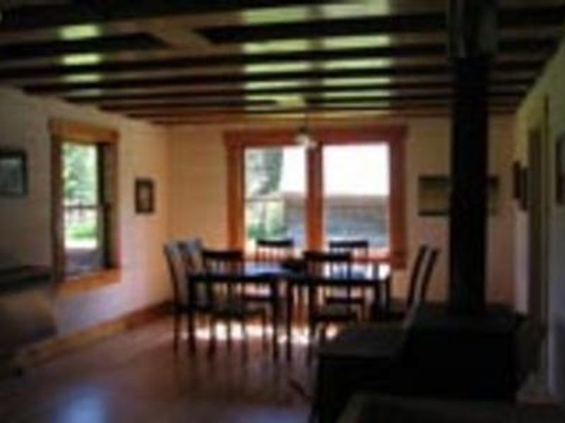
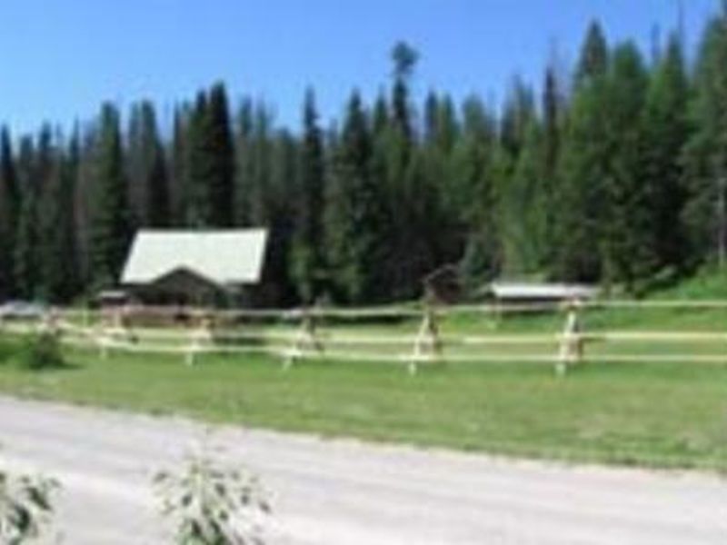
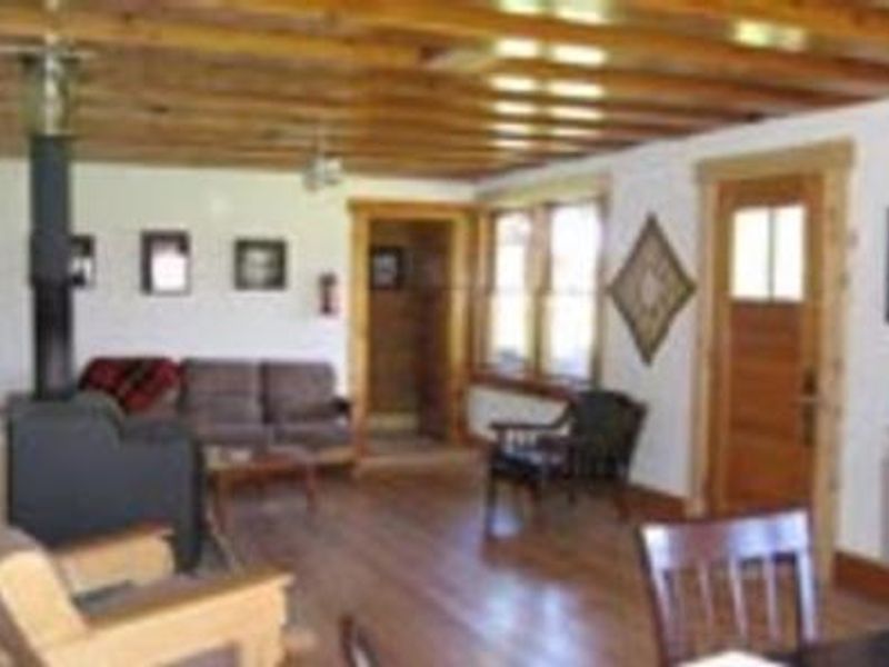
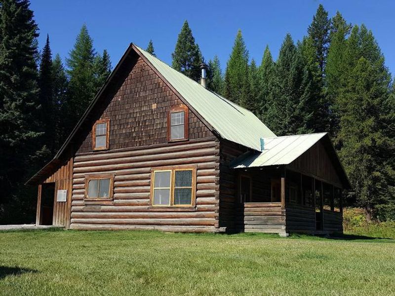
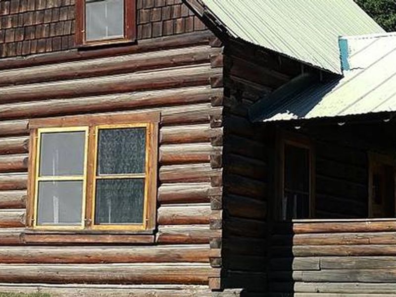
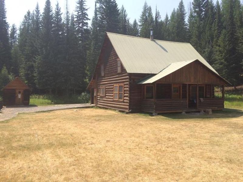
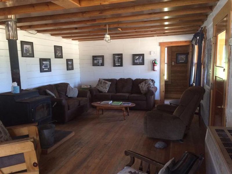
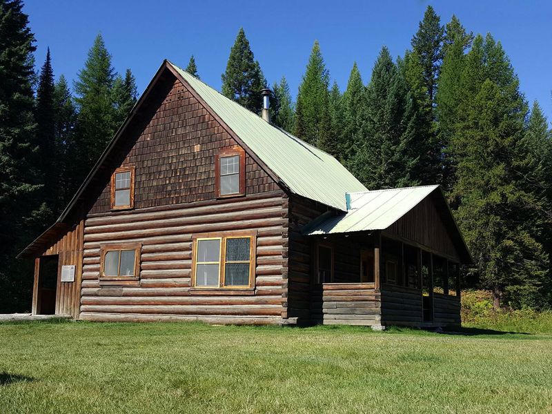
Wurtz Cabin offers a unique opportunity to stay in a piece of Montana history. Originally built by Frank and Ella Wurtz in 1913, this homestead was expanded as their family grew and remained occupied through the 1960s. Volunteers helped the Forest Service restore the structure, which now sits on the National Historic Register. The cabin features two double beds and a bunk bed on the main floor plus twin beds in the loft, accommodating up to 12 guests. The rear of the cabin is lined with dense conifers while the front faces a grassy lawn overlooking pine trees with the snow-capped Livingston Range in Glacier National Park visible in the distance. Amenities include propane cook stove, propane heater, propane lights, wood stove, and an outdoor vault toilet. Firewood is provided October 1 through May 1. There is no potable water or electricity; guests must bring their own water, food, bedding, flashlights, and garbage bags. Grizzly bears frequent the area, so all food, beverages, coolers, and garbage must be stored inside the cabin. The North Fork Road is gravel and only intermittently plowed in winter; four-wheel drive and chains are recommended during winter months. Glacier National Park can be accessed at Polebridge, south of the cabin.
Directions
From Columbia Falls, travel north on Nucleus Avenue and turn east onto Railroad Street at the stop sign. The road becomes North Fork Road as it travels over the railroad overpass. Continue north approximately 46 miles; Wurtz Cabin is on the left (west side of the road). The majority of the road is gravel.
Amenities
| Water | No |
| Fires Allowed | Yes |
| Toilets | Yes |
| Dump Station | No |
| Wifi | — |
| Pets Allowed | No |
| Showers | No |
| Electric Hookups | — |
| Water Hookups | — |
| Sewer Hookups | — |
| Camp Store | No |
| Price | $75 |
Vehicle
| Max RV Length | — |
| Max Trailer Length | — |
| Big Rig Friendly | — |
| Pull Through Sites | No |
Contact
| Phone | +1 (406) 387-3800 |
Cell Service
| AT&T | None |
| Verizon | None |
| T-Mobile | None |
Availability
Photos

Community Posts
No posts yet. Be the first to share your experience!