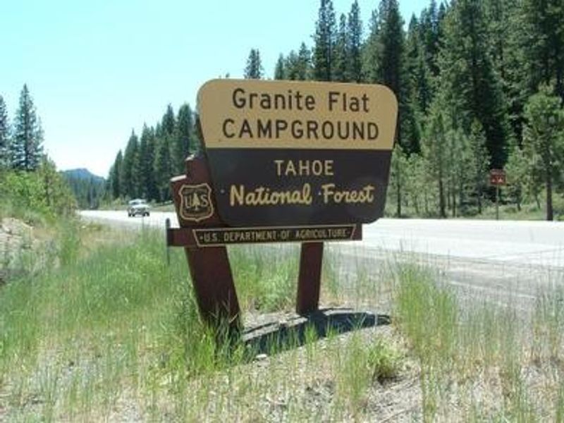
Granite Flat
Open for the 2026 season from May 27 through October 11. Reservations available via Recreation.gov. Expect full campgrounds on weekends unless you have a reservation.
Flood Watch issued July 20 at 12:17PM PDT until July 21 at 11:00PM PDT by NWS Reno NV
* WHAT...Flash flooding caused by excessive rainfall is possible due to thunderstorms. * WHERE...Portions of east central California, including the following area, Greater Lake Tahoe Area and western Nevada, including the following areas, Greater Lake Tahoe Area and Greater Reno-Carson City-Minden Area. * WHEN...From Tuesday afternoon through Tuesday evening. * IMPACTS...Excessive runoff may result in flooding of creeks, streams, urban areas, burn scars, and areas near steep terrain. * ADDITIONAL DETAILS... - Deeper monsoonal moisture combined with daytime heating will produce scattered thunderstorms Tuesday afternoon and evening. Slower moving storms could redevelop over similar areas, increasing the risk for heavy rainfall capable of producing flash flooding. - http://www.weather.gov/safety/flood
National Forest System Roads
Follow California Vehicle Code on National Forest System Roads
Fireworks and Explosives are always Prohibited
Fireworks and explosives (including explosive targets) are always prohibited on national forest lands. The prohibition of fireworks and exploding targets on national forest system lands is part of a set of permanent fire safety regulations in the Code of Federal Regulations (CFR), listed below.…
About
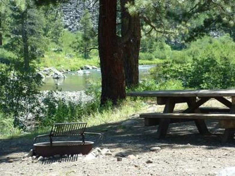
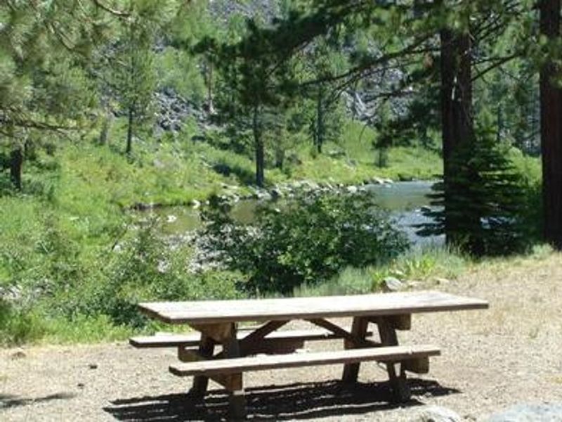
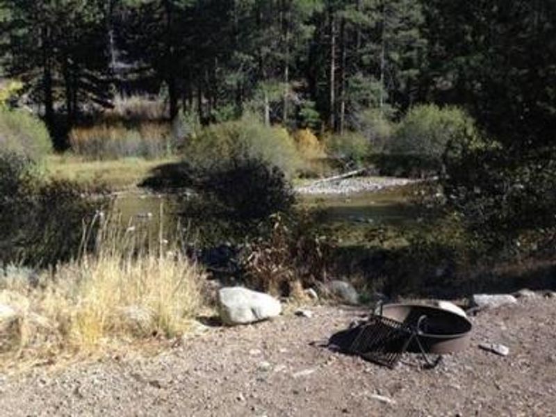
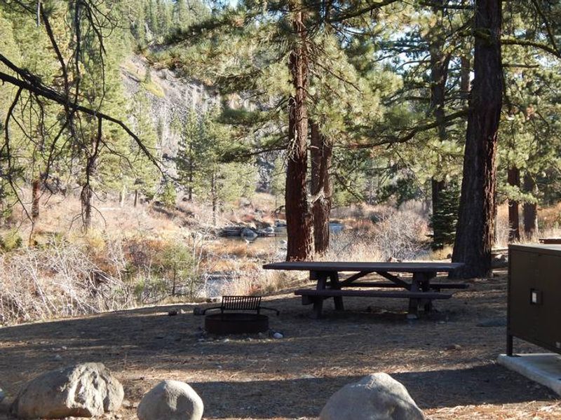
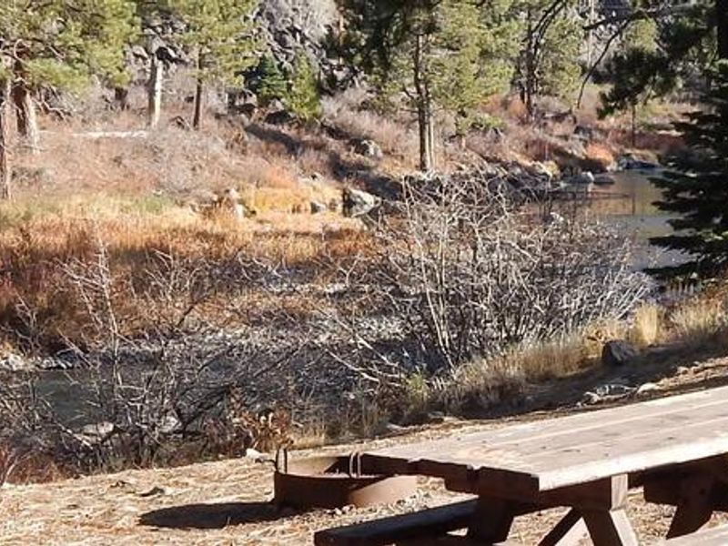
Granite Flat Campground occupies a scenic forest of Jeffrey and lodgepole pine trees along the Truckee River in Tahoe National Forest. Located just 1.5 miles south of Truckee on Highway 89, the campground provides easy access to both the mountain town of Truckee and Lake Tahoe, which is about 15 minutes south. The 70 single-family sites vary from heavily shaded to open, with some offering views of the Truckee River. All sites are a short walk to the river. Seven additional tent-only sites require a short walk-in from the parking area. Fly-fishing for rainbow trout on the Truckee River draws many visitors, along with swimming and tubing in the river during warmer months. The surrounding area offers access to numerous trails including the Western States Trail, Five Lakes Trail, and Pacific Crest Trail. Nearby attractions include Donner Camp Interpretive Trail, Prosser, Boca, and Stampede reservoirs to the north, and Lake Tahoe's boating, kayaking, and scenic driving opportunities to the south. Each campsite is equipped with a picnic table, campfire ring, grill, and bear-proof storage locker. Accessible vault toilets and drinking water are provided throughout the campground. Roads within the campground are paved. Highway 89 road noise is audible at some sites. Quiet hours are 10:00 p.m. to 6:00 a.m., with a 14-day stay limit.
Directions
From Truckee, drive 1.5 miles south on Highway 89 to the campground entrance.
Amenities
| Water | Yes |
| Fires Allowed | Yes |
| Toilets | Yes |
| Dump Station | — |
| Wifi | — |
| Pets Allowed | Yes |
| Showers | No |
| Electric Hookups | — |
| Water Hookups | — |
| Sewer Hookups | — |
| Camp Store | — |
| Price | $22 |
Vehicle
| Max RV Length | 45ft |
| Max Trailer Length | — |
| Big Rig Friendly | No |
| Pull Through Sites | No |
Contact
| Phone | +1 (530) 587-3558 |
Cell Service
| AT&T | None |
| Verizon | Yes |
| T-Mobile | Yes |
Availability
Photos
Community Posts
No posts yet. Be the first to share your experience!