Grandview Shelter 1
This is a day-use shelter, not an overnight campground. Reservations are available via Recreation.gov. Check-in is 6:00 AM, check-out is 9:00 PM.
Severe Thunderstorm Warning issued August 11 at 12:48PM EDT until August 11 at 1:45PM EDT by NWS Charleston WV
SVRRLX The National Weather Service in Charleston West Virginia has issued a * Severe Thunderstorm Warning for... Nicholas County in southeastern West Virginia... Southeastern Kanawha County in central West Virginia... South central Braxton County in north central West Virginia... Northwestern Raleigh County in southeastern West Virginia... Southwestern Webster County in northeastern West Virginia... Clay County in north central West Virginia... Fayette County in southeastern West Virginia... Northeastern Boone County in central West Virginia... * Until 145 PM EDT. * At 1248 PM EDT, severe thunderstorms were located along a line extending from near Grantsville to 6 miles southeast of Culloden, moving southeast at 50 mph. HAZARD...60 mph wind gusts. SOURCE...Radar indicated. IMPACT...Expect damage to roofs, siding, and trees. * Locations impacted include... Summersville, Fayetteville, Richwood, Sutton, Clay, Babcock State Park, Oak Hill, Montgomery, Mount Hope, Ansted, Cedar Grove, East Bank, Gassaway, Glasgow, Smithers, Gauley Bridge, Pratt, Camden-On-gauley, Birch River, and Burnwell. This includes the following highways... Interstate 79 between mile markers 52 and 63. West Virginia Turnpike between mile markers 50 and 86. Route 19 between mile markers 4 and 68.
Severe Thunderstorm Watch issued August 11 at 12:41PM EDT until August 11 at 5:00PM EDT by NWS Charleston WV
SEVERE THUNDERSTORM WATCH 566 REMAINS VALID UNTIL 5 PM EDT THIS AFTERNOON FOR THE FOLLOWING AREAS IN KENTUCKY THIS WATCH INCLUDES 1 COUNTY IN NORTHEAST KENTUCKY LAWRENCE IN VIRGINIA THIS WATCH INCLUDES 2 COUNTIES IN SOUTHWEST VIRGINIA BUCHANAN DICKENSON IN WEST VIRGINIA THIS WATCH INCLUDES 29 COUNTIES IN CENTRAL WEST VIRGINIA BRAXTON CALHOUN CLAY GILMER JACKSON NICHOLAS ROANE WEBSTER IN NORTHERN WEST VIRGINIA DODDRIDGE LEWIS PLEASANTS RITCHIE TYLER UPSHUR WIRT WOOD IN SOUTHERN WEST VIRGINIA BOONE FAYETTE KANAWHA LINCOLN LOGAN MCDOWELL MINGO PUTNAM RALEIGH WYOMING IN WESTERN WEST VIRGINIA CABELL MASON WAYNE THIS INCLUDES THE CITIES OF ALUM CREEK, BECKLEY, BELMONT, BREAKS INTERSTATE PARK, BUCKHANNON, BURNSVILLE, CEREDO, CHAPMANVILLE, CHARLESTON, CLAY, CLINTWOOD, COWEN, CRAIGSVILLE, DAVENPORT, ELIZABETH, FAYETTEVILLE, GARY, GASSAWAY, GLENVILLE, GRANTSVILLE, GRUNDY, HAMLIN, HARRISVILLE, HARTS, HOLLY RIVER STATE PARK, HUNTINGTON, HURLEY, HURRICANE, KENOVA, LOGAN, LOUISA, MADISON, MAN, MIDDLEBOURNE, MULLENS, NEW HAVEN, OAK HILL, OCEANA, PADEN CITY, PARKERSBURG, PENNSBORO, PINEVILLE, POINT PLEASANT, RAVENSWOOD, RICHWOOD, RIPLEY, SAINT ALBANS, SISTERSVILLE, SOUTH CHARLESTON, SPENCER, ST. MARYS, SUMMERSVILLE, SUTTON, TEAYS VALLEY, VANSANT, VIENNA, WAR, WAYNE, WEBSTER SPRINGS, WELCH, WEST UNION, WESTON, WILLIAMSON, AND YATESVILLE LAKE STATE PARK.
Flood Watch issued August 11 at 3:35AM EDT until August 14 at 8:00AM EDT by NWS Charleston WV
* WHAT...Flash flooding caused by excessive rainfall continues to be possible. * WHERE...Portions of northeast Kentucky, including the following counties, Boyd, Carter, Greenup and Lawrence, southeast Ohio, including the following counties, Athens, Gallia, Jackson OH, Lawrence OH, Meigs, Morgan, Perry, Vinton and Washington, southwest Virginia, including the following counties, Buchanan and Dickenson, and West Virginia, including the following counties, Barbour, Boone, Braxton, Cabell, Calhoun, Clay, Doddridge, Gilmer, Harrison, Jackson WV, Kanawha, Lewis, Lincoln, Logan, Mason, McDowell, Mingo, Northwest Fayette, Northwest Nicholas, Northwest Pocahontas, Northwest Raleigh, Northwest Randolph, Northwest Webster, Pleasants, Putnam, Ritchie, Roane, Southeast Fayette, Southeast Nicholas, Southeast Pocahontas, Southeast Raleigh, Southeast Randolph, Southeast Webster, Taylor, Tyler, Upshur, Wayne, Wirt, Wood and Wyoming. * WHEN...Through Friday morning. * IMPACTS...Excessive runoff may result in flooding of rivers, creeks, streams, and other low-lying and flood-prone locations. Creeks and streams may rise out of their banks. * ADDITIONAL DETAILS... - Rounds of thunderstorms will track through the area, bringing the potential for heavy downpours and training storms, which may cause flooding. - http://www.weather.gov/safety/flood
About
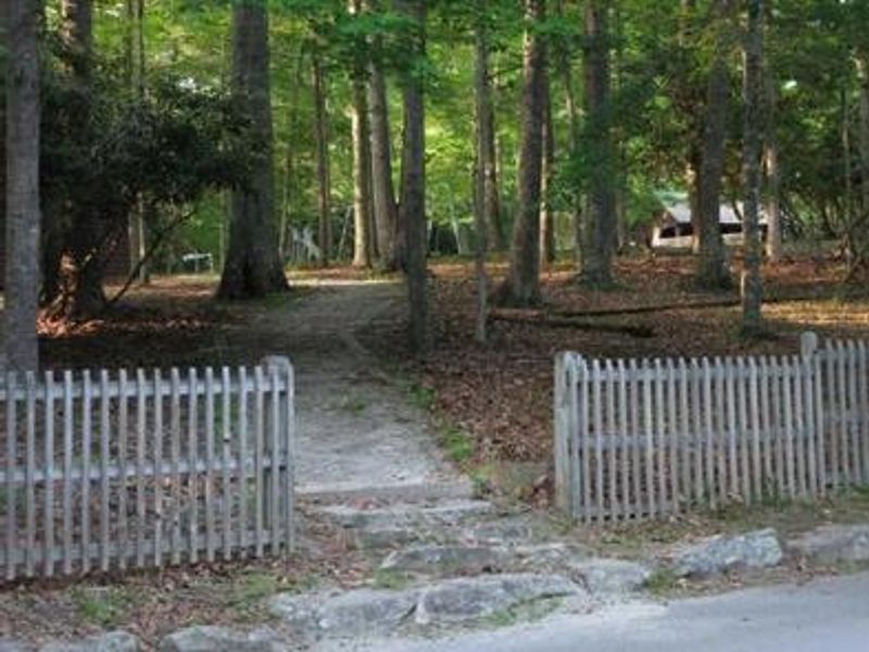
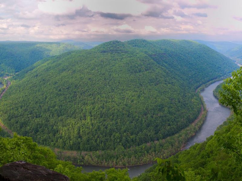
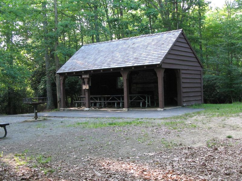
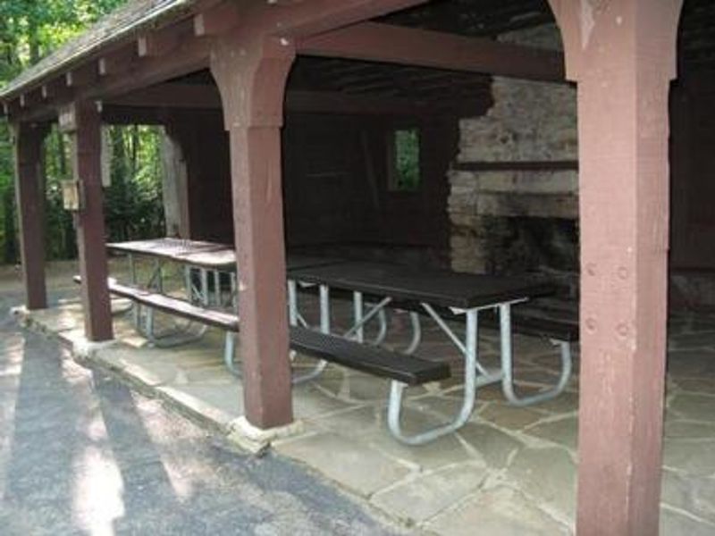
Grandview Shelter 1 is a reservable day-use picnic shelter situated near the North Rim Overlook in the Grandview area of New River Gorge National Park and Preserve. The shelter is enclosed on three sides with a stone fireplace inside, two electrical outlets, one charcoal grill, and a fireplace grate. It can accommodate approximately 40 people inside the shelter and 35 outside. The Grandview area became part of New River Gorge National River in 1990 after more than 50 years as a West Virginia state park. The area offers spectacular views of the New River from 1,400 feet above, beautiful rhododendron displays, five hiking trails, a seasonal visitor center, and summer outdoor dramas. Nearby Beckley (12 miles) provides shopping, restaurants, and accommodations. This shelter requires climbing a small set of stone stairs and a short walk up a hill, making it not accessible for those with mobility limitations. Alcohol, glitter, confetti, fireworks, and drones are prohibited. Pets must be leashed.
Directions
From Beckley, follow I-64 East five miles to Exit 129 B. From Lewisburg, follow I-64 West forty miles to Exit 129. From either exit, turn right and follow Route 9 North six miles to Grandview.
Amenities
| Water | Yes |
| Fires Allowed | Yes |
| Toilets | Yes |
| Dump Station | No |
| Wifi | — |
| Pets Allowed | Yes |
| Showers | No |
| Electric Hookups | Yes |
| Water Hookups | No |
| Sewer Hookups | No |
| Camp Store | No |
| Price | $70 |
Vehicle
| Max RV Length | — |
| Max Trailer Length | — |
| Big Rig Friendly | — |
| Pull Through Sites | No |
Contact
| Phone | +1 (304) 465-0508 |
Cell Service
| AT&T | Yes |
| Verizon | Yes |
| T-Mobile | None |
Availability
Photos
Community Posts
No posts yet. Be the first to share your experience!