Grandfather Mountain State Park
Profile Trail, its parking area, and associated campsites remain closed due to Hurricane Helene damage sustained in fall 2024. Tentative reopening for the upper trail portion is mid-summer 2026. Other campsites remain accessible via Boone Fork Parking Area on the Blue Ridge Parkway at mile marker 299.9. Reservations required for all sites.
Flood Watch issued October 11 at 6:44AM EDT until October 11 at 8:00PM EDT by NWS Blacksburg VA
* WHAT...Flooding caused by excessive rainfall continues to be possible. * WHERE...Portions of North Carolina, including the following areas, Alleghany NC, Ashe, Surry, Watauga and Wilkes and southwest Virginia, including the following areas, Carroll, Floyd, Grayson and Patrick. * WHEN...Through this evening. * IMPACTS...Excessive runoff may result in flooding of rivers, creeks, streams, and other low-lying and flood-prone locations. Creeks and streams may rise out of their banks. Low-water crossings may be flooded. Storm drains and ditches may become clogged with debris. * ADDITIONAL DETAILS... - As the remnants of Isaias move northward into the lower Ohio Valley, periods of rain will continue. Heavier rainfall will continue in short bursts through the day. Additional rainfall amounts of 1 to 3 inches, along with what has already fallen will keep the threat of flooding around. - http://www.weather.gov/safety/flood
Flood Advisory issued October 11 at 12:53PM EDT until October 11 at 4:00PM EDT by NWS Blacksburg VA
* WHAT...Minor flooding caused by excessive rainfall continues. * WHERE...South Central Ashe County in northwestern North Carolina... Watauga County in northwestern North Carolina... Southwestern Wilkes County in northwestern North Carolina... * WHEN...Until 400 PM EDT. * IMPACTS...Flooding in low-lying and poor drainage areas. Strong flows over low-water crossings will continue through late afternoon, especially those along the Watauga River in western Watauga County. While most rivers continue to recede this afternoon, water remains over a few roadways, including Todd Railroad Grade Road along the South Fork of the New River. * ADDITIONAL DETAILS... - At 1250 PM EDT, Doppler radar and automated rain gauges indicated rainfall has ended. Minor flooding persists within the advisory area due to between 4.5 and 7.5 inches of rain that fell from Saturday morning through this morning. Area creeks and rivers will continue to recede through the afternoon. - This includes the following streams and drainages... Fall Creek, Norris Fork, Flat Branch, Elk Creek, Mill Creek, Dugger Creek, Little Dugger Creek, Laurel Fork, Dutch Creek, Meat Camp Creek, Brushy Fork, Grassy Creek and Left Prong Stony Fork. - Some locations that will experience flooding include... Boone, Blowing Rock, Deep Gap, Todd, Foscoe, Seven Devils and Aho. - For flooding safety information, please visit http://www.weather.gov/safety/flood
Flood Advisory issued October 11 at 12:47PM EDT until October 11 at 3:00PM EDT by NWS Blacksburg VA
* WHAT...Flooding caused by excessive rainfall continues. * WHERE...Ashe County in northwestern North Carolina... Watauga County in northwestern North Carolina... * WHEN...Until 300 PM EDT. * IMPACTS...Flooding in low-lying and poor drainage areas. Strong flows over low-water crossings will continue through the middle of the afternoon, especially those along the Watauga River in western Watauga County. Most river levels continue to recede this afternoon, however water remains over a few roadways, including Todd Railroad Grade Road along the South Fork of the New River. * ADDITIONAL DETAILS... - At 1243 PM EDT, Doppler radar and automated rain gauges indicated that rain has exited the advisory area. However, minor flooding continues due to between 4 and 7 inches of rain that fell from Saturday morning through this morning. - This includes the following streams and drainages... Big Laurel Creek, Beaver Creek, Beech Creek, Big Horse Creek, Cove Creek, Call Creek, Beaverdam Creek and Brushy Fork. - Some locations that will experience flooding include... Jefferson, West Jefferson, Beech Mountain, Lansing, Ashland, Glendale Springs and Sugar Grove. - For flooding safety information, please visit http://www.weather.gov/safety/flood
About
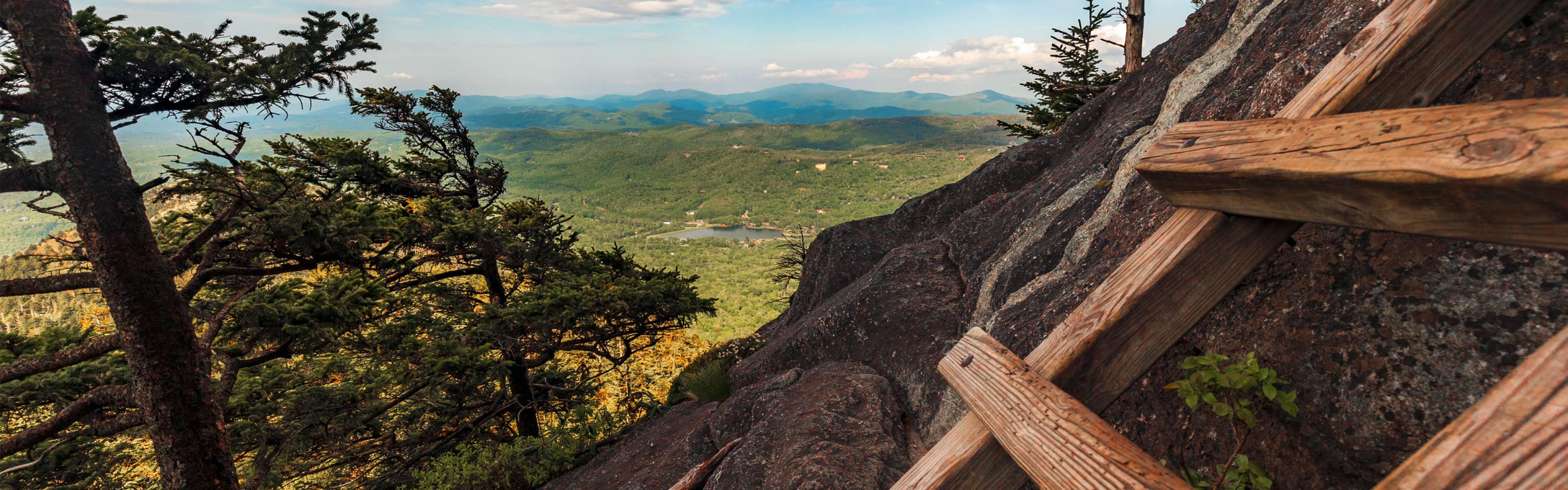
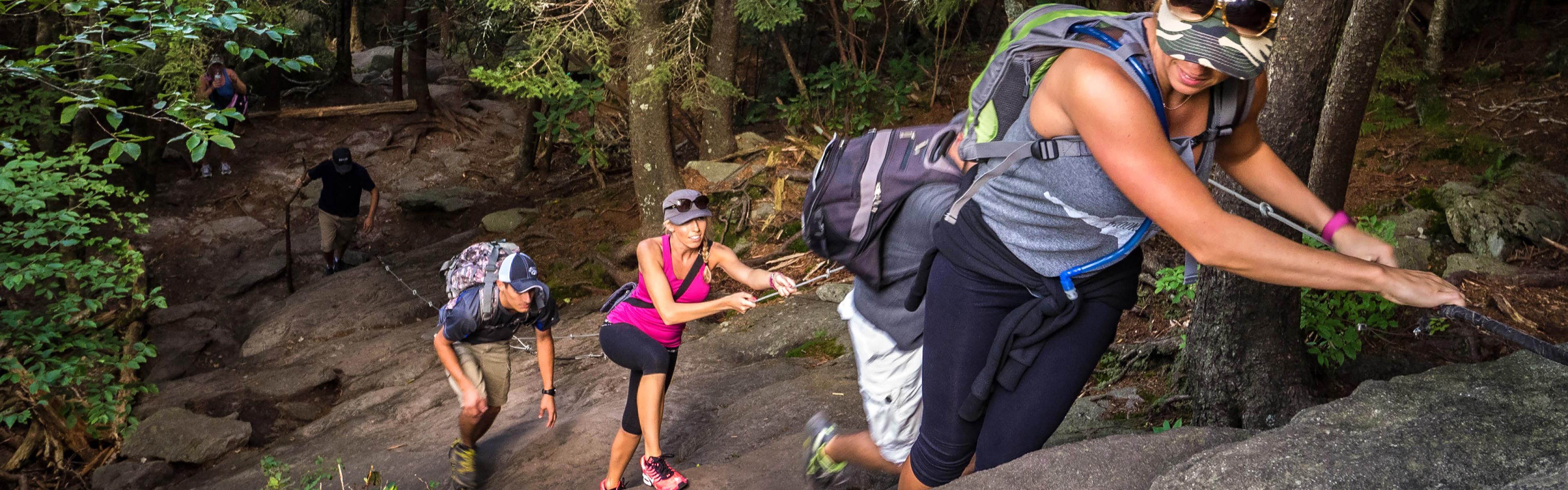
Grandfather Mountain State Park provides a true backcountry camping experience in the southern Appalachians, with 13 primitive hike-in sites scattered across the mountain's rugged terrain. Sites include Streamside, Hermitage, Storyteller, Refuge, Briar Patch, Profile (currently closed), Daniel Boone, Calloway Gap, Alpine Meadow, Hi-Balsam Shelter, Raven's Roost, Cliffside, and Attic Window. Each individual site accommodates up to 6 campers, while group sites require 7-12 campers. Many sites feature 8x8-foot wooden tent platforms and food storage cables for bear protection. Fire rings are provided at lower elevation sites, though campfires are prohibited at higher elevation locations to protect the fragile ecosystem. Water sources vary by site, with some near streams or springs while others have no water access. Campers must pack out all trash and bring their own drinking water. The terrain is steep and challenging, with hikes ranging from 1.2 miles (Streamside via Boone Fork) to 5.5 miles. The state park is separate from the nearby privately-owned Grandfather Mountain attraction with the Mile-High Swinging Bridge. The park itself is free to access, though camping requires advance reservations. Trails connect to the larger Blue Ridge Parkway trail system including Tanawha, Daniel Boone Scout, and Nuwati trails.
Directions
Primary access via Boone Fork Parking Area on Blue Ridge Parkway at mile marker 299.9, accessible from Holloway Mountain Road. The Profile Trailhead parking at 4198 N.C. 105 N. is currently closed. Asutsi Trail Parking is also available on U.S. 221 near Blowing Rock. Park office located at 9872 N.C. 105 S., Suite 6, Banner Elk, NC 28604.
Nearby Campgrounds
Amenities
| Water | No |
| Fires Allowed | Yes |
| Toilets | No |
| Dump Station | No |
| Wifi | No |
| Pets Allowed | Yes |
| Showers | No |
| Electric Hookups | — |
| Water Hookups | — |
| Sewer Hookups | — |
| Camp Store | No |
| Price | $17 - $37 |
Vehicle
| Max RV Length | — |
| Max Trailer Length | — |
| Big Rig Friendly | No |
| Pull Through Sites | No |
Contact
| grandfather.mountain@ncparks.gov | |
| Phone | +1 (828) 963-9522 |
Cell Service
| AT&T | None |
| Verizon | Yes |
| T-Mobile | None |
Availability
Photos

Community Posts
No posts yet. Be the first to share your experience!