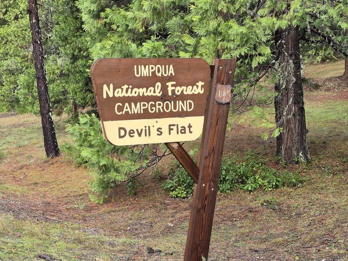
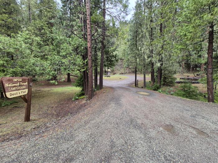
Devils Flat Campground
Open year-round on a first-come, first-served basis. No advance reservations. Payment via Recreation.gov Scan & Pay app only; cash and checks not accepted. No potable water available; bring your own. Pack out all trash.
Fire Weather Watch issued July 20 at 12:40PM PDT until July 22 at 11:00PM PDT by NWS Medford OR
The National Weather Service in Medford has issued a Fire Weather Watch, which is in effect from Wednesday morning through Wednesday evening. * IMPACTS...Abundant lightning on dry fuels will likely create new ignitions across the region. Any fires that develop could spread rapidly. Numerous new fire starts could overwhelm initial attack. * AFFECTED AREA...Areas in southern Oregon along and east of the Cascades, along the western foothills and slopes of the Cascades, and over the Siskiyous, including Fire Weather Zones 617...621...622...623...624 and 625. * THUNDERSTORMS...Moving roughly north to northeast around 15 to 20 mph. Storm mode will be mostly wet thunderstorms, but dry lightning strikes can occur outside of wet cores. * OUTFLOW WINDS...Isolated gusts up to 45 mph. * DETAILED URL...View the hazard area in detail at https://weather.gov/wrh/hazards?wfo=mfr
Alcohol Prohibitions
This Order describes acts that are prohibited upon lands, roads and trails within the National Forest System administered by the Forest Service Pacific Northwest Region in regards to alcoholic beverages.
Aquatic Invasive Species
This Order prohibits 1) possessing, storing, or transporting any aquatic invasive animal species AND 2) prohibits possessing, storing, or transporting any aquatic or riparian invasive plant species - on National Forest System lands in the Pacific Northwest Region as specified in the Order.
About
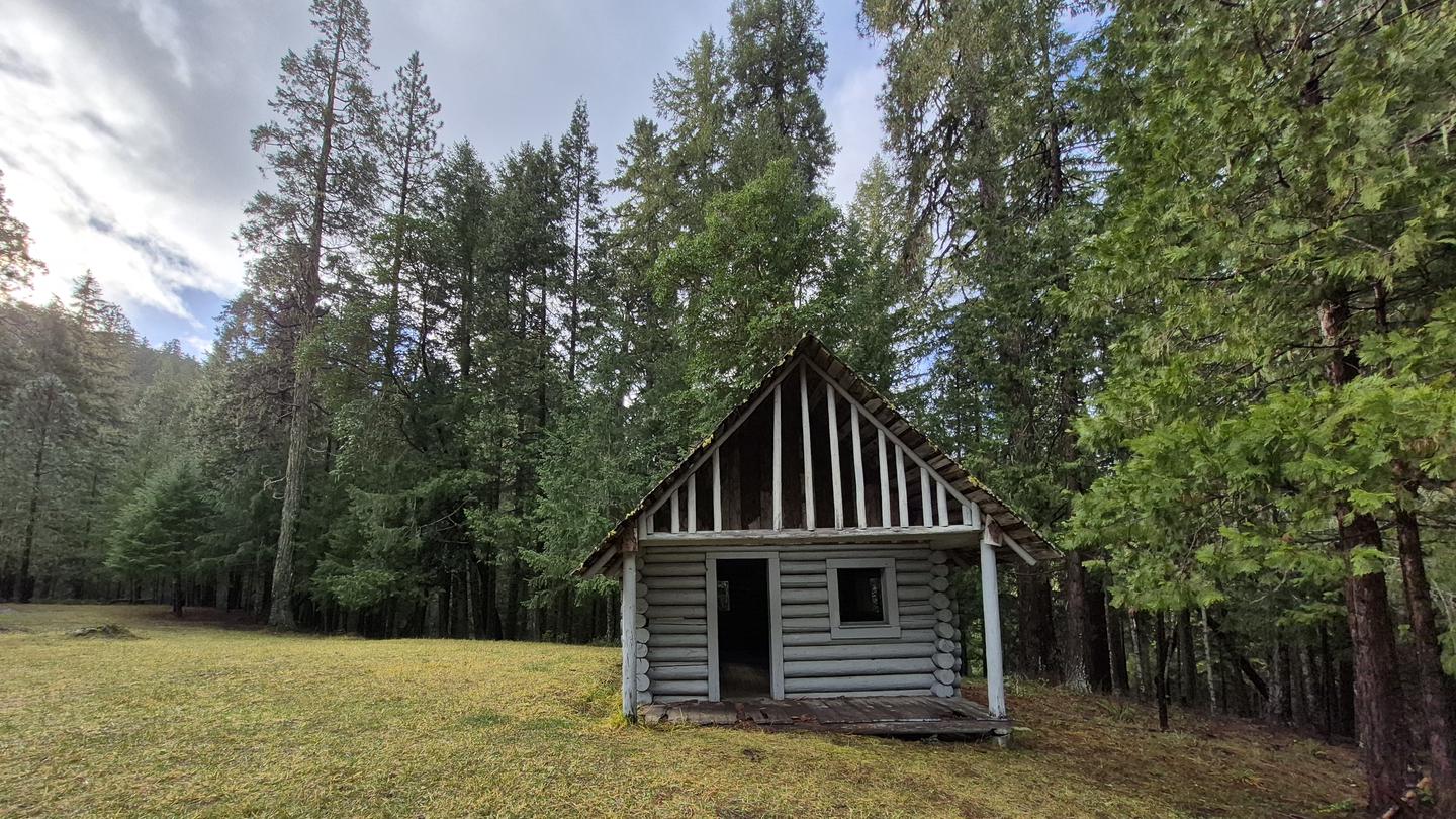
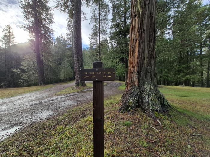
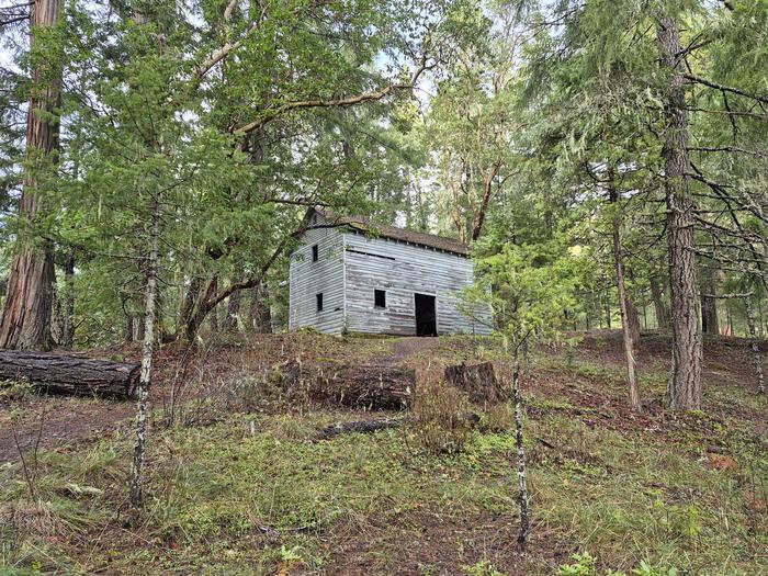
Devil's Flat Campground is a small, primitive campground nestled under a bluff and surrounded by a forest of cedar, pine, and madrone in Oregon's Umpqua National Forest. With just three tent/trailer sites, it offers a quiet, secluded experience in the picturesque Cow Creek drainage. The campground is notable for its historic landmarks. On the north side, you'll find stone ruins of a water fixture built by the Civilian Conservation Corps "Fire-Eaters" in the 1930s. The south side features the old Devil's Flat Guard Station with a 1915 ranger cabin and a 1920s-era horse barn. Near the cabin, a tiki carving in a fir tree gives the campground its name. Hiking opportunities abound: Cow Creek Falls Trail #1422 makes a 0.3-mile loop along cascading Cow Creek Gorge, Elk's Skull Bluff Trail #1428A offers a 0.5-mile loop to a viewpoint, Maranatha Trail #1422A travels 1.5 miles to an overlook, and Devil's Flat Trail #1428 leads 5 miles to the top of Red Mountain.
Directions
From Azalea, OR, travel east on Upper Cow Creek Road/County Hwy-36 for about 17 miles to Devil's Flat Campground, located on the left and right side of the road.
Amenities
| Water | No |
| Fires Allowed | Yes |
| Toilets | Yes |
| Dump Station | No |
| Wifi | No |
| Pets Allowed | Yes |
| Showers | No |
| Electric Hookups | — |
| Water Hookups | — |
| Sewer Hookups | — |
| Camp Store | No |
| Price | $0 |
Vehicle
| Max RV Length | 22ft |
| Max Trailer Length | 22ft |
| Big Rig Friendly | No |
| Pull Through Sites | — |
Contact
| Phone | +1 (541) 825-3100 |
Cell Service
| AT&T | None |
| Verizon | None |
| T-Mobile | None |
Photos
Community Posts
No posts yet. Be the first to share your experience!