USA 250 Shirt →

Davis Bayou Group Campground

Open

Open and accepting reservations. The main campground restroom at loop B/D is undergoing interior remodeling, but all other restroom facilities remain operational. Gates close at sunset; late arrivals should call (228) 230-4136 by 4:00 PM for the gate code.

Coastal Flood Warning issued July 22 at 4:32AM CDT until July 23 at 4:00AM CDT by NWS New Orleans LA

4:32 AM — 6:45 PM

* WHAT...Significant coastal flooding. * WHERE...In Louisiana, Lower St. Bernard, Southeast St. Tammany, Eastern Orleans and Lower Plaquemines Parishes. In Mississippi, Southern Hancock, Southern Harrison and Southern Jackson Counties. * WHEN...Until 4 AM CDT Thursday. * IMPACTS...Numerous roads may be closed. Low lying property including homes, businesses, and some critical infrastructure will be inundated. Some shoreline erosion will occur.

Tropical Storm Warning issued July 22 at 4:18AM CDT by NWS New Orleans LA

4:18 AM — 12:30 PM

* LOCATIONS AFFECTED - Pascagoula - Ocean Springs - St. Martin - Gautier - Moss Point * WIND - LATEST LOCAL FORECAST: Below tropical storm force wind - Peak Wind Forecast: 15-25 mph with gusts to 30 mph - THREAT TO LIFE AND PROPERTY THAT INCLUDES TYPICAL FORECAST UNCERTAINTY IN TRACK, SIZE AND INTENSITY: Potential for wind 39 to 57 mph - The wind threat has remained nearly steady from the previous assessment. - PLAN: Plan for hazardous wind of equivalent tropical storm force. - PREPARE: Efforts to protect property should now be underway. Prepare for limited wind damage. - ACT: Act now to complete preparations before the wind becomes hazardous. - POTENTIAL IMPACTS: Limited - Damage to porches, awnings, carports, sheds, and unanchored mobile homes. Unsecured lightweight objects blown about. - Many large tree limbs broken off. A few trees snapped or uprooted, but with greater numbers in places where trees are shallow rooted. Some fences and roadway signs blown over. - A few roads impassable from debris, particularly within urban or heavily wooded places. Hazardous driving conditions on bridges and other elevated roadways. - Scattered power and communications outages. * STORM SURGE - LATEST LOCAL FORECAST: Life-threatening storm surge possible - Peak Storm Surge Inundation: The potential for 2-4 feet above ground somewhere within surge prone areas - Window of concern: through Thursday morning - THREAT TO LIFE AND PROPERTY THAT INCLUDES TYPICAL FORECAST UNCERTAINTY IN TRACK, SIZE AND INTENSITY: Potential for storm surge flooding greater than 3 feet above ground - The storm surge threat has remained nearly steady from the previous assessment. - PLAN: Shelter against life-threatening storm surge of greater than 3 feet above ground. - PREPARE: Flood preparations and ordered evacuations should be complete. Evacuees should be in shelters well away from storm surge flooding. - ACT: Remain sheltered in a safe location. Do not venture outside. - POTENTIAL IMPACTS: Unfolding - Potential impacts from the main surge event are unfolding. * FLOODING RAIN - LATEST LOCAL FORECAST: - Peak Rainfall Amounts: Additional around 1 inch - THREAT TO LIFE AND PROPERTY THAT INCLUDES TYPICAL FORECAST UNCERTAINTY IN TRACK, SIZE AND INTENSITY: Potential for localized flooding rain - The flooding rain threat has remained nearly steady from the previous assessment. - PLAN: Emergency plans should include the potential for localized flooding from heavy rain. - PREPARE: Consider protective actions if you are in an area vulnerable to flooding. - ACT: Heed any flood watches and warnings. - POTENTIAL IMPACTS: Limited - Localized rainfall flooding may prompt a few evacuations. - Rivers and tributaries may quickly rise with swifter currents. Small streams, creeks, canals, and ditches may become swollen and overflow in spots. - Flood waters can enter a few structures, especially in usually vulnerable spots. A few places where rapid ponding of water occurs at underpasses, low-lying spots, and poor drainage areas. Several storm drains and retention ponds become near-full and begin to overflow. Some brief road and bridge closures. * TORNADO - LATEST LOCAL FORECAST: - Situation is unfavorable for tornadoes - THREAT TO LIFE AND PROPERTY THAT INCLUDES TYPICAL FORECAST UNCERTAINTY IN TRACK, SIZE AND INTENSITY: Tornadoes not expected - The tornado threat has remained nearly steady from the previous assessment. - PLAN: Tornadoes are not expected. Showers and thunderstorms with gusty winds may still occur. - PREPARE: Little to no preparations needed to protect against tornadoes at this time. Keep informed of the latest tornado situation. - ACT: Listen for changes in the forecast. - POTENTIAL IMPACTS: Little to None - Little to no potential impacts from tornadoes. * FOR MORE INFORMATION: - https://www.msema.org

Heat Advisory issued July 22 at 4:35AM CDT until July 22 at 8:00PM CDT by NWS New Orleans LA

4:35 AM — 6:45 PM

* WHAT...Heat index values up to 113 expected. * WHERE...Northern Hancock, Northern Harrison, Northern Jackson, Southern Hancock, Southern Harrison, and Southern Jackson Counties. * WHEN...From 10 AM this morning to 8 PM CDT this evening. * IMPACTS...Hot temperatures and high humidity may cause heat illnesses.

About

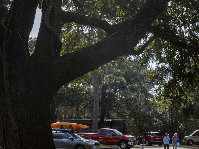
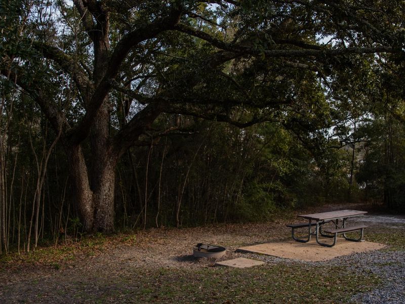
Davis Bayou Group Campground is a dedicated group camping area within Gulf Islands National Seashore near Ocean Springs, Mississippi. The tent-only site is designed for organized parties ranging from 10 to 40 individuals and sits adjacent to pavilion #5 on Boat Launch Road. Campers have access to restroom facilities, showers, potable water, a large communal fire circle, grills, and picnic tables. Trash dumpsters are provided on site. The campground's location provides easy access to the natural features of the Davis Bayou Area, including hiking trails, a fishing pier, and a small boat launch. The Gulf of Mexico shoreline is within walking distance via boardwalks and trails. Swimming is not permitted in the Davis Bayou waters. Reservations are made through Recreation.gov up to 12 months in advance. Check-in is at 1:00 PM and check-out at 11:00 AM. Gates close at sunset; groups arriving after dark should call the campground office at (228) 230-4136 by 4:00 PM to obtain a gate code. Maximum of 12 vehicles allowed; carpooling is recommended due to limited parking. Generators are prohibited.

Directions

From Ocean Springs, travel east on US Highway 90 to Park Road. Turn south onto Park Road and follow signs to Davis Bayou Area within Gulf Islands National Seashore. The group campground is located on Boat Launch Road adjacent to pavilion #5.

Amenities

Water Yes
Fires Allowed Yes
Toilets Yes
Dump Station No
Wifi
Pets Allowed Yes
Showers Yes
Electric Hookups
Water Hookups
Sewer Hookups
Camp Store No
Price $20 - $30

Vehicle

Max RV Length
Max Trailer Length
Big Rig Friendly No
Pull Through Sites No

Contact

Email guis_information@nps.gov
Phone +1 (228) 230-4136

Cell Service

AT&T Yes
Verizon Yes
T-Mobile Yes

Photos

Community Posts

No posts yet. Be the first to share your experience!