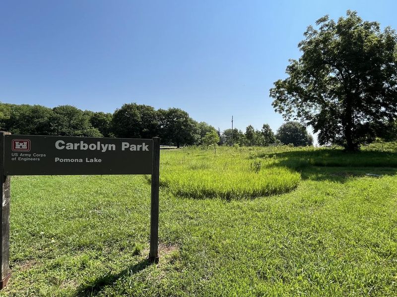
Carbolyn Park
Open for camping. Reservations available through Recreation.gov. The campground is managed by the U.S. Army Corps of Engineers and patrolled by rangers and local sheriff during recreation season.
Flood Watch issued May 18 at 10:19PM CDT until May 19 at 7:00AM CDT by NWS Topeka KS
* WHAT...Flooding caused by excessive rainfall continues to be possible. * WHERE...Portions of east central and northeast Kansas, including the following counties, in east central Kansas, Anderson, Coffey, Douglas, Franklin, Lyon, Osage and Shawnee. In northeast Kansas, Jefferson. * WHEN...Until 7 AM CDT Tuesday. * IMPACTS...Excessive runoff may result in flooding of rivers, creeks, streams, and other low-lying and flood-prone locations.
Hydrologic Outlook issued May 18 at 9:45PM CDT by NWS Topeka KS
ESFTOP Marais Des Cygnes River above Reading This hydrologic outlook is based on the forecast rainfall for the next 24 hours and estimated runoff from earlier rainfall. Crests may vary if actual rainfall or runoff is greater or less than anticipated. Location: Marais Des Cygnes River above Reading Flood stage: 19.0 feet Latest stage: 4.9 feet at 9 PM Monday Maximum Forecast Stage: 20.8 feet at 7 AM Tuesday May 19 Later statements, possibly warnings, may be issued as additional information becomes available.
Hydrologic Outlook issued May 18 at 9:45PM CDT by NWS Topeka KS
ESFTOP Salt Creek in Osage County near Lyndon This hydrologic outlook is based on the forecast rainfall for the next 24 hours and estimated runoff from earlier rainfall. Crests may vary if actual rainfall or runoff is greater or less than anticipated. Location: Salt Creek in Osage County near Lyndon Flood stage: 10.0 feet Latest stage: 1.9 feet at 9 PM Monday Maximum Forecast Stage: 11.0 feet at 7 AM Tuesday May 19 Later statements, possibly warnings, may be issued as additional information becomes available.
Hydrologic Outlook issued May 18 at 8:11PM CDT by NWS Topeka KS
ESFTOP Salt Creek in Osage County near Lyndon This hydrologic outlook is based on the forecast rainfall for the next 24 hours and estimated runoff from earlier rainfall. Crests may vary if actual rainfall or runoff is greater or less than anticipated. Location: Salt Creek in Osage County near Lyndon Flood stage: 10.0 feet Latest stage: 1.0 feet at 7 PM Monday Maximum Forecast Stage: 11.0 feet at 7 AM Tuesday May 19 Later statements, possibly warnings, may be issued as additional information becomes available.
Hydrologic Outlook issued May 18 at 9:24AM CDT by NWS Topeka KS
ESFTOP Marais Des Cygnes River above Reading This hydrologic outlook is based on the forecast rainfall for the next 24 hours and estimated runoff from earlier rainfall. Crests may vary if actual rainfall or runoff is greater or less than anticipated. Location: Marais Des Cygnes River above Reading Flood stage: 19.0 feet Latest stage: 3.1 feet at 8 AM Monday Maximum Forecast Stage: 20.6 feet at 7 AM Tuesday May 19 Fld Obs Forecasts Location Stg Stg Day/Time Mon Tue Tue 1pm 1am 1pm Marais Des Cygnes River Reading 19.0 3.1 Mon 8am 3.6 20.3 17.3 Later statements, possibly warnings, may be issued as additional information becomes available.
About
Carbolyn Park is a scenic family campground managed by the U.S. Army Corps of Engineers on the shores of Pomona Lake in eastern Kansas. Set among the rolling hills, mixed grasslands, and forests typical of the region, the campground offers 32 sites spread along Dragoon Creek. Twenty-nine sites feature 30-amp electric and water hookups, while three primitive sites are available for tent campers. Maximum RV lengths vary by site, with electric sites accommodating rigs up to 55 feet and non-electric sites up to 40 feet. The campground is well-equipped with flush and vault toilets, a shower building, dump station, playground, and picnic shelter. A boat ramp provides direct lake access, and bank-fishing areas are plentiful. The 4,000-acre reservoir offers excellent fishing for crappie, walleye, and channel catfish, while bald eagles, white-tailed deer, and wild turkey can be observed in the surrounding area. Three trails meander around Pomona Lake for hiking and nature study. The Deer Creek Nature Trail and Witches' Broom Trail are short hikes, while the 33-mile Black Hawk Trail loop accommodates hikers, mountain bikers, and horseback riders. A visitor center near the park provides educational displays about the lake ecosystem.
Directions
Located 25 miles south of Topeka on US 75. The park entrance is 4.5 miles north of Lyndon, KS on US 75 on the east side of the road.
Amenities
| Water | Yes |
| Fires Allowed | Yes |
| Toilets | Yes |
| Dump Station | Yes |
| Wifi | — |
| Pets Allowed | Yes |
| Showers | Yes |
| Electric Hookups | Yes |
| Water Hookups | Yes |
| Sewer Hookups | No |
| Camp Store | — |
| Price | $14 - $20 |
Vehicle
| Max RV Length | 55ft |
| Max Trailer Length | 55ft |
| Big Rig Friendly | Yes |
| Pull Through Sites | No |
Contact
| Phone | +1 (785) 453-2201 |
Cell Service
| AT&T | Yes |
| Verizon | Yes |
| T-Mobile | Yes |
Availability
Photos
Community Posts
No posts yet. Be the first to share your experience!