Calpine Lookout
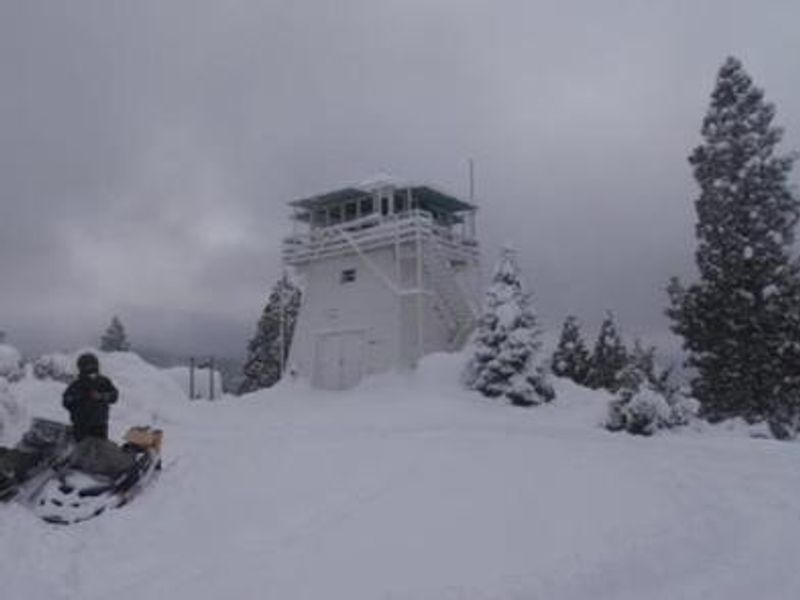
Open year-round for reservations via Recreation.gov. This is an extremely popular facility typically booked every night. Summer access is by vehicle; winter access requires snowshoes, skis, or snowmobile due to unplowed roads. Contact the Sierraville Ranger District before arrival for current road conditions.
Fireworks and Explosives are always Prohibited
Fireworks and explosives (including explosive targets) are always prohibited on national forest lands. The prohibition of fireworks and exploding targets on national forest system lands is part of a set of permanent fire safety regulations in the Code of Federal Regulations (CFR), listed below.…
Downieville Downhill Closure Order
Closure of identified forest roads and trails for Downieville Downhill.
Gauntlet Stewardship IRTC Closure
In response to unhealthy forest conditions, and the need to enhance wildland fire defense in the area, the Tahoe National Forest is treating approximately 1375 acres to the south of Highway 49 in the areas of Forest City, Pliocene Ridge, and Table Mountain. For public safety, the project area will…
Big Chief Sale Closure
This order closes forest system roads and trails within the Big Chief project area. This closure is to provide for public safety while 675 acres of forest are treated to enhance wildfire defense in the area.
Woodchopper Timber Sale Closure
Closure of the Woodchopper project area to allow for timber removal and wildfire risk reduction work.
Boca Stewardship Agreement Closure
Closure of the Boca Stewardship Agreement project area to allow for wildfire risk reduction work.
Cabin Creek Closure
Closure for the Cabin Creek Project area to allow for wildfire risk reduction work.
Rattlesnake Road Closure
Closure of Rattlesnake Road to allow for PG&E to complete the Lake Fordyce Dam Seepage Mitigation Project.
Alpine Meadows Stewardship Agreement Closure
This order closes the Alpine Meadows Project area to allow forest restoration work to take place.
Sugar Pine Roadside Fuel Break Project
Tahoe National Forest contractors are conducting fuels reduction work in the Sugar Pine Reservoir area. Contractors will be masticating ladder fuels to reduce wildfire risk adjacent to North Brimstone Rd (24) between Sugar Pine Rd and Big Reservoir Rd. There may be unexpected hazards such as flying…
Parking Restrictions
Parking or leaving a vehicle is prohibited on Tahoe National Forest where posted.
14-day Camping Occupancy Restrictions
Camping on the Tahoe National Forest is limited to 14 days in a calendar year.
PRESCRIBED FIRE NOTICE: McNair & Quail Landings - 59 acres
Tahoe National Forest is planning to conduct a prescribed burn in the Calpine area, conditions permitting. Smoke will be visible from Calpine, Sierraville, Loyalton and surrounding areas. Smoke may settle overnight in valleys, drainages, and throughout the surrounding communities. Smoke will…
Snow Grooming Updates
Grooming operations have ceased pending new storms. Conditions are more like late April/May than March. Expect running water and thin snow coverage. Trailhead location for Little Truckee Summit staging is currently at the Perazzo turnoff. GROOMING PROGRAM: Snowmobile trail grooming is funded by…
Sierraville Ranger District Trail Closure
Forest Trail 16E87 (Boca-Loyalton Trail) is closed for public health and safety.
Camping and Campfire Restrictions-Truckee and Sierraville Districts
Pursuant to 16 U.S.C. § 551 and 36 C.F.R. § 261.50(a) and (b), and to provide for public safety and toprotect natural resources, the following acts are prohibited within the Truckee and Sierraville RangerDistricts of the Tahoe National Forest. This Order is effective from July 1, 2025, through…
Highway 20 Area Camping Restrictions
To provide for public safety and to protect natural resources, the following acts are prohibited within the Tahoe National Forest.
14-day Camping Occupancy Restrictions
Camping on the Tahoe National Forest is limited to 14 days in a calendar year.
Hoke Valley- Forest Road 860-07 (17E11 Trail) Closed
Forest Road 860 -01 (17E11 Trail) in the Hoke Valley area has been closed to allow for Hoke Valley Meadow restoration.
About
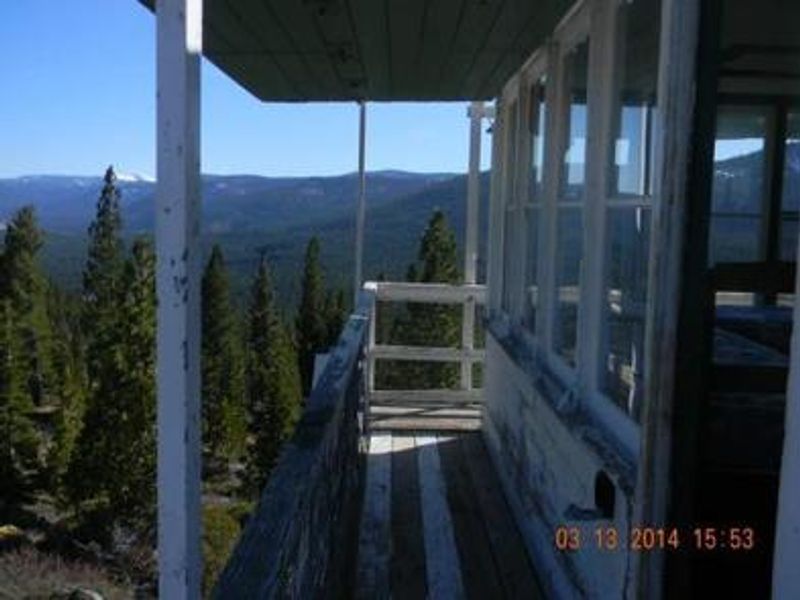
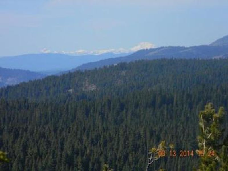
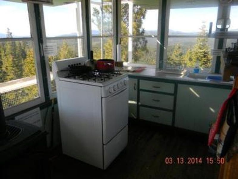
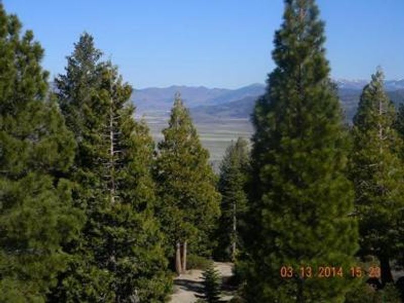
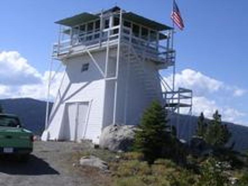
Calpine Lookout is one of three remaining enclosed windmill-style fire lookout towers in California, constructed in 1934 by the Civilian Conservation Corps. It served as an active fire lookout every summer until 1975 and is now available as a unique overnight rental through Recreation.gov. The three-story tower features external stairs leading to the 14x14 foot observation cab, which serves as the rental space. The cab is equipped with two single twin beds, a propane stove/oven, propane heater, three propane lights, a dry sink, table and chairs, and basic cooking utensils. Outside the tower is an accessible vault toilet, a picnic table, and a fire ring. Guests must bring their own water, bedding, toilet paper, and firewood. There is no electricity. During summer months, guests can drive directly to the base of the tower. In winter, the Forest Service does not plow the access road, so guests must access the lookout via snowshoes, skis, or snowmobile on a 2-mile trail with 1,000 feet of elevation gain. Winter temperatures can drop to -21°F.
Directions
From Sierraville, drive approximately 10 miles north on State Highway 89. A renter's packet with specific access and parking information based on current conditions is provided after check-in. During winter months, access is by snowshoes, skis, or snowmobile on a 2-mile trail with 1,000 feet of elevation gain.
Location
Amenities
| Water | No |
| Fires Allowed | Yes |
| Toilets | Yes |
| Dump Station | No |
| Wifi | No |
| Pets Allowed | — |
| Showers | No |
| Electric Hookups | — |
| Water Hookups | — |
| Sewer Hookups | — |
| Camp Store | No |
| Price | $75 |
Vehicle
| Max RV Length | — |
| Max Trailer Length | — |
| Big Rig Friendly | No |
| Pull Through Sites | No |
Contact
| Phone | +1 (530) 994-3401 |
Cell Service
| AT&T | None |
| Verizon | Yes |
| T-Mobile | Yes |
Availability
Photos
Community Posts
No posts yet. Be the first to share your experience!